

Last updated: August 2026
Wild Trail Hiker is reader-supported. We may earn a commission when you buy through links on this page, at no extra cost to you. We only recommend products we’d consider taking on a multi-day trip ourselves.
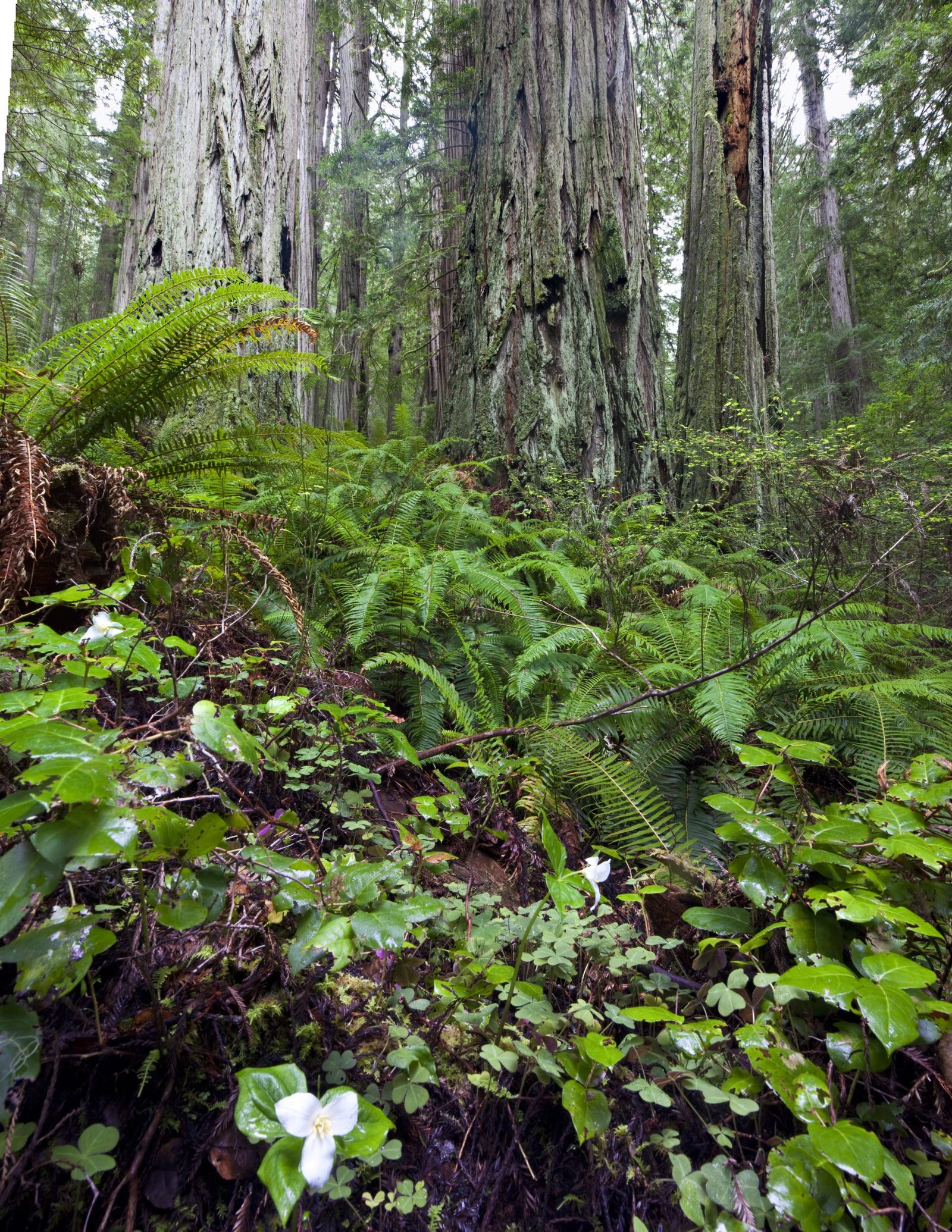
Before You Go
The Lost Coast Trail is the one trail on this site where the tide chart matters more than your fitness level. Three sections of the route are only safe to walk within specific tide windows, and on some dates the low tide simply never drops far enough to pass. You must check tides before you book a permit, not after. A hard-sided bear canister is mandatory for every overnight visitor, and there is no cell coverage and no BLM search and rescue team on this stretch of coast. Plan around all three before you commit to dates.
Why This Trail
The Lost Coast earned its name honestly. When engineers routed Highway 1 up the California coast, the King Range simply refused to cooperate: mountains rise straight out of the surf here, King Peak reaches 4,088 feet just three miles from the ocean, and the terrain was too steep and unstable for any road. The highway builders gave up and pushed the route inland, leaving 35 miles of coastline with no paved access at all. It is the longest stretch of undeveloped coast in the contiguous United States.
What makes it worth the planning headache is the sense of total exposure to the coast itself. There are no huts, no bridges, and for long stretches no real trail, just a route along the beach that changes with every tide. Hikers cross paths with Roosevelt elk, black bears, coyotes, and a growing colony of northern elephant seals hauled out near Punta Gorda, among the most northern breeding colonies of their kind on the West Coast. Tidepools crowd the rocky benches, and in spring the coastal bluffs turn over with wildflowers. The old Punta Gorda Lighthouse, decommissioned in 1951, still stands watch over a stretch of coast that has claimed more than a few ships and, more recently, more than a few unprepared hikers.
Experienced backpackers consistently rank it among the best multi-day trips in California, not for a summit or a pass but for the sustained, unfiltered contact with the Pacific. It rewards hikers who treat the tide table as seriously as their map.
Trail at a Glance
| Spec | Detail |
|---|---|
| Distance | 24.6 miles (the BLM’s official figure, Mattole to Black Sands Beach). AllTrails lists 24.9 miles; most guides round to 25. |
| Duration | 3 to 4 days is standard. The BLM recommends allowing at least 3 days; a 4-day, 3-night pace is the more comfortable default and gives room to wait out a tide if needed. |
| Difficulty | Moderate to hard. Cumulative elevation gain is a modest 3,500 feet or so and there is no technical climbing, but constantly shifting sand and boulder fields make the miles slower and more tiring than the numbers suggest, and the mandatory tide-timing adds a genuine logistics and safety load most trails don’t have. |
| Best season | Late May through early October for the driest, calmest conditions (expect coastal fog even then). October through April is the wet season, with the King Range averaging around 120 inches of annual rainfall, among the wettest spots in the country. |
| Permits | Required for all overnight camping in the King Range Wilderness (day use does not require one). Reservations open on a 90-day rolling window via recreation.gov, released at 7am Pacific. Walk-up permits (max 3 people) are available by daily lottery at the King Range Visitor Center. |
| Start trailhead | Mattole Trailhead (Mattole Campground and Recreation Site), north end: Mattole Trailhead on Google Maps |
| End trailhead | Black Sands Beach Trailhead, Shelter Cove, south end: Black Sands Beach Trailhead on Google Maps |
This is a point-to-point trail, not a loop, and it is almost always walked north to south (Mattole to Shelter Cove), since the prevailing coastal wind sits at your back that direction.
Trail Map
View the Lost Coast Trail (Mattole to Black Sands Beach) on AllTrails: includes an elevation profile, current condition reports, and hiker photos.
Official King Range National Conservation Area topographic map and guide (BLM, PDF): the source of truth for the three tidal impassable zones and their exact boundaries. Carry this or the printed version on trail, not just a phone screenshot, since there is no signal to reload it.
Getting There and Away
Getting there (Mattole Trailhead, north end): The King Range National Conservation Area sits about 230 miles north of San Francisco and 60 miles south of Eureka. The most common route is the north access: take US-101 to the Ferndale exit, follow signs through Ferndale to Petrolia, then continue one mile past Petrolia and turn onto Lighthouse Road for the final 5 miles to Mattole. Budget about 1.5 hours for the 42-mile stretch from the 101, more with stops; the roads are narrow, steep, and winding. A central access route via Honeydew and Smith-Etter Road is also usable and cuts roughly an hour off the drive from the south. The nearest airport is Arcata-Eureka (ACV), roughly 1.5 to 2 hours from the trailhead; flying into San Francisco adds a full day’s drive either way. There is no public transit to Mattole. Mattole Campground, right at the trailhead, has basic car camping ($8/night, no potable water) if you want to arrive the evening before.
Getting away (Black Sands Beach Trailhead, south end): From US-101, take the Redway/Garberville exit and follow signs to Shelter Cove Road, about 22 miles and 45 minutes to Shelter Cove. Black Sands Beach has a day-use parking lot; camping is not permitted at the trailhead itself.
The shuttle problem: because this is a one-way hike, you need either two vehicles staged at each end or a paid shuttle. Per the BLM’s own trip planning guide, only two operators currently hold the Special Recreation Permit required to legally shuttle hikers on this land: Lost Coast Adventure Tours (707-382-1959) and Mendocino Insider Tours (707-962-4131). Lost Coast Adventure Tours runs the more established service, with vans between Shelter Cove and Mattole roughly twice daily in season; expect to pay in the ballpark of $95 to $100 per person for the roughly 2-hour drive, and to book well ahead.
Staging towns: Petrolia, a few miles from Mattole, is the last stop for basic supplies, fuel, and bear canister rental before the trailhead. On the south end, Shelter Cove has a general store, a handful of small lodgings, and campgrounds (Wailaki and Nadelos, both about 10 minutes from Black Sands Beach); Garberville and Redway, 30 to 45 minutes further on the 101, offer a wider range of accommodation and food for a pre- or post-trip night.
Day-by-Day Breakdown
The breakdown below follows a 4-day, 3-night itinerary north to south (Mattole to Shelter Cove), the pace most commonly recommended for a first trip. Distances between named camps vary by half a mile or more between trip reports and GPS tracks, since there is no formal trail tread for much of the route, so treat the mileposts as approximate. A faster 3-day version suits strong, experienced hikers; a slower 5-day version gives more buffer for waiting out tides. Whichever pace you choose, confirm your itinerary against the actual tide predictions for your dates first.
Day 1: Mattole Trailhead to Sea Lion Gulch or Cooskie Creek (about 5.5 to 6 miles)
Highlight: Punta Gorda Lighthouse and the elephant seal colony.
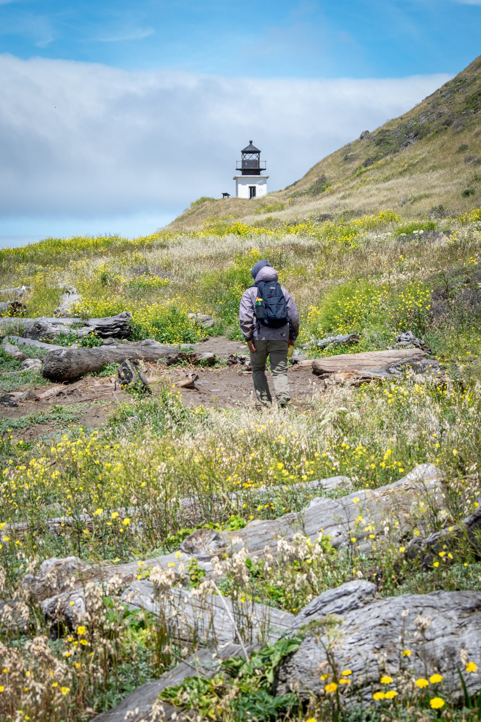
An easy first day by Lost Coast standards. From Mattole, the trail runs along open beach and low bluffs to the Punta Gorda Lighthouse at around the 3-mile mark, decommissioned in 1951 and now a quiet concrete shell worth the short detour. Just past the lighthouse is the first tidal pinch point, a quarter-mile stretch passable under roughly a 6-foot tide, and the beach beyond it hosts a growing elephant seal colony. Dogs must be leashed through this stretch by BLM rule, and hikers should give any hauled-out seals a wide berth: they are easy to mistake for driftwood until they move. Camp at Sea Lion Gulch or push on slightly to Cooskie Creek, both reasonable stops before the next tidal section.
Day 2: Sea Lion Gulch to Spanish Flat via Randall Creek (about 9 miles)
Highlight: Crossing the Sea Lion Gulch to Randall Creek tidal zone, then climbing to the open grassland of Spanish Flat.
Start early and check the tide before leaving camp. The stretch from Sea Lion Gulch to Randall Creek is the longest of the three impassable zones, about 4 miles, and only opens under a 2.5-foot tide or lower. There is no bluff escape route through most of it, just narrow beach backed by vertical rock, so enter on a receding tide and plan roughly 1 mile per hour. Once clear at Randall Creek (around the 8.8-mile mark), the trail turns inland and climbs through Spanish Creek’s canyon to Spanish Flat, a broad grassy bench and one of the few solid-ground camps on the route.
Day 3: Spanish Flat to Big Flat or Miller Flat (about 6 to 7 miles)
Highlight: Kinsey Creek and Big Creek, and the old homestead flats at Big Flat.
A gentler day, threading past Kinsey Creek and Big Creek before dropping back to the coast at Big Flat, a wide grassy terrace once homesteaded and now one of the most popular camps on the trail. Just south, across Flat Creek, the same terrace becomes Miller Flat. Both offer sheltered camping with driftwood windbreaks built up over years of use; resist the urge to build a new one, since loose shelters draw rattlesnakes and rodents. This stretch also tends to hold the trail’s best tidepooling at low tide.
Day 4: Miller Flat to Black Sands Beach via the Miller Flat to Gitchell Creek zone (about 5 to 6 miles)
Highlight: The trail’s final tidal crossing and the black sand beaches leading into Shelter Cove.
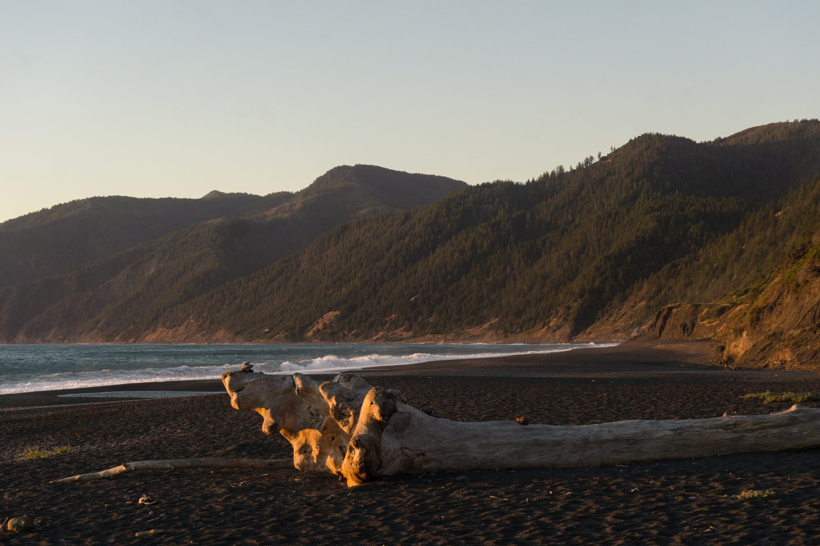
The last and, by some accounts, most demanding tidal zone starts just south of Miller Flat: 4.5 miles of narrow beach and boulder impassable above a 3-foot tide. Shipman Creek and Buck Creek sit within this stretch and make reasonable emergency camps if the window closes mid-crossing, though the goal is to clear it in one push on a receding tide. Past Gitchell Creek the terrain eases and the trail follows Horse Mountain Creek’s outflow before finishing along the black volcanic sand that gives Black Sands Beach its name, with Shelter Cove in view for the last mile. Most hikers find this final stretch an easier, faster finish after three days of unstable footing.
Faster 3-day option: combine Day 1 and Day 2 into a single long day from Mattole through both the Punta Gorda and Sea Lion Gulch zones to Spanish Flat (roughly 14 to 15 miles), then follow Days 3 and 4 as written. This only works if the tides align for both zones on the same push.
What to Expect
Terrain: Constantly changing and rarely level underfoot, even though the elevation profile is mild. Expect packed wet sand, deep dry sand that saps pace, cobble beaches, and true boulder fields the size of bowling balls to small cars. A handful of short bluff sections and inland reroutes (Punta Gorda, Spanish Flat to Big Flat) offer brief relief from beach walking.
Weather: Late May through early October brings the driest, calmest conditions, with daytime highs typically in the upper 60s to low 70s°F, though persistent coastal fog is common even in summer. From October through April the King Range is one of the wettest places in the country, averaging around 120 inches of annual rainfall, and storms can turn creek crossings dangerous fast.
Wildlife: Black bears are present throughout the King Range, which is the reason behind the mandatory canister rule. Roosevelt elk, mule deer, coyotes, foxes, and raccoons all turn up regularly, and rattlesnakes are a real, not theoretical, hazard, especially around driftwood. On the marine side, expect harbor seals, Steller sea lions, and the northern elephant seal colony near Punta Gorda and Sea Lion Gulch, plus river otters and tidepool life along the rocky benches.
Crowds: Managed by a daily quota (60 overnight permits per day from mid-May through mid-September, 30 per day the rest of the year), so it never feels crowded in the way a national park trail can, but you will see other groups, especially at the popular flats (Spanish Flat, Big Flat). Shoulder season (late spring, early fall) offers noticeably more solitude.
Signature features: Punta Gorda Lighthouse, the elephant seal colony, the black sand beaches near Shelter Cove, and the sheer scale of the King Range rising straight out of the surf.
Water: sources, safety, and treatment
Water is genuinely abundant along the coastal route: hikers commonly report a creek or spring crossing every mile or less along the beach sections, especially outside the driest months. The trail’s upland reroutes are a different story: springs there are scarcer and, per the BLM’s own guidance, increasingly unreliable in drought years, so carry extra water before any inland stretch and check the current Roads and Trails Report if one is available before your trip.
The BLM’s own guidance does not distinguish “clean” coastal creeks from riskier ones. All water should be treated, either filtered or boiled, regardless of how clear or remote the source looks. This is a heavily visited wilderness with wildlife traffic (including bears and elk) around every reliable water source, and there is no official statement anywhere that any source on this trail is safe to drink untreated. A standard squeeze or gravity filter handles this trail’s water well; a water filter built for backcountry use is standard kit here, not optional.
Known hazard, not a drinking-water issue: creek crossings can rise fast and become genuinely dangerous during and after storms. The BLM’s explicit rule is not to cross anything above knee height and to wait for the water to subside instead. This is far more relevant in the wet season (October to April) than the recommended dry-season hiking window, but worth knowing if you are hiking shoulder season.
What Hikers Say About the Lost Coast Trail
This section pulls together what people who have hiked the Lost Coast wrote down afterwards, so the planning above is checked against real trips. The reports run from 2011 to 2026, so treat them as the trail’s character, not today’s tide windows or permit rules. Check the current BLM and tide information before you go.
The tides rule everything. Every report treats the three impassable sections as the main constraint. A 2026 group planned crossings around low tide with an online chart, avoided one crossing by camping on a bluff before high tide and crossed the last zone just before the water came in. A 2012 pair cleared the tricky sections about two hours either side of high tide and, on their last morning with a 5:45am high, waited for the water to drop. A 2015 hiker noted that hikers have needed rescue after being trapped between cliffs and sea.
The footing is harder than it looks. One report calls the trail deceptively difficult, with shifting sand, boulders and small rocks, and says to expect to go slower than your normal pace. A 2012 pair found sand walking averaged about 2 mph and preferred the grassy trails above the beach. A 2015 hiker called the soft start sand a slog, found the rocky sections slow and said black sand near Randall Creek is tiring with a heavy pack; walking the hard-packed sand near the surf helped. His boot soles came off on the rocks, so he finished in slippers.
Creek crossings are manageable but wet. A 2026 group found the creeks relatively easy in May. A 2012 pair said most were easiest where they met the ocean, some needed boots off and Crocs on, and Big Flat Creek was the hardest.
Navigation is simple, with a few missed exits. The trail mostly follows the shoreline. A 2026 group warned that exits from the beach are not always marked and that one at Big Flats is a very subtle cairn with two logs that leads away from a private landing strip. A 2015 hiker recommended the bluff alternates marked by easy-to-miss cairns.
Weather: wind is the pattern. A 2026 trip began in coastal fog and a rainy night, then turned sunny, with afternoon winds making tents hard to pitch at Miller Flat. A 2012 pair had 15 to 20 mph north winds on day one and a marine layer on day two. A 2015 hiker’s sleeping bag got wet in rain and wind at Spanish Flat and he moved about 200 yards inland to trees to escape the wind.
Wildlife is a draw. A 2026 group saw a sea lion colony that took over part of the trail, whales, a river otter, a seal pup and deer. A 2012 pair reported many sea lions and elk, plus rattlesnakes, one nearly stepped on. Several reports note plenty of bear sign. A hard-sided bear canister is required.
Camps. A 2026 group praised Miller Flat for space, reliable water and tree windbreaks, and noted Horse Mountain Creek is exposed to wind but has a waterfall pond. Other reports call Cooskie Creek popular and Randall Creek a nice camping area. Sea Lion Gulch camps get noisy.
Permits and getting there. A 2026 group said permits sold out within a minute. They used a shuttle from Arcata airport and found it saved time compared with a rental car. One report recommends staying near Black Sands Beach the night before and taking a morning shuttle to Mattole Beach, so you are not rushing at the end.
Pests. A 2026 group pre-treated clothing with permethrin for ticks and warned about poison oak and poison ivy inland. A 2012 pair abandoned a planned route because the trail was washed out and overgrown with poison oak.
What Hikers Say They Packed, Used and Wished They Had
- Boots that are ready for rock. A 2015 hiker regretted not maintaining his old boots after the soles failed; sturdy boots with ankle support and trekking poles were recommended on the rocky terrain. See best waterproof hiking boots and best ankle support hiking boots.
- Camp shoes you can cross creeks in. Crocs helped a 2012 pair at the creek crossings. See best hiking sandals.
- Trekking poles. For the cobbles, loose rock and creeks. See best trekking poles.
- A stove. A 2012 pair left theirs at home to save weight and said they really missed hot food. See best backpacking stoves.
- A secure pad and dry gear. A 2015 hiker lost his sleeping pad and found it half a mile back in the surf. Wet bags help against spray and rain. See best dry bags for hiking.
- A bear canister. Required, because many camps have no trees. See best bear canisters for multi-day hiking.
- A wind-ready shelter. Two reports describe tarps flapping loudly or tents hard to pitch in the wind. See best lightweight tarps for camping.
Sources (paraphrased, no text copied): Backpackers Review trip report; Fionnuala Morrish, The Mountaineers, May 2026; Born2BBrad on Oregon Hikers, May 2012; Ravialdo on Backcountry Post, April 2015; Adam Criswell on Backpacking Light, 2011.
Logistics
Permits are the trail’s real planning bottleneck, and they are inseparable from the tide chart. Individual overnight wilderness permits are booked through recreation.gov on a 90-day rolling reservation system, released at 7am Pacific each day for the corresponding date. Fees are modest: a $6 reservation fee plus a $12 per person Special Area Fee (waived under 16). The BLM is explicit that you should check tide predictions for your intended dates before purchasing a permit, not after, since a valid permit does not guarantee the zones will actually be passable. Walk-up permits for groups of up to 3 are available by lottery at the King Range Visitor Center, drawn Monday through Saturday at 8am.
A hard-sided bear canister is mandatory, one per person minimum, and rangers do check. Canisters rent for $5 per trip (plus a refundable $75 deposit) at several locations, including the Visitor Center and the Petrolia General Store near Mattole. Campfires are banned everywhere in the wilderness from June 19 through September 30; outside that window, a CAL FIRE campfire permit is required even for a camp stove. Waste disposal has one rule that surprises most first-timers: solid human waste is buried in a shallow hole in the intertidal zone, not the usual 200 feet from water, and toilet paper is always packed out, never buried or burned. Dogs are technically allowed but not recommended given the terrain and wildlife, and must be leashed between Punta Gorda and Sea Lion Gulch.
Mandatory Gear Checklist
For the full kit, with product picks and why each one earns its place, see what to pack for the Lost Coast Trail.
- A hard-sided bear canister. Non-negotiable, one per person, and checked at the trailhead. Rent one in Petrolia or at the Visitor Center if you don’t own one. See best bear canisters for multi-day hiking.
- A reliable water filter, since no source on this trail is stated as safe to drink untreated. See best water filters for hiking.
- Sturdy, broken-in boots with real ankle support, for the boulder fields and the unstable footing on wet sand. The BLM’s own guidance singles this out. See best waterproof hiking boots.
- Gaiters. Loose, deep sand finds its way into everything on this trail; gaiters are one of the most consistently recommended items in trip reports. See best hiking gaiters.
- Trekking poles, genuinely useful for balance across boulder fields and soft sand. See best trekking poles.
- A current tide table for the Shelter Cove NOAA station, printed or downloaded before you lose signal, plus a watch. This is arguably the single most important piece of “gear” on this trail and it is free; do not rely on a phone app that needs live data.
- A dry bag or dry sack for your phone, permit, and any electronics, given the ocean spray through the tidal zones and multiple creek fords. No dedicated dry bag article exists on the site yet (logged catalogue gap).
- A rain shell, especially outside the core May to October window. See best waterproof jackets.
Honest Assessment
This trail suits hikers who already have at least one multi-day trip behind them and who are comfortable with a genuinely different kind of navigation: reading tides and terrain rather than following a marked tread. The reward is real solitude and one of the wildest coastlines left in the country, but the trail asks for real planning discipline in return.
It is not a forgiving first backpacking trip. There is no cell coverage, no BLM search and rescue presence, and the tidal zones carry real consequences if misjudged. Hikers who want a gentler taste of the same coastline without the tidal math can walk the southern section through Sinkyone Wilderness State Park instead, a shorter, less constrained stretch with its own trailheads.
Among experienced backpackers, the consensus is that this is one of the best multi-day trips in California precisely because it demands respect. It is not a walk in the park, and it is not meant to be.
Final Thoughts
The Lost Coast Trail rewards the same discipline as any tide-dependent trip: check the tide chart before you check anything else, carry a real bear canister, and treat every drop of water you drink. If you are still building toward a trip with this much logistics, start with how to plan your first multi-day hike, and for the navigation and water-safety fundamentals this trail leans on hardest, multi-day hiking skills is worth a read before you go. If you want the exact gear list before you go, see what to pack for the Lost Coast Trail.
Frequently Asked Questions
Do I need a permit for the Lost Coast Trail?
Yes, for any overnight stay in the King Range Wilderness. Book through recreation.gov on the 90-day rolling reservation system, or try for a walk-up permit (max 3 people) by daily lottery at the King Range Visitor Center. Day hikes don’t require a permit.
What’s the best month to hike the Lost Coast Trail?
Late May through early October offers the driest, calmest weather, though summer coastal fog is common. Every date still needs its own tide check regardless of season: some late-summer and fall dates simply don’t have a low enough tide to pass the impassable zones at all.
Do I really need a bear canister?
Yes, one per person, hard-sided, no exceptions. Black bears are present throughout the King Range and rangers do check at trailheads. Canisters rent for $5 per trip at several locations including the Petrolia General Store near the Mattole trailhead.
How dangerous are the tidal zones, really?
Genuinely dangerous if mistimed. The BLM cites recurring rescues and close calls from hikers who misjudged the tide windows. The three zones require tides under 6, 2.5, and 3 feet respectively to pass safely, and low tide does not automatically mean passable: check the actual tide height against these thresholds before you enter each zone.
Can beginners hike the Lost Coast Trail?
Not recommended as a first backpacking trip. The tide-timing, lack of cell coverage, and absence of a formal search and rescue presence all reward hikers who already have some multi-day experience and are comfortable navigating without a marked trail.
