

Last updated: July 2026
Wild Trail Hiker is reader-supported. We may earn a commission when you buy through links on this page, at no extra cost to you. We only recommend products we’d consider taking on a multi-day trip ourselves.
Before You Go
The John Muir Trail is 211 miles from Happy Isles in Yosemite Valley to the summit of Mount Whitney, the highest point in the contiguous United States. It is not a trail you can decide to walk next month. Yosemite issues a hard exit quota of 45 permits a day over Donohue Pass, the gateway south out of the park, and the lottery for a July or August start opens 24 weeks in advance. A bear canister is mandatory for the entire route, no exceptions, even for Pacific Crest Trail thru-hikers passing through on a different permit. Plan the permit before you plan anything else.
Why This Trail
The John Muir Trail earns its reputation by never letting up. You climb out of Yosemite Valley and don’t really come back down to civilisation for two to three weeks. In between are eight named passes over 10,000 feet, the deepest concentration of granite peaks, alpine lakes and sub-alpine meadows in the Sierra Nevada, and a final morning where the trail you have been walking for weeks ends on the summit of the tallest mountain in the Lower 48.
What sets the JMT apart from a single big hike is the accumulation. No one day is the hardest day. It’s the eighth pass that breaks people, not the first. Roughly a third of the route sits above 10,000 feet, and the trail spends long stretches entirely above treeline, which means huge payoff views but also real exposure to weather, sun and altitude for days at a stretch. Add in that close to 170 miles of the JMT run concurrently with the Pacific Crest Trail, and you’re walking one of the most storied pieces of long-distance trail in North America, not just a California classic.
It rewards fitness and planning more than technical skill. There is no scrambling, no exposed climbing, no via ferrata. What it demands is the discipline to carry the right kit for three weeks in the backcountry and the legs to do it pass after pass.
Trail at a Glance
| Spec | Detail |
|---|---|
| Distance | 211 miles (340 km) point to point, Yosemite Valley to Mt Whitney summit. Add roughly 11 miles if you exit down to Whitney Portal, for a door-to-door total near 221 miles. |
| Duration | Most hikers take 14 to 21 days. Budget closer to 3 weeks if this is your first extended thru-hike. |
| Elevation gain | Approximately 47,000 feet cumulative, over eight major passes. |
| Difficulty | Hard to expert. No technical terrain, but sustained high-altitude mileage day after day for weeks. |
| Best season | Mid-July through September. Earlier trips risk lingering snow on the passes and dangerous high water at river fords; September brings fewer bugs and quieter trail but colder nights and a real chance of early snow. |
| Permits | Mandatory wilderness permit via the Yosemite lottery on recreation.gov. Southbound lottery opens 24 weeks (168 days) before your start date. Only 45 exit permits a day are issued for Donohue Pass (15 for Happy Isles, 30 for Lyell Canyon). |
| Start trailhead | Happy Isles, Yosemite Valley: Happy Isles Trailhead on Google Maps |
| End trailhead | Whitney Portal, via the Mt Whitney summit: Whitney Portal Trailhead on Google Maps |
Trail Map
View the John Muir Trail on AllTrails: elevation profile, recent trip reports and current conditions from hikers who’ve just come off the trail.
Yosemite National Park: John Muir and Pacific Crest Trails (official NPS page): the source of truth for permits, quotas and bear canister rules.
John Muir Trail trail planning page (PCTA): resupply, permit and section detail from the organisation that maintains the overlapping PCT corridor.
Getting There and Away
Getting there (to Happy Isles, Yosemite Valley): The nearest sizeable hub is Fresno, about 2.5 to 3 hours by car, or the San Francisco Bay Area, closer to 4 hours. If you’re not driving, YARTS (Yosemite Area Regional Transportation System) runs buses into Yosemite Valley from Merced (with an Amtrak connection), Mariposa, and Fresno, which is the simplest way in if you don’t want to arrange a car shuttle. Long-term parking for the length of your trip is free in Yosemite Valley, no reservation needed, though spots fill early in the day in peak season.
Getting away (from Whitney Portal): This is the logistical catch of the JMT. There is no scheduled public transport between Whitney Portal and Yosemite, and none linking Whitney Portal directly to much of anywhere. Eastern Sierra Transit runs a route between Lone Pine and Mammoth Lakes, and YARTS Highway 120 East connects Mammoth Lakes back to Yosemite Valley, but that’s a multi-leg trip, not a same-day exit plan. Most hikers either pre-position a second car at Whitney Portal before starting, or arrange a private shuttle from a Lone Pine-based operator ahead of time. Lone Pine itself, 13 miles below Whitney Portal, is the practical staging and recovery town: it has motels, food and a bus connection onward toward Bishop and the Eastern Sierra. Book your post-trail night in Lone Pine before you start walking. Rooms sell out in summer, especially around the days a big cohort of JMT and Whitney hikers are due to finish.
Route Overview
Distances below are approximate and drawn from official and trip-report sources; actual daily mileage depends entirely on your pace and permit start point. Most hikers break the trail into five to seven segments between resupply points.
Happy Isles to Tuolumne Meadows (approx. 22 miles)
The trail leaves Yosemite Valley climbing hard past Vernal and Nevada Falls, one of the steepest sustained climbs on the entire route, made harder by starting at low elevation with a full pack. Past Little Yosemite Valley the crowds thin fast. This section tops out near Cathedral Pass before dropping into Tuolumne Meadows, the JMT’s first real resupply point and a good place to confirm your pace before the trail gets serious.
Tuolumne Meadows to Red’s Meadow (approx. 40 miles, via Donohue Pass)
Donohue Pass, at 11,056 feet, is the gateway out of Yosemite and the first genuine high pass of the trip. Beyond it the trail drops through Lyell Canyon and into the Ansel Adams Wilderness, past Thousand Island Lake and Garnet Lake, two of the most photographed spots on the whole JMT. Red’s Meadow, near Devils Postpile, is a common resupply stop with a small store and, when road access allows, a shuttle connection to Mammoth Lakes for a proper resupply run or a shower.
Red’s Meadow to Vermilion Valley Resort (approx. 28 miles, via Silver Pass)
A quieter stretch through Cascade Valley and over Silver Pass. Vermilion Valley Resort (VVR) sits off-trail via a short ferry or trail detour across Lake Thomas Edison and is a well-known hiker stop for a resupply bucket, a cooked meal and, famously, a free beer for thru-hikers.
Vermilion Valley Resort to Muir Trail Ranch (approx. 30 miles, via Selden Pass)
Selden Pass and the Sallie Keyes Lakes lead into Muir Trail Ranch (MTR), the JMT’s most remote resupply point and the last one most hikers use before the trail’s most demanding section. MTR holds pre-mailed resupply buckets but sells no food itself, so plan precisely.
Muir Trail Ranch to LeConte Canyon (approx. 30 miles, via Muir Pass)
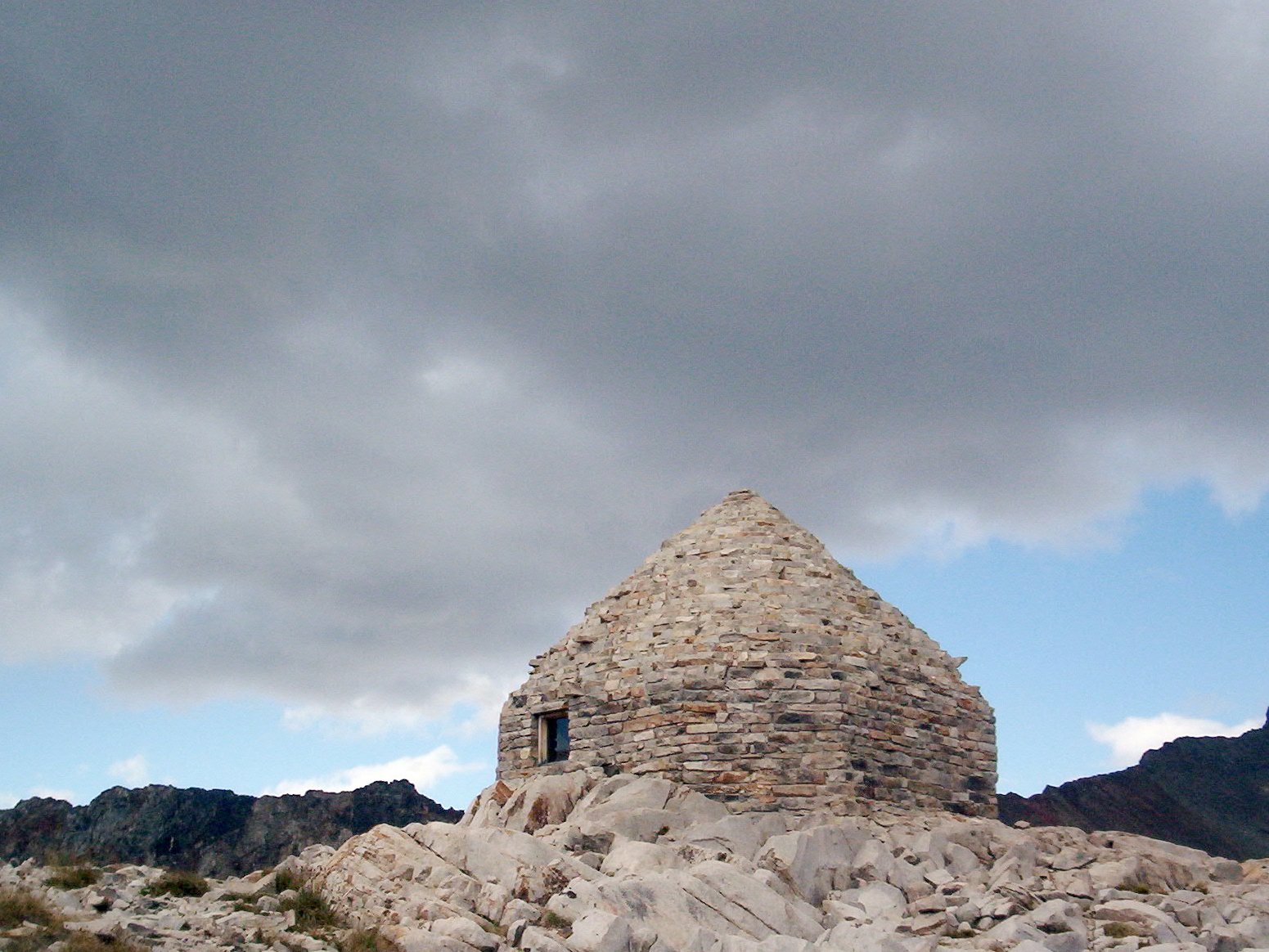
The climb to Muir Pass (11,955 feet) through Evolution Valley and past Evolution Lake is widely rated one of the most beautiful stretches of the entire trail: broad alpine basins, chains of lakes, and the stone Muir Hut sitting right on the pass. The descent into LeConte Canyon is steep and rocky.
LeConte Canyon to Kearsarge Pass area (approx. 40 miles, via Mather, Pinchot and Glen Passes)
Three passes in quick succession, all above 12,000 feet, through some of the most remote and rugged terrain on the JMT, deep in Kings Canyon National Park. Kearsarge Pass, just off the main JMT line, is the standard resupply detour for the final stretch: a side trail drops to Onion Valley trailhead and a shuttle or hitch into Independence.
Kearsarge Pass area to Whitney Portal (approx. 40 miles, via Forester Pass and Mt Whitney)
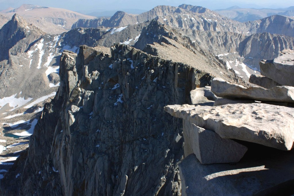
The final push. Forester Pass, at 13,153 feet, is the highest point on the JMT proper and one of the more exposed passes on the route, with a trail cut into a near-vertical rock face near the top. From there the trail runs south through Sequoia National Park to Guitar Lake, the last camp before Whitney, and then climbs to the 14,505-foot summit. The descent from the summit to Whitney Portal drops over 6,000 feet in 11 miles, on tired legs, and is widely described by finishers as the hardest single day of the trip.
What to Expect
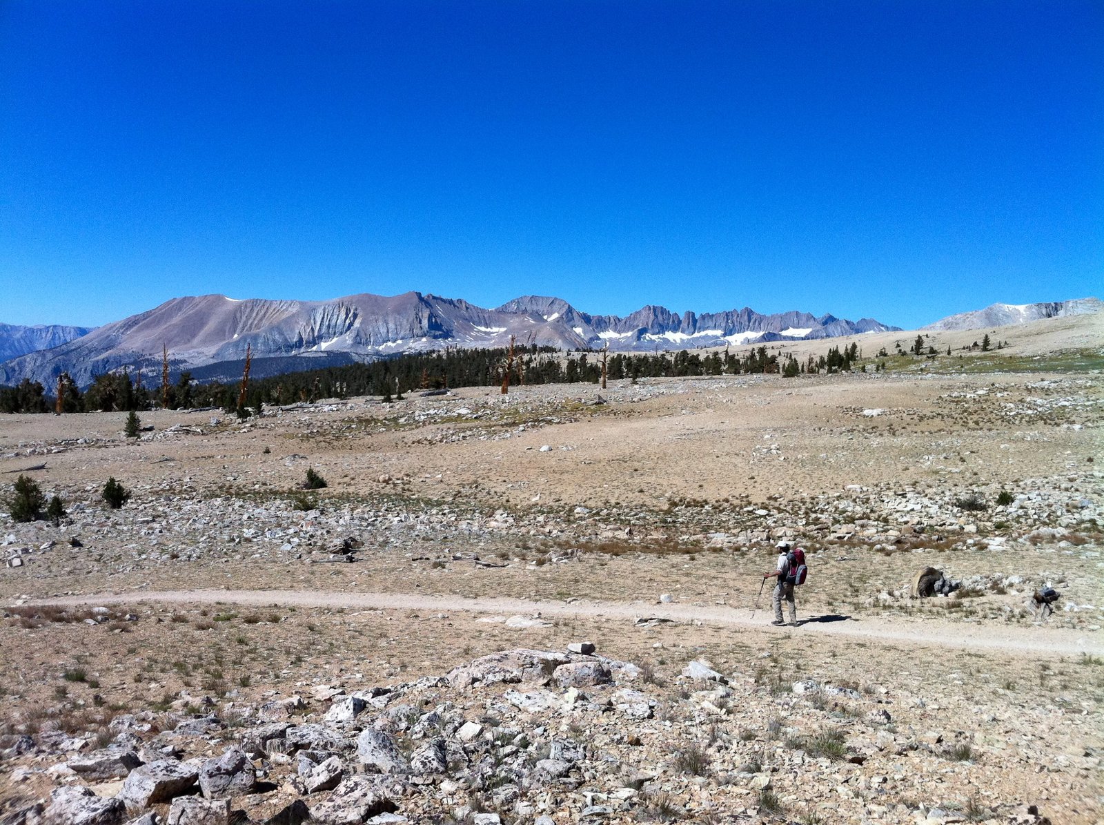
Terrain. Almost entirely maintained trail: well-graded switchbacks on the passes, granite slab, sandy meadow sections, and regular stream and creek crossings that can run high and fast in July on a big snow year. There is no scrambling or exposed climbing, but several passes have real drop-offs next to the trail.
Weather. Sierra summer weather is generally stable and dry, but afternoon thunderstorms build over the high passes from mid-July into August, often with lightning. Mornings are the safest time to be on an exposed pass. Nights above 10,000 feet regularly drop below freezing even in August.
Wildlife. Black bears are common along the northern half of the trail, which is exactly why the canister rule is enforced without exception. Marmots and pikas are constant companions above treeline. Rattlesnakes turn up at lower elevations near the start and end of the trail.
Crowds. Heaviest in the first few days out of Yosemite Valley and around the Whitney summit approach, both shared with day hikers and separate permit systems. The middle third, through Kings Canyon, is genuinely remote and quiet by comparison.
Signature features. Thousand Island Lake, Evolution Valley, the Muir Hut on Muir Pass, the Forester Pass headwall, and the Whitney summit at sunrise.
Water: sources, safety and treatment
Water is genuinely abundant along the JMT. Official guidance and trip reports agree it’s rare to go more than a couple of hours without crossing a stream or passing a lake, and most hikers carry no more than two litres at a time. The one reliably dry stretch worth planning around is the final climb from Guitar Lake to Whitney Trail Camp, where you need to carry enough to get over the summit and down the other side.
Even though most JMT water runs clear off granite and snowmelt, treat everything. Giardia is present in the Sierra backcountry, and lower-elevation sources near meadows and stock trails carry more risk than high alpine streams. A squeeze filter (rated to remove protozoa and bacteria) is the standard choice on this trail: fast, no batteries, and it copes with the volume of refills a three-week trip demands. See our water filters for hiking guide for picks that hold up over that kind of mileage. Carry a backup purification method (tablets or drops) in case your filter clogs or freezes.
Logistics
Permits are the entire game here. Apply through the Yosemite wilderness permit lottery on recreation.gov the moment your window opens, 24 weeks ahead of your target start date, and have backup start dates ready. If the lottery doesn’t come through, watch for cancellations, which are released two weeks out. A trailhead entry quota does not guarantee food storage or campsite reservations further down the trail; those are managed on the day.
Bear canisters are mandatory for the entire route, no exceptions. If you don’t own one, Yosemite rents them at wilderness permit stations, a genuinely sensible option if this is a one-off trip. Resupply is entirely on you: mail buckets or boxes ahead to Tuolumne Meadows, Red’s Meadow, Vermilion Valley Resort or Muir Trail Ranch, or plan a shuttle detour into Mammoth Lakes or Independence. Fires are prohibited above 10,000 feet along most of the route, so your cooking plan needs to assume a stove regardless of season.
Mandatory Gear Checklist
This is not a generic backpacking list. Three things the JMT specifically demands:
- An approved bear canister. Legally required the entire way, no exceptions. This is the one item where “I’ll risk it” is not an option. See our best bear canisters for multi-day hiking guide for approved models, or the full John Muir Trail packing list for the benchmark we recommend.
- An insulated sleeping pad. A third of this trail sits above 10,000 feet, and nights there are cold even in August. See our best insulated sleeping pads for hiking guide for genuine R-value picks; the full gear guide covers what to look for.
- A water filter rated for high refill volume. You’ll be filtering constantly. Our water filters for hiking guide has picks built for exactly this kind of daily use.
For the complete category-by-category kit, including sleep system, footwear, layers and navigation, see What to Pack for the John Muir Trail.
Honest Assessment
Who should walk it: hikers with real multi-day backpacking experience already behind them, comfortable carrying 25 to 35 lbs at altitude for weeks, and willing to put in the permit-application effort a year or more out. If you’ve done a handful of 3 to 5 day trips and want the next step up, the JMT is the natural one.
Who shouldn’t, at least not yet: anyone whose longest trip so far is a single overnight, or who hasn’t spent real time above 8,000 feet. Altitude and sustained daily mileage compound in a way that’s hard to appreciate until you’re two passes in.
Alternatives: the High Sierra Trail covers similar terrain and finishes on the same Mt Whitney summit in 5 to 8 days rather than three weeks, a genuinely good way to test whether this style of trail suits you before committing to the full JMT. Sections of the trail, like Tuolumne Meadows to Red’s Meadow, also work well as standalone 3 to 5 day trips if the permit lottery for the full route doesn’t come through.
Final Thoughts
The John Muir Trail is less a single hike than an extended commitment: to the permit process, to the training, to the logistics of feeding yourself for three weeks in the backcountry. What you get back is one of the most complete alpine experiences in the country, condensed into one continuous line on the map. If this is your first trip at this scale, start with our guide to planning your first multi-day hike and build toward it rather than treating it as trip one. If you want a shorter taste of this same corridor without the multi-week commitment, our Rae Lakes Loop guide covers a 4 to 5 day loop through the same Kings Canyon granite, crossing the shared JMT/PCT corridor at Glen Pass.
If you’re drawn to trails of this scale, our guides to the Milford Track in New Zealand and the Torres del Paine O Circuit in Chile cover two more multi-week routes in a similar register.
Frequently Asked Questions
How hard is it to get a John Muir Trail permit?
Genuinely hard for popular July and August start dates. Yosemite caps exits over Donohue Pass at 45 people a day, split between the Happy Isles and Lyell Canyon trailheads, against a lottery that opens 24 weeks ahead of your date. Apply with several backup dates and watch for released cancellations two weeks before each date.
Do I really need a bear canister the whole way?
Yes. It’s a legal requirement across the entire route through Yosemite, Sequoia and Kings Canyon, with no exceptions for thru-hikers or PCT permit holders. Rangers do check. Yosemite rents canisters at wilderness permit stations if you don’t want to buy one for a single trip.
How fit do I need to be?
Fit enough to carry 25 to 35 lbs over 10 to 15 miles a day, repeatedly, for two to three weeks, with roughly a third of that mileage above 10,000 feet. Prior multi-day backpacking experience matters more than raw running fitness.
Can I hike just part of the John Muir Trail?
Yes, and it’s a smart way to test the terrain before committing to a full permit. Tuolumne Meadows to Red’s Meadow and the Kearsarge Pass approach to Whitney are both well-used shorter sections with their own trailhead access.
