

Last updated: September 2026
Wild Trail Hiker is reader-supported. We may earn a commission when you buy through links on this page, at no extra cost to you. We only recommend products we’d consider taking on a multi-day trip ourselves.
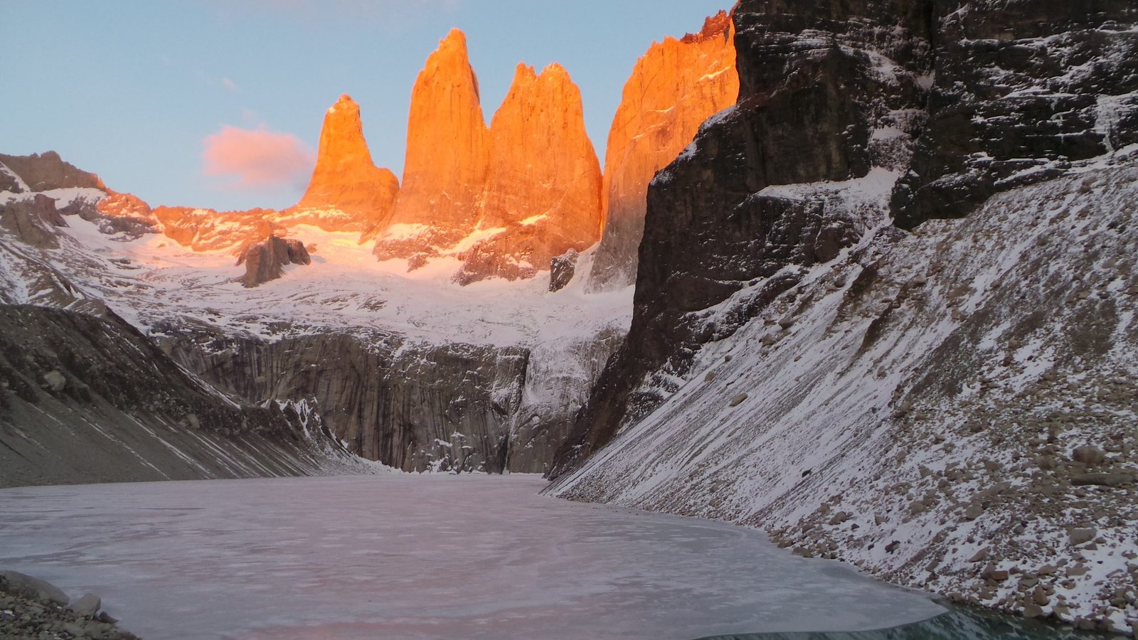
Hero photo: Luchomunozm (source), CC BY-SA 4.0, via Wikimedia Commons.
Before You Go
The O Circuit is not a trail you can book last minute or wing on arrival. Every campsite and refugio night must be reserved in advance, split across two separate operators, and the full chain has to be unbroken: if one night in your sequence is sold out, the whole itinerary breaks and you’re rebuilding the plan. The route only runs counter-clockwise, the backcountry (northern and western) sections are only open for a shorter window than the popular W Trek, and Patagonia’s wind and weather can shut down the high pass with no warning. Read the Logistics section before you get attached to specific dates.
Why the O Circuit Is Worth the Effort
The O Circuit is the full loop around the Paine Massif. The W Trek, the route most visitors do, covers the same park’s most photographed valleys in 4 to 5 days using a chain of refugios. The O adds the remote northern and western backcountry to that same W route, roughly doubling the trek length and taking you along the southern edge of the Southern Patagonian Ice Field, one of only two continental ice sheets on Earth outside Antarctica.
What sets the landscape apart is how abruptly it changes. There’s no gradual build-up through foothills. Sharp, ice-covered granite peaks rise straight out of flat Patagonian steppe, so you go from open grassland with grazing guanaco to vertical rock and hanging glaciers within a few hours of walking. Add southern Patagonia’s position at the bottom of the continent, with weather systems from the Southern Ocean hitting the Andes largely uninterrupted, and you get conditions that shift fast and hit hard even in the middle of summer.
The defining day is the crossing of John Gardner Pass on day 4, the trek’s highest point at roughly 1,200 metres. It’s also the day most likely to be affected by wind or snow, which is why guides recommend building in a spare day if your schedule allows it.
Trail at a Glance
- Distance: Approximately 120 km / 75 miles (operator itineraries vary by 5 to 10 km depending on side trips taken)
- Duration: 8 days / 7 nights is the standard reservation pattern; 9 to 10 days if you want a weather buffer or extra side hikes
- Difficulty: Hard to expert. Not a first multi-day hike.
- Best season: November to March for the full O Circuit (the backcountry sector between Serón and Grey has a shorter season than the W Trek’s October to April window; confirm exact opening dates for your season before booking, they shift year to year)
- Permits: National park entry ticket required, plus mandatory pre-booked campsite or refugio nights for every night of the trek
- Start / End trailhead: Torres del Paine Welcome Center, Central Sector (the O is a loop, so start and end are the same point): Torres del Paine Welcome Center on Google Maps
- Terrain: Patagonian steppe, beech forest, glacial lake shoreline, high alpine pass, glacier-edge trail
Trail Map
Torres del Paine Circuit O/W on AllTrails: distance, elevation profile, and recent hiker photos and conditions reports.
Official CONAF trekking maps (download page) (PDF, Spanish and English versions)
Getting There and Away
Getting there: Almost everyone stages through Puerto Natales, reached by road from Punta Arenas (roughly 3 hours) or by domestic flight into Punta Arenas from Santiago. From Puerto Natales, daily buses run to the park’s eastern entrances, with a roughly 2 to 3 hour journey depending on your exact drop point. Buses depart the Puerto Natales bus terminal (Terminal Rodoviario, Av. España) with multiple morning departures in peak season. Once inside the park, a short shuttle connects the Laguna Amarga entrance to the Welcome Center and Central Sector, where the O Circuit actually starts.
Getting away: Because the O is a loop, you finish back where you started, at the Central Sector. Getting away is the same journey in reverse: shuttle to Laguna Amarga or directly from Central, then the Puerto Natales bus.
Staging towns: Puerto Natales is the practical base both before and after the trek; book accommodation there in advance during December to February, when the whole town fills up around trekker arrivals and departures. Punta Arenas is the fallback if you’re flying internationally and need a night either side.
Torres del Paine O Circuit: 8-Day Itinerary
Counter-clockwise: east, then north, then west, then south back to Central.
Day 1: Central Sector → Serón
Distance: ~13 km | Time: 4 to 5 hours | Terrain: Open steppe, rolling hills, river crossings
The trek opens gently, heading north across wide open plains with the Paine Massif still distant on the horizon. It’s an easy introduction to distance, but not to wind: this is where most first-time O Circuit hikers get their first real sense of how constant and physical Patagonian wind actually is, even on a day with no rain. Guanaco sightings are common on the open steppe sections. Camp at Serón, a sheltered, grassy site with reliable water access.
Day 2: Serón → Dickson
Distance: ~18 km | Time: 6 to 7 hours | Terrain: Forest trail, river valley, glacial lakeshore
The longest day of the standard itinerary and one of the most scenic on the northern half of the route. The trail moves through native beech forest and along rivers fed by the ice field before opening onto Lago Dickson, a glacial lake surrounded on three sides by ice-covered peaks. Camp at Dickson, right on the lakeshore.
Day 3: Dickson → Los Perros
Distance: ~12 km | Time: 4 to 5 hours | Terrain: Narrow valley, dense forest, glacial moraine
Shorter than the day before but noticeably more dramatic. The valley narrows, the surrounding peaks close in, and the presence of the ice field becomes obvious as hanging glaciers come into view above the trail. This is the staging camp for the pass crossing the next morning, so most hikers treat it as an early night. Camp at Los Perros, a forested site near the Los Perros Glacier.
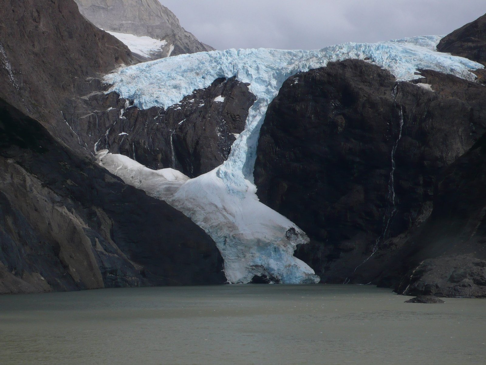
Bring for this stretch: nothing beyond your standard kit, but check the forecast here. John Gardner Pass is closed to hikers when wind or visibility make the crossing unsafe, and rangers at Los Perros are the ones who make that call the next morning.
Day 4: Los Perros → Grey (via John Gardner Pass)
Distance: ~15 km | Time: 8 to 10 hours | Terrain: Steep alpine ascent, snowfield, exposed high pass, long descent
The defining day of the O Circuit, and the one day where the trek’s difficulty rating earns itself. A pre-dawn start is standard practice, both to beat the worst of the afternoon wind and to give yourself the full daylight window for a long day. The climb to John Gardner Pass (roughly 1,200 m) is steep and frequently holds snow even in summer. From the top, the reward is one of the most striking views on any trek anywhere: Grey Glacier and the Southern Patagonian Ice Field spreading out below toward the horizon. The descent on the far side is long, steep, and exposed in sections, including ladder-assisted drops, and takes a real physical toll after the climb. Camp at Grey, near Refugio Grey, with the glacier visible from camp.
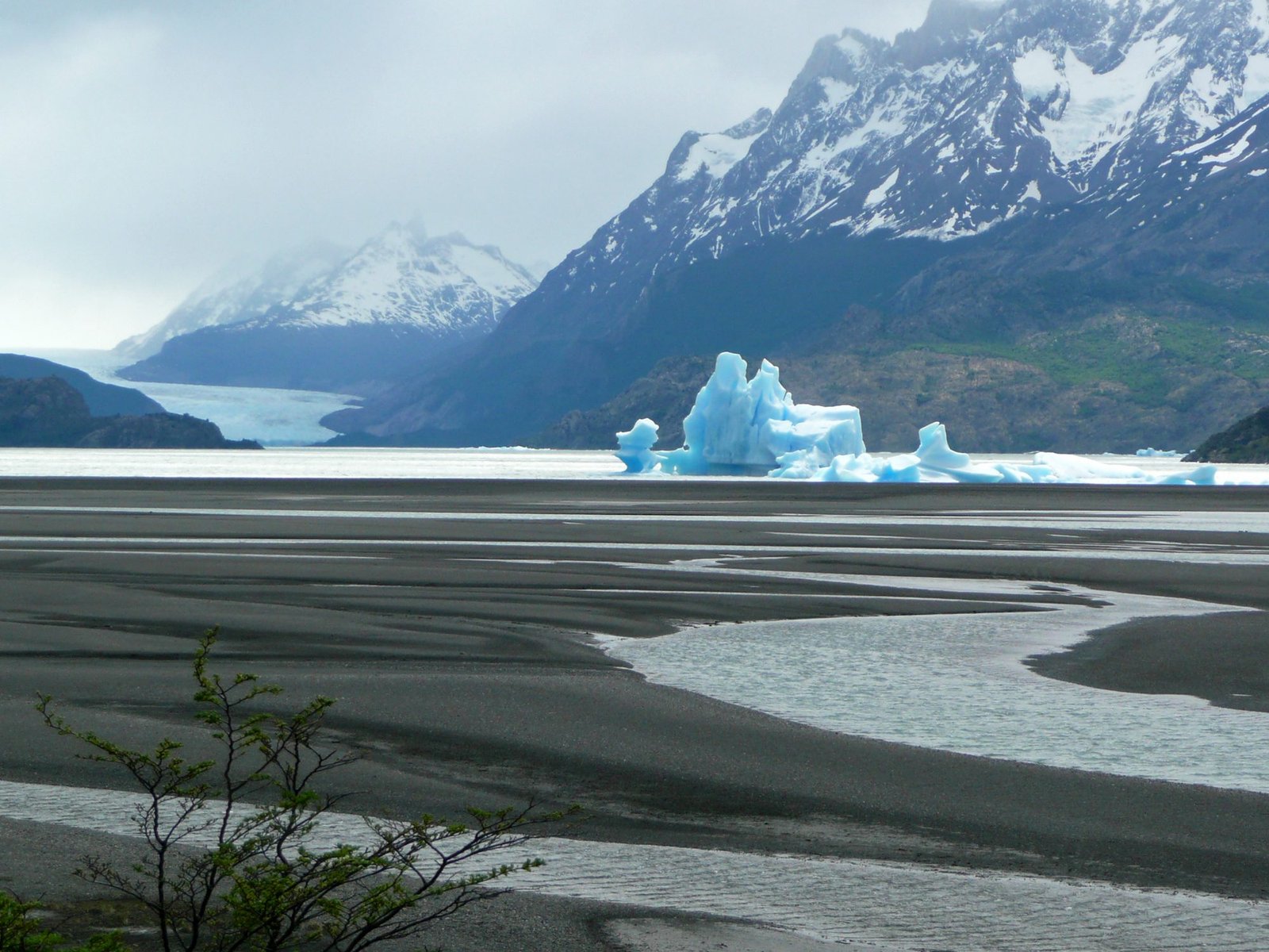
Bring for this stretch: a wind shell or hard-shell jacket you can move in, not just stand in. This is the one sustained above-treeline, fully exposed stretch on the entire circuit, and it’s also the stage where hikers most often get caught out by a shell that’s fine in light rain but not in sideways Patagonian wind. See the Best Waterproof Jackets guide if yours hasn’t been tested in genuinely bad conditions.
Day 5: Grey → Paine Grande
Distance: ~11 km | Time: 4 to 5 hours | Terrain: Cliffside trail, glacier viewpoints, rolling hills
A comparatively gentle day that follows the western shore of Lago Grey, with repeated views down onto the glacier and the icebergs it calves into the lake. This is also where the O Circuit rejoins the W Trek route, so expect noticeably more hikers on the trail from here on. Camp at Paine Grande, the largest and best-serviced site on the circuit.
Day 6: Paine Grande → Francés / Italiano
Distance: ~9 to 13 km depending on the French Valley side trip | Time: 4 to 7 hours | Terrain: Forest trail, valley ascent, rocky alpine terrain
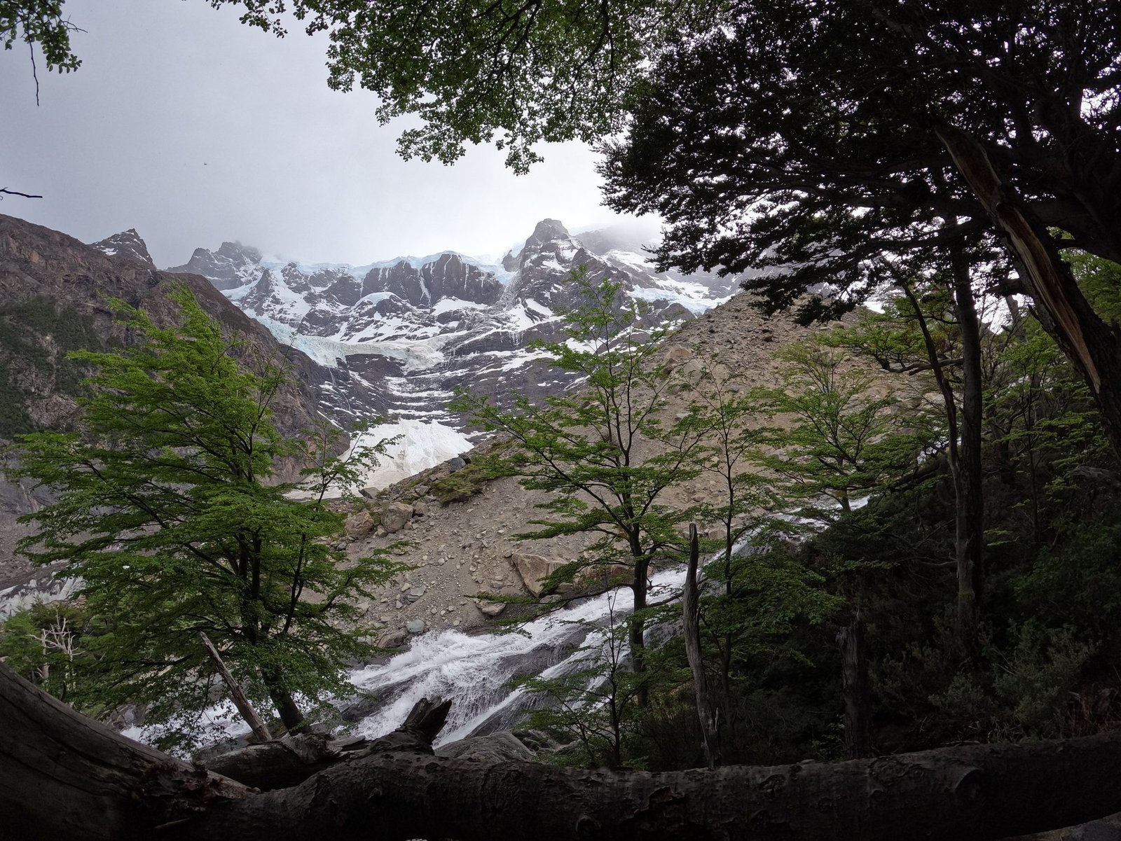
Today’s main event is the French Valley, one of the most dramatic basins in the park. Most hikers drop their packs at Camp Italiano and do the return side trip up-valley without full weight, which is the main reason for the wide time range. Hanging glaciers on the valley walls shed regular avalanches you can hear and sometimes see from the trail. Camp at Francés or Italiano.
Day 7: Francés → Chileno
Distance: ~15 km | Time: 6 to 7 hours | Terrain: Lakeside trail, forest climb, ridgeline
A long traverse along Lago Nordenskjöld, with the Cuernos del Paine reflected in the water on a calm day, before climbing into forest toward Chileno. This is also good condor-viewing terrain in the late morning, when thermals off the massif start to form. Camp at Chileno, positioned for an early start the next morning.
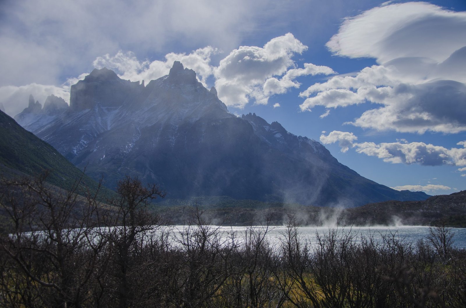
Day 8: Chileno → Base Torres → Central Sector
Distance: ~10 km | Time: 4 to 6 hours | Terrain: Steep rocky ascent, forest descent
The finish. An early climb takes you to the Base of the Torres viewpoint, the three granite spires the whole park is named for, rising above a glacial lake. Many hikers start in the dark specifically to catch sunrise on the towers before the day-tripper crowds arrive from Central. From there, it’s a descent back to the Welcome Center to close the loop.
What to Expect
Terrain: A genuine mix, from flat open steppe to forest to one serious high alpine pass. Nothing on the O Circuit is technical climbing, but John Gardner Pass demands real fitness and sure footing on loose, sometimes snow-covered ground.
Weather: Summer (December to February) daytime highs run around 15 to 20°C, with nights dropping to 5 to 7°C, but the number that matters more than temperature is wind. Gusts regularly exceed 80 to 100 km/h, and the park is known for cycling through several distinct weather patterns in a single day. Pack for all of them, not the forecast.
Wildlife: Guanaco are common on the steppe sections, especially days 1 and 8. Torres del Paine has one of the highest documented densities of wild puma anywhere, though sightings from the trail itself are opportunistic rather than guaranteed, dawn and dusk are the best windows. Andean condor are frequently visible riding thermals off the massif, particularly late morning. There is no bear population in Patagonia, so unlike most of the trails on this site, there’s no canister or food-storage mandate to plan around here.
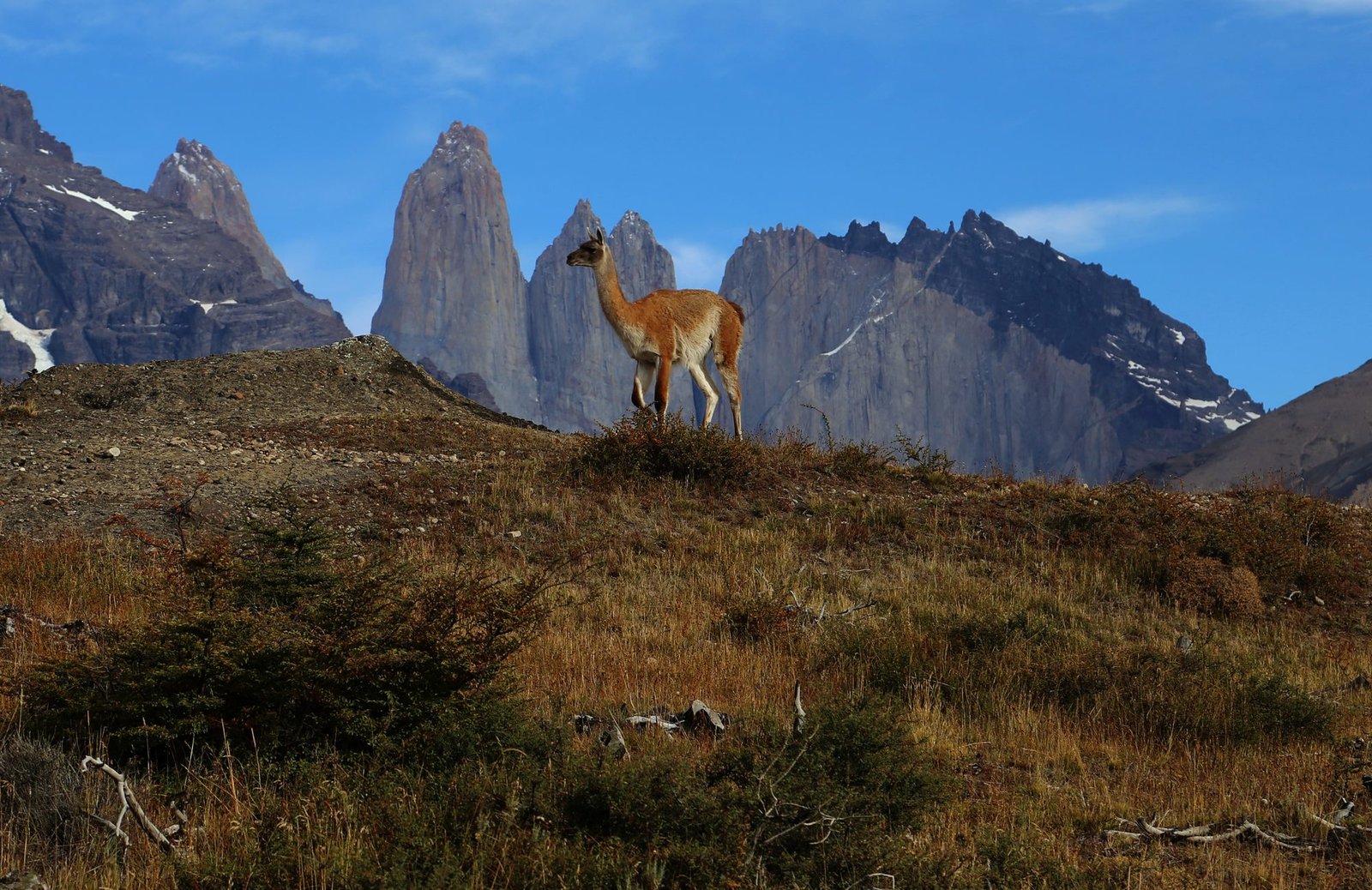
Crowds: Light on the northern backcountry stretch (Serón through Grey), noticeably busier from Paine Grande onward, where the O rejoins the W Trek’s day-tripper and shorter-itinerary traffic.
Water: sources, safety, and treatment
Water is available throughout the route from rivers, streams, and lakes fed by glacial melt, so carrying capacity isn’t a major planning constraint the way it is on drier trails. Park operators generally describe the water as safe given its glacial origin, and many hikers do drink untreated from smaller side streams away from trails, campsites, and ranger stations.
That said, the picture isn’t universally clean. Torres del Paine has an established population of invasive beavers, and giardia (sometimes called “beaver fever”) has been documented in hikers who drank untreated water from larger, more heavily trafficked watercourses. The practical middle ground most experienced hikers land on: draw from smaller, fast-flowing tributaries well away from campsites and the main river, and treat water drawn from anything larger or slower. A lightweight filter removes the ambiguity entirely and weighs little enough that there’s not much reason to skip it. See Best Water Filters for Hiking if you don’t already carry one.
Logistics
Accommodation on the O Circuit is split between two separate operators with separate booking systems: Vértice Patagonia handles Paine Grande, Grey, Dickson, and Los Perros; Las Torres Patagonia handles Central, Chileno, Cuernos, Francés, and Serón. You will need confirmed bookings with both to complete the circuit, since every night is mandatory and the two systems don’t share availability with each other.
Reservations for a given season typically open several months ahead (April to June for the following October to April season), and the O Circuit’s northern backcountry sites sell out faster than the W Trek’s, since capacity there is smaller. Booking platforms that aggregate both operators exist and are worth using if managing two separate reservation systems sounds like its own project.
National park entry is a separate ticket, purchased through the official CONAF portal, and is checked alongside your accommodation confirmations at the Welcome Center before you’re allowed to start. Chile moved to a route-based entry fee structure from May 2026; budget roughly CLP 30,000 to 50,000 (around USD 30 to 55) for a foreign adult, depending on the exact pass type, and confirm current pricing before you book, since this system is new and pricing has already been revised once this year.
Mandatory Gear Checklist
For the full packing list with everything laid out category by category, see our complete Torres del Paine O Circuit gear guide. The essentials below are the categories that matter most.
This is a wind-and-cold trek first, distance second. A few categories matter more here than on most trails on this site:
- A genuinely storm-rated rain shell, not a fair-weather one. Patagonian wind finds every weakness in a jacket’s seams and hood. See Best Waterproof Jackets.
- A 60 to 75L backpack if you’re carrying full camp kit for all 7 nights. See Best Large Hiking Backpacks, or Best Ultralight Backpacks if you’re on a lighter refugio-supported itinerary.
- Trekking poles, less for the terrain than for the wind. A loaded pack in an 80 km/h crosswind on an exposed section is a genuine stability problem. See Top-Rated Trekking Poles.
- An insulated sleeping system rated below freezing, even in summer. High camps and shoulder-season nights regularly drop close to 0°C. See Best Synthetic Sleeping Bags.
- A durable, waterproof boot for the mixed terrain and stream crossings. See Best Durable Hiking Boots.
- A water filter, given the mixed guidance on untreated water (see the Water section above). See Best Water Filters for Hiking.
- A GPS device as backup, even though the trail is well-marked. Whiteout conditions on John Gardner Pass are the one scenario where “well-marked” stops being reliable. See Best Hiking GPS Devices.
Honest Assessment
This is a trek for experienced multi-day hikers who are comfortable being fully self-sufficient in sustained bad weather, not a step up from a first overnight trip. If you want a genuine taste of the Paine Massif without the O’s booking complexity and backcountry commitment, the shorter W Trek covers the park’s most photographed sections in about a third of the time.
The O rewards people who specifically want the northern and western backcountry, the ice field views from John Gardner Pass, and meaningfully fewer people on the trail than the W gets. It is not the trek for anyone hoping for a guaranteed-good-weather trip, anyone who finds two separate booking systems and a rigid pre-paid itinerary stressful to plan around, or anyone without real multi-day backpacking experience already banked.
Final Thoughts
The O Circuit isn’t remarkable because Patagonia is scenic, plenty of places are scenic. It’s remarkable because so little stands between you and the weather systems that circle the bottom of the planet, and the trek makes you feel that directly for eight days. If the appeal is genuine backcountry commitment rather than a highlight reel, this delivers it.
For trip planning fundamentals that apply well beyond this one trek, start with How to Plan Your First Multi-Day Hike. If sustained exposure and serious self-sufficiency are what draw you to a trek like this, the Long Range Traverse in Newfoundland and the Cirque of the Towers Loop in Wyoming both ask for a similar level of backcountry commitment, on a very different budget and continent.
Frequently Asked Questions
How much does the Torres del Paine O Circuit cost?
Costs vary widely by how you organise the trip. Budget for national park entry, campsite or refugio bookings across two operators for 7 nights, food, and transport from Puerto Natales if going independently; a fully guided trip with meals and logistics handled costs considerably more. Get current quotes from both accommodation operators before budgeting, since pricing has changed multiple times in recent seasons.
Do I need a guide to hike the O Circuit?
No, the O Circuit can be hiked independently and most hikers do. You do need every night’s accommodation pre-booked and your park entry ticket in hand before you start, since rangers check both at the Welcome Center.
What’s the best month to hike the O Circuit?
December through February is peak season with the most stable weather and the longest daylight, but also the most people and the earliest-selling-out campsites. Late November and March offer a reasonable weather trade-off with noticeably fewer hikers.
Can I do the W Trek instead if the O sounds like too much?
Yes. The W Trek covers the park’s most photographed valleys, the Torres, the French Valley, and Grey Glacier, in about 4 to 5 days using refugios, without the O’s extra backcountry days or the more complex booking chain. It’s a genuinely good trek in its own right, not just a lesser version of the O.
Is prior high-altitude experience necessary?
No, altitude itself isn’t the issue since John Gardner Pass sits at roughly 1,200 m. What you do need is genuine multi-day backpacking experience: several nights of self-sufficient camping, comfort hiking 15+ km days back to back, and experience making weather-based decisions on trail.
