

Last updated: August 2026
Wild Trail Hiker is reader-supported. We may earn a commission when you buy through links on this page, at no extra cost to you. We only recommend products we’d consider taking on a multi-day trip ourselves.
Before You Go
The Chilkoot Trail cannot be hiked as a single continuous route right now. The international border at Chilkoot Pass has no port of entry, and both the US and Canadian governments closed it to through-hikers in 2025: it is illegal to cross in either direction, and you must turn around at the boundary line. This guide covers the US side, Dyea to Chilkoot Pass and back, an out-and-back trek of roughly 26 miles that still delivers the trail’s signature climb, the Golden Stairs, and the gold rush history that made this route famous. Permits are mandatory from June 1 through September 12, bears are a real and constant presence, and the pass sits above treeline in genuinely alpine weather. This is not a trail to wing.
Why This Trail
Long before the gold rush, the Chilkoot was a Tlingit trade route, its name a partial translation of Chilkoot Dei•yi, “Chilkoot-owned Trail.” Then, between 1897 and 1899, it became the fastest and cheapest way from the Pacific coast to the Yukon goldfields, and tens of thousands of stampeders tried to walk it. Canada’s North-West Mounted Police, alarmed at how many prospectors were arriving without the supplies to survive a Yukon winter, required every person crossing into Canada to carry a full ton of gear: food, tools, and clothing enough for a year. Most of that ton went up the trail on human backs, load by load, which is why the final approach to the pass, a boulder-strewn slope prospectors carved crude steps into, became known as the Golden Stairs.
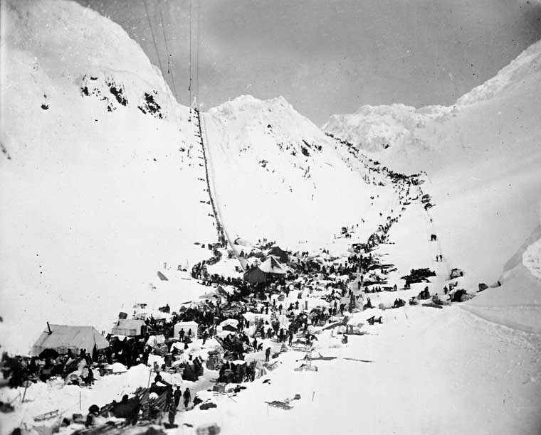
What makes the Chilkoot worth the planning headache today is how much of that history is still lying on the ground. Rusted stoves, boot soles, cable spools, and collapsed boats from abandoned tramway operations sit alongside the trail the way they were left in 1898, preserved by the same cold and snow that made the climb so brutal. You are walking through coastal temperate rainforest, then subalpine forest, then genuine alpine tundra, in about thirteen miles, with the physical demand of the Golden Stairs itself as the trail’s honest centerpiece.
Trail at a Glance
- Distance: 26 miles (42 km) round trip, Dyea to Chilkoot Pass and back. One-way to the pass is 16.5 miles (26.6 km), the full length of the Alaska portion of the trail.
- Duration: 4 days / 3 nights is the itinerary this guide follows. 3 to 5 days is the range most hikers take, depending on pace and how many nights you break the exit into.
- Difficulty: Hard. Flat and forested for the first 13 miles, then a genuinely demanding 3.5-mile, 2,500-foot climb over a boulder field (the Golden Stairs) to reach the pass, all above treeline in exposed alpine terrain.
- Best season: Mid-June through August for the most reliable conditions. The trail typically opens mid-May and closes early September; early season carries lingering avalanche danger and large snowfields, and mid-August into September brings colder nights and more fog.
- Permits: Mandatory for all overnight camping, June 1 through September 12. Reserved through Recreation.gov (one permit per group), then validated in person with a mandatory safety orientation at the Trail Center in Skagway.
- Start trailhead: Chilkoot Trailhead, Dyea, Alaska: Chilkoot Trailhead on Google Maps
- End trailhead: Same as start. This is an out-and-back route: you finish where you began, at the Dyea trailhead, after turning around at Chilkoot Pass (the US/Canada border, roughly the route’s halfway point by mileage).
A note on the border: as of 2026, hikers may walk right up to the pass and the boundary marker itself, but continuing north into Canada toward Happy Camp and beyond is prohibited.
Trail Map
Chilkoot Pass Trail on AllTrails: elevation profile, current condition reports, and hiker photos for the US side of the route.
NPS Chilkoot Trail maps and trip-planning page: the official source for the current trail map, campground locations, and elevation profiles for each leg.
Getting There and Away
Getting there: Skagway, Alaska is the gateway town, and the Chilkoot Trailhead sits about 10 miles beyond it, at the end of the mostly gravel Dyea Road. By road, Skagway is 110 miles from Whitehorse, Yukon, via the South Klondike Highway, a paved, year-round route and the most practical option for hikers coming from Canada. By sea, Skagway is normally served by the Alaska Marine Highway ferry system from Juneau, Haines, and Bellingham, Washington, but AMHS service to Skagway is currently suspended following dock damage at the Skagway terminal, with no confirmed repair timeline as of this writing, so confirm current ferry status before you plan around it. Cruise ships call at Skagway daily through the summer season, and small aircraft connect Skagway’s airport to Juneau. There is no public shuttle to Dyea itself; most hikers arrange a taxi or shuttle from a Skagway outfitter, or drive a rental car.
Getting away: Same road, same direction, back to Skagway. Because this is an out-and-back route, there is no separate exit logistics problem the way there is on a point-to-point trail: you walk out the way you walked in and drive out the way you drove in.
Staging: Skagway has hotels, hostels, groceries, and gear rental, and is the only realistic place to base yourself before and after the hike, since Dyea itself is a ghost town with only a front-country campground and no services. All hikers must check in at the Trail Center in Skagway (open 9 am to 4:30 pm daily) to validate their permit and complete the mandatory safety orientation before starting, so build that stop into your arrival day.
Day-by-Day Breakdown
This 4-day, 3-night itinerary follows the pacing the National Park Service itself recommends: a short first two days to bank energy, a dedicated summit day at the Golden Stairs, and a long final day back out. Distances and elevations below are the NPS’s own official mile markers for each campground, not estimates.
Day 1: Dyea to Canyon City (7.7 miles, about 460 ft net gain)
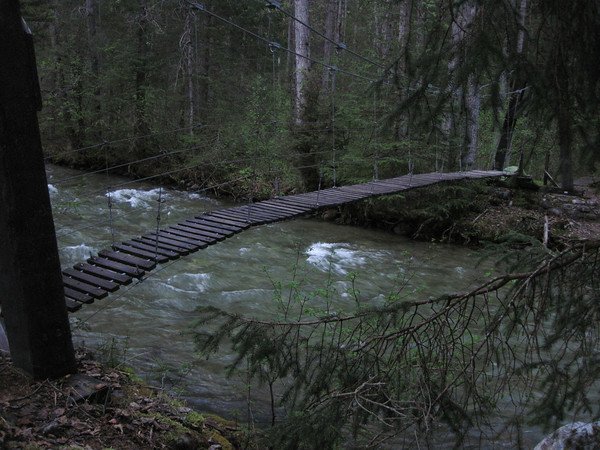
Highlight: The Canyon City gold rush ruins, reachable by a short suspension footbridge crossing.
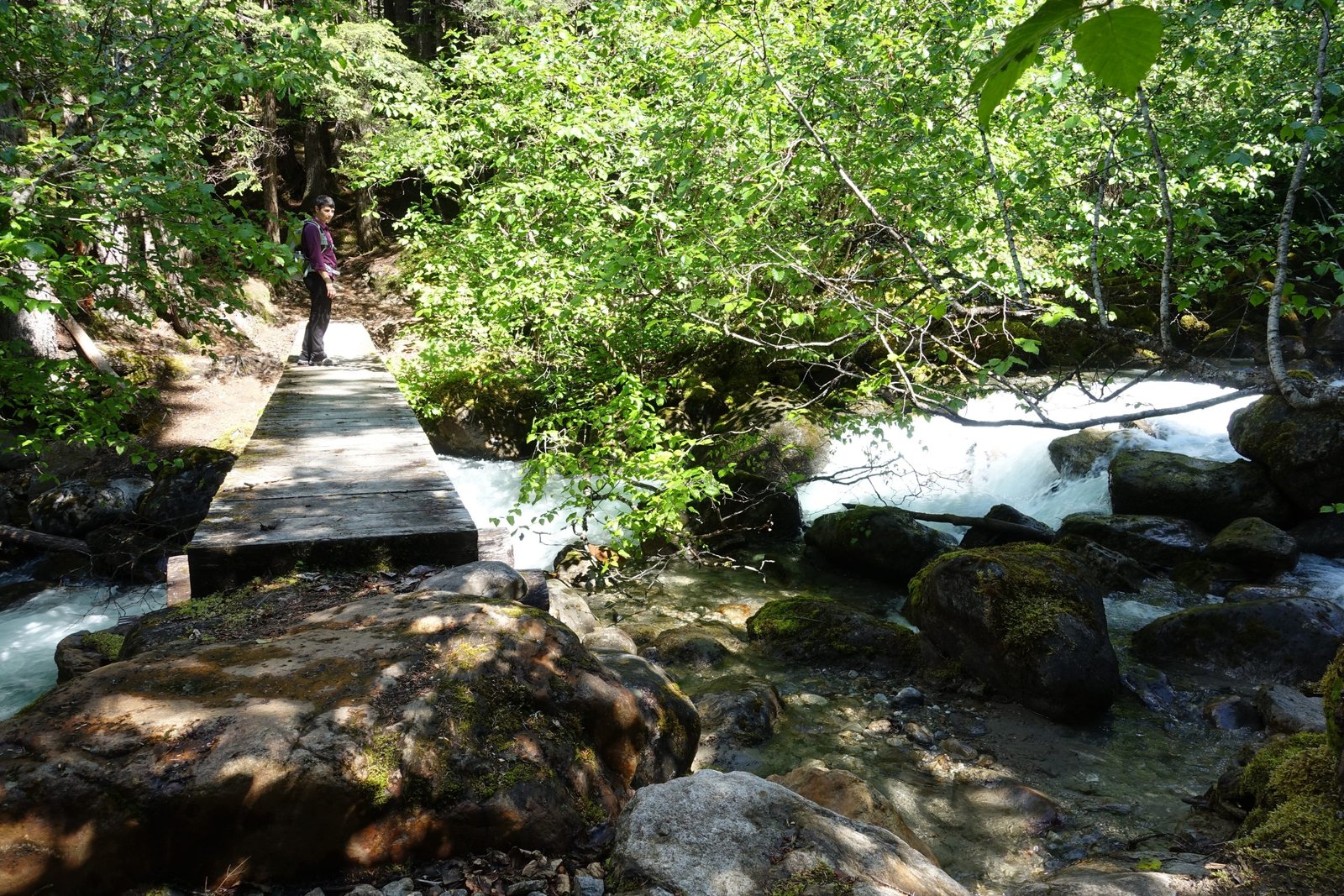
A gentle introduction. The trail leaves the Dyea trailhead through coastal temperate rainforest along the Taiya River, passing Finnegan’s Point (mile 5) on the way. The terrain is flat with no substantial obstacles, and the forest is thick enough that you will not get a real view until later days. Canyon City itself, just half a mile off the main trail, has genuine gold rush ruins: building foundations, a large tram boiler, and other machinery left behind when the town emptied in 1899. Camp here rather than push further; it is the most common first-night stop for good reason.
Day 2: Canyon City to Sheep Camp (5.3 miles, about 600 ft net gain)
Highlight: Pleasant Camp’s quiet stretch of river, and your last look at real forest before the alpine begins.
A short, deliberately easy day, and worth keeping that way. The trail passes Pleasant Camp (mile 10.7) roughly two-thirds of the way, a small, lightly used campground that some hikers use as a base for a very long single push to the pass and back. The NPS specifically advises against that for most hikers: staying at Sheep Camp (mile 13, elevation 1,058 ft) instead sets up a shorter, safer summit day. Sheep Camp is the largest and busiest camp on the US side, with the only backcountry ranger station on the trail; rangers give a nightly briefing on route conditions, weather, and the plan for the next day’s climb. Water here, like everywhere on this trail, comes from the Taiya River and must be filtered before drinking.
Day 3: Sheep Camp to Chilkoot Pass and back to Sheep Camp (about 7 miles round trip, 2,500+ ft gain each way)
Highlight: The Golden Stairs and the view north from the US/Canada border at the pass.
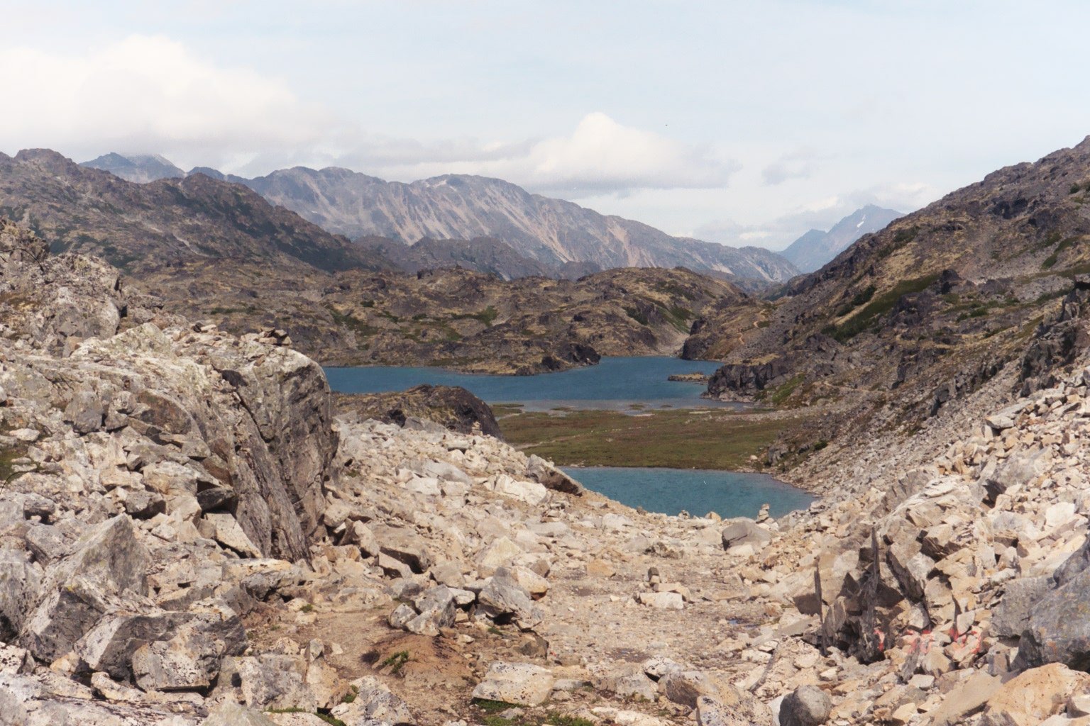
The trail’s defining day, and the reason most hikers plan the whole trip around it. Most parties leave Sheep Camp before dawn, often as early as 4 am, both to beat afternoon weather at the pass and because the climb genuinely takes most of a day. The route climbs through a large avalanche chute and past The Scales, the flat staging area where gold rush freight was reweighed before the final push, then tackles the Golden Stairs itself: a sustained, chunky boulder field gaining more than 2,500 feet in 3.5 miles, requiring hands as much as feet in places. At the pass, marked by a small warming cabin and a part-time Parks Canada warden post, you are standing on the US/Canada border. This is your turnaround point. From here, retrace your steps back down to Sheep Camp for a second night; the descent is faster but still demanding on tired legs and loose rock.
Day 4: Sheep Camp to Dyea (13 miles, net loss to sea level)
Highlight: A long, straightforward walk back through the rainforest, with the Canyon City ruins as a natural lunch stop.
The exit day, and a genuinely long one after three days of climbing. Some hikers split this into two shorter days, camping again at Canyon City or Pleasant Camp rather than pushing all 13 miles at once, especially if the pass day left legs sore. Either way, the terrain itself is easy relative to what came before: flat, forested, and familiar from Day 1. Budget time at the Trail Center in Skagway if you need to report your exit or return gear.
What to Expect
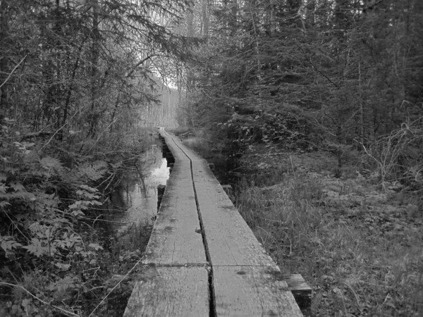
Terrain: Coastal temperate rainforest for the first 13 miles (flat, root-tangled in places, boardwalk-supported through wet sections like Beaver Pond), transitioning abruptly to subalpine forest, then true alpine tundra above Sheep Camp. The Golden Stairs section is a genuine boulder scramble, not a maintained tread.
Weather: Wet, cold, and changeable even in July and August, with sudden rain and wind possible any day. The stretch from Sheep Camp up to the pass sees the trail’s worst conditions: driving rain, sleet, hail, or snow, low visibility, and high wind are all normal, not exceptional, at that elevation. Early June still carries meaningful avalanche risk and large lingering snowfields; by late August, expect colder nights, often below freezing, and more fog.
Wildlife: Both black bears and grizzly bears are common along the entire route, and bears are the primary safety concern on the Chilkoot. Firearms are not permitted on the Canadian side of the historical park (a moot point on this out-and-back guide, since you never cross into Canada); bear spray is allowed and strongly recommended on both sides.
Crowds: The National Park Service caps the trail at 50 backpackers starting per day, split across both directions, so it never feels overrun, but Sheep Camp is genuinely busy in peak July and August since nearly every US-side hiker overnights there before the pass.
Signature features: The Golden Stairs and the pass itself, the Canyon City gold rush ruins, the Sheep Camp ranger station and its evening trail briefing, and the sheer density of century-old artifacts, tram cable, boot leather, collapsed boats, visible right beside the trail tread.
Water: sources, safety, and treatment
Water is abundant and never a planning concern on this route: the Taiya River runs alongside or near the trail for essentially its entire length, and every official campground (Finnegan’s Point, Canyon City, Pleasant Camp, and Sheep Camp) draws from it directly. The catch is treatment. The National Park Service is explicit and consistent on every campground page: the water is non-potable and must be filtered before drinking, due to sediment and potential bacterial and viral contamination. There is no official claim anywhere that any source on this trail is safe to drink untreated. A standard squeeze or gravity filter rated for bacteria, protozoa, and viral-scale particles handles this trail well, though the Taiya’s glacial sediment load can clog a fine filter faster than a clear alpine stream would; carry a pre-filter or be ready to backflush. See best water filters for hiking.
Logistics
Reserve your permit through Recreation.gov or by phone (1-877-444-6777) once the 2026 booking window opens (typically mid-April for that summer’s season); choose your campgrounds and dates at the same time, since one permit covers your whole group and locks in specific camps. Recent pricing has run around $30 per adult plus an $11 per-person reservation fee, but check the live Recreation.gov listing before you book, as fees are subject to change. Every hiker must validate the permit in person at the Trail Center in Skagway, which requires the whole group to sit through a safety orientation covering bear safety, route conditions, and the (mandatory) turnaround at the border; the Trail Center is open 9 am to 4:30 pm daily. Front-country camping is available at the Dyea Campground near the trailhead if you want to start the hike early the next morning rather than drive out from Skagway on hike-start day.
Mandatory Gear Checklist
For the full kit, category by category, see what to pack for the Chilkoot Trail.
- A genuinely waterproof rain jacket and rain pants. The NPS’s own weather guidance describes driving rain, sleet, and high wind as normal conditions between Sheep Camp and the pass, not worst-case scenarios. See best rain pants for hiking and best lightweight hiking jackets.
- Waterproof hiking boots with good ankle support. Root-tangled, muddy rainforest tread for the first 13 miles, then loose boulder for the climb; you want support and a dry foot for both. See best waterproof hiking boots.
- Trekking poles. Genuinely useful on the Golden Stairs boulder field and on the tired-legged descent back to Sheep Camp. See best trekking poles.
- Bear spray. Both black and grizzly bears are a constant presence on this route; carry it accessible, not buried in your pack. See best bear sprays.
- A reliable water filter. Every official campground on this trail states its water is non-potable. See best water filters for hiking.
- A warm insulated jacket for camp and the pass. Alpine temperatures at Sheep Camp and above run cold even in July and August, and can sit below freezing by late season. See best insulated jackets for hiking.
- A synthetic-fill sleeping bag. Persistent damp conditions on the US side of the trail make a synthetic bag, which keeps some insulating power wet, a safer bet than down. See best synthetic sleeping bags.
- A headlamp with spare batteries, given the frequent pre-dawn starts for the Sheep Camp to pass push and the low light under rainforest canopy on the lower trail.
Honest Assessment
This trail suits hikers who want history alongside their miles and who are fit enough for one genuinely hard day sandwiched between two easy ones. You should be comfortable with sustained boulder scrambling using your hands, carrying a full overnight pack, and hiking in cold, wet, exposed alpine conditions where the weather can turn with little warning.
It is not a good first backpacking trip. The Golden Stairs day demands real fitness and comfort with exposure, and the early starts and unpredictable alpine weather leave little room for hikers who are not already confident with multi-day trip planning. Hikers who want the gold rush history without the boulder field can day-hike as far as Canyon City and back from Dyea; hikers who specifically want the full historic route, border closure notwithstanding, should watch for any change in the international crossing rules, since that would reopen the classic Dyea-to-Bennett traverse this guide currently cannot offer.
Among Alaska and Yukon hikers, the Chilkoot’s reputation holds up: it is consistently rated one of the most historically rich multi-day hikes in North America, boulder field and border closure included.
Final Thoughts
The Chilkoot rewards hikers who respect its two personalities: an easy, historic river walk for the first 13 miles, then one of the more demanding single days you will find on a US National Historic Trail. Plan around the Golden Stairs, not around the mileage total. If you are still building toward a trip with this much elevation and exposure, multi-day hiking skills is worth reading first, and how to plan your first multi-day hike covers the groundwork this trail assumes you already have. Hikers drawn to trails with a strong historic thread may also want to look at the John Muir Trail, a very different landscape with its own century of mountain history. If you are ready to pack, what to pack for the Chilkoot Trail covers the exact kit for both halves of the trail.
Frequently Asked Questions
Can you still hike the full Chilkoot Trail from Alaska to Canada?
No, not as a single continuous hike. The international border at Chilkoot Pass has no official port of entry, and both governments closed it to through-travel in 2025. Hikers can walk the US side (Dyea to the pass and back) or the Canadian side (Bennett to the pass and back) as separate out-and-back trips, but crossing the pass itself in either direction is illegal as of 2026.
How hard is the Chilkoot Trail?
Hard, concentrated almost entirely into one day. The first 13 miles from Dyea to Sheep Camp are flat and manageable for most fit hikers. The climb from Sheep Camp to the pass, the Golden Stairs, gains more than 2,500 feet in 3.5 miles over loose boulder, and that single day is what earns the trail its reputation.
Do I need a permit to hike the Chilkoot Trail?
Yes, for any overnight stay between June 1 and September 12. Reserve through Recreation.gov and validate it in person with a mandatory safety orientation at the Trail Center in Skagway before you start.
Do I need to worry about bears on the Chilkoot Trail?
Yes. Both black bears and grizzlies are common along the entire route, and food storage in bear boxes or on bear poles is required at every campground. Bear spray is allowed and strongly recommended.
What’s the best month to hike the Chilkoot Trail?
Mid-June through August offers the most reliable conditions, though rain and cold are possible any day at elevation. Early season (May into early June) carries avalanche risk and large snowfields on the pass approach; by late August, expect colder nights and more fog.
