

Last updated: September 2026
Wild Trail Hiker is reader-supported. We may earn a commission when you buy through links on this page, at no extra cost to you. We only recommend products we’d consider taking on a multi-day trip ourselves.
Before You Go
This 41 km loop in Peter Lougheed Provincial Park crosses the Continental Divide twice, from Alberta into British Columbia and back again, over North and South Kananaskis Pass. Three of its four backcountry campgrounds require a reserved permit through Alberta Parks, booked up to 90 days ahead, plus a separate Kananaskis Conservation Pass just to park at the trailhead. A bridge washout on the approach trail has forced a temporary detour since the end of July 2026, adding distance and rough footing to the first and last days. The middle day is the one to plan around: it crosses two passes, fords a creek twice, and includes a stretch of trail that is genuinely easy to lose. This is grizzly country throughout.
Why This Trail
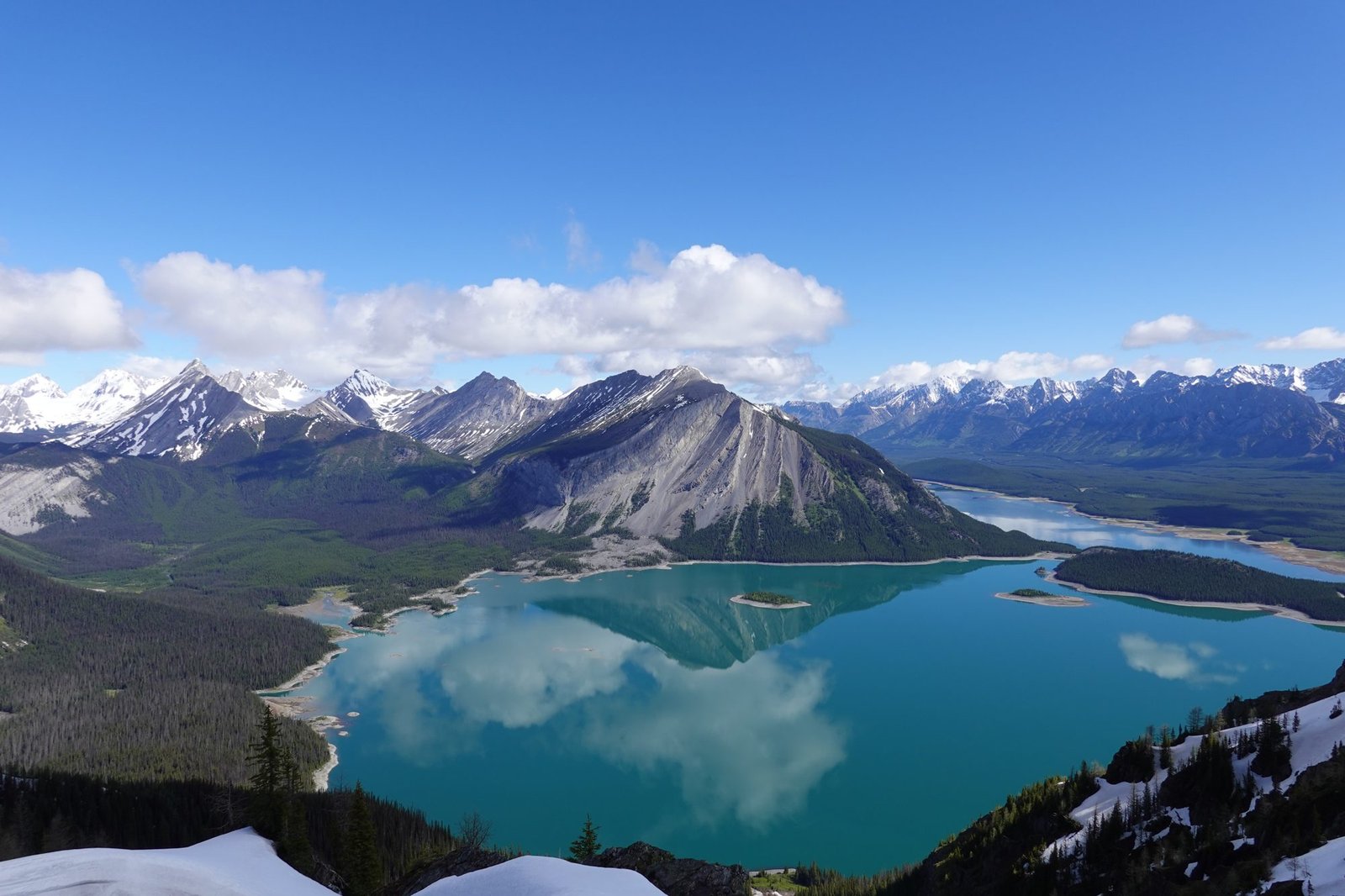
The Turbine Canyon to Three Isle Lake loop, also called the North/South Kananaskis Pass Loop, packs an unusual amount of variety into three days for a trailhead barely two hours from Calgary. The first day is a well-signed, well-travelled approach through forest and talus slopes to a quiet, newly renovated campground at Turbine Canyon. The second day is where the trail earns its reputation: a climb to North Kananaskis Pass reveals Maude Lake’s turquoise water beneath Beatty Glacier, then the trail drops into British Columbia and the Royal Group of peaks, three summits over 3,200 m, fills the skyline ahead.
What sets this loop apart from Peter Lougheed’s more heavily trafficked trails is the stretch beyond North Kananaskis Pass. The trail leaves official park signage behind for a quieter, less-maintained corridor along LeRoy Creek, climbs a narrow scree traverse with real exposure, and crosses South Kananaskis Pass before dropping back into Alberta near Three Isle Lake. Experienced Rockies hikers consistently name this middle section, not the lakes at either end, as the best few hours on the route. The final day descends a steep headwall with a waterfall close to the trail before rejoining the busier corridor back to the trailhead. Overlapping with Section C of the Great Divide Trail, this loop delivers a genuine two-province backcountry crossing without the multi-week commitment of the full GDT.
Trail at a Glance
- Distance: 41 km (25.5 miles), a loop (technically a “balloon on a string,” since the approach to Forks is walked in both directions).
- Duration: 3 days is standard. A 4-day pace, adding an overnight at Forks Campground, suits groups wanting a gentler start or a later trailhead departure.
- Difficulty: Hard. Alberta Parks itself rates the segment into Turbine Canyon “hard” and the segment into Three Isle Lake “moderate.” The middle day adds two mountain passes, two creek crossings, and a narrow, exposed scree traverse to that baseline.
- Best season: Mid-July through late September. Alberta Parks’ official camping season runs longer (mid-to-late June through late November), but snow routinely lingers on both passes into July, and conditions vary year to year.
- Permits: Backcountry camping permits are mandatory at Forks, Turbine Canyon, and Three Isle Lake Campgrounds, booked through Alberta Parks up to 90 days ahead of arrival. A Kananaskis Conservation Pass ($15/day or $90/year) is also required to park at the trailhead, separate from the camping fee.
- Start trailhead: North Interlakes Day Use, Peter Lougheed Provincial Park: North Interlakes Day Use on Google Maps.
- End trailhead: Same as start. This is a loop trip, so there is no separate shuttle logistics to plan for.
Trail Map
View the Turbine Canyon to Three Isle Lake Backpacking Loop on AllTrails: user-submitted GPS tracks, elevation profile, and recent condition reports. This exact route also appears on AllTrails and Gaia GPS under closely related names (“Turbine Canyon Backpacking Loop,” “North/South Kananaskis Pass Loop”), since it combines several officially named trails rather than carrying one single trail designation on park maps.
Alberta Parks’ Spray Valley & Peter Lougheed geo-referenced trail map (PDF, available on the park’s Information & Facilities page): the source of truth for campground locations and current trail advisories. Carry a proper topographic map in the backcountry regardless; the Gem Trek Kananaskis Lakes map is the standard paper reference for this specific route, since it isn’t marked on most generic park maps as a single named trail.
The Organic Maps app’s routing is known to miss a section of trail between North Kananaskis Pass and LeRoy Creek, per a first-hand account from hikers who used it on this exact route; don’t rely on a single navigation app for the middle day.
Getting There and Away
Getting there: North Interlakes Day Use sits in Peter Lougheed Provincial Park, about 50 km south of the Trans-Canada Highway on Highway 40 and Kananaskis Lakes Trail, roughly a 2-hour drive from Calgary on fully paved roads. Calgary International Airport (YYC) is the nearest airport with regular service, and there’s no practical alternative to flying into Calgary first. The On-It Regional Transit shuttle that has previously connected Calgary to the Bow Valley and Kananaskis is suspended for the 2026 summer season with no confirmed return date, so a rental car or your own vehicle is effectively required; verify current shuttle availability before finalizing plans. The trailhead has a paved parking lot, outhouses, and trash bins.
Getting away: Since this is a loop, you finish at the same North Interlakes parking lot where you started. If you left a vehicle there, you’re done, no shuttle or second car needed.
Staging and post-trail base: Canmore and Kananaskis Village both work well as a pre- or post-hike base, roughly 40 minutes to an hour’s drive away. Boulton Creek Campground, within Peter Lougheed itself, is the closest option with showers and a small store. Book accommodation ahead for peak July and August dates, since the whole corridor draws heavy summer traffic regardless of this trail.
Day-by-Day Breakdown
Most hikers walk this loop counter-clockwise from North Interlakes, staying at Turbine Canyon on night one and Three Isle Lake on night two. This is also the direction that matches the trail’s AllTrails name and keeps each day’s distance closer to even.
Day 1: North Interlakes to Turbine Canyon Campground (15.1 km, roughly 525 m of elevation gain)
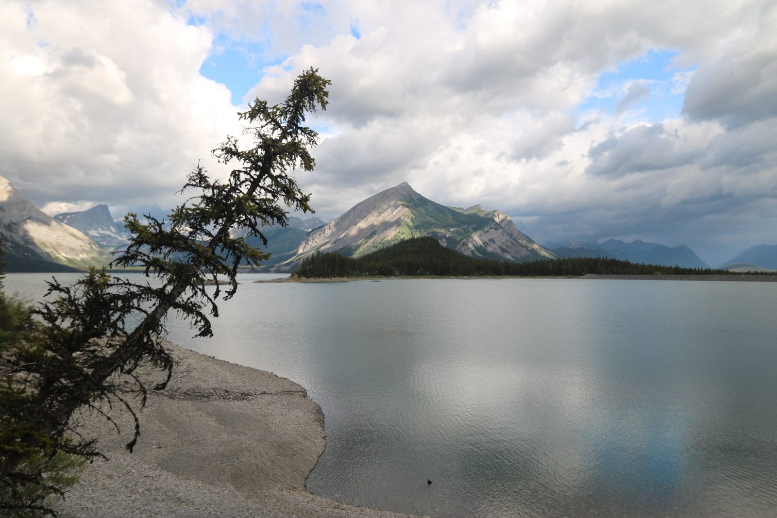
The trail skirts the shore of Upper Kananaskis Lake before climbing through forest, with far-reaching views back across the lake to the mountains on the opposite shore. It crosses a talus slope, narrows back into forest, and crosses the Upper Kananaskis River on a bridge, a good spot for a first break. Beyond that, the trail is mostly flat through forest and over several more bridged crossings before Forks Campground appears at 7.3 km, with seating and outhouses worth using.
Past Forks, the trail climbs for real: about 400 m of elevation gain packed into roughly 3 km, on a narrow path across a brushy, intermittently forested slope with a series of short, occasionally steep switchbacks. Most of that climbing happens in the first 1.5 km. The gradient then eases into wildflower-filled subalpine meadows, with a viewpoint over a small tarn (Putnik Pond) framed by a long rock wall. The trail descends gently past Lawson Lake, staying some distance from the shoreline, before reaching Turbine Canyon Campground in the forest beyond, a newly renovated site with a mix of wooden tent platforms and gravel pads.
Day 2: Turbine Canyon Campground to Three Isle Lake Campground via North and South Kananaskis Pass (roughly 15.6 km, approximately 800 m of cumulative elevation gain and a similar loss)
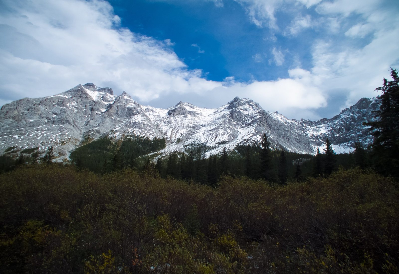
This is the hardest and most rewarding day on the loop, crossing the Continental Divide twice. From Turbine Canyon Campground, the trail climbs steadily toward North Kananaskis Pass, gaining around 100 m in the first kilometre. Beatty Glacier comes into view on the left as the path nears Maude Lake, its water a striking turquoise against the surrounding rock. A boundary marker on the pass itself signals the crossing into British Columbia. From the pass, the trail descends steeply on loose, sometimes slippery rock into a valley framed by the Royal Group of peaks, three summits above 3,200 m, with Mount King George the highest at 3,411 m.
Route-finding stretch, roughly 5 km: past the descent from North Kananaskis Pass, the trail enters forest along LeRoy Creek and becomes noticeably less maintained. This section sits outside Peter Lougheed’s signed trail network, in Height of the Rockies Provincial Park on the BC side, and multiple first-hand accounts describe it as overgrown and easy to lose, particularly around the two LeRoy Creek crossings and the climb immediately after them. Cairns and occasional tape flagging mark the route, but there is no official signage; one trip report called it “the more technical day… this portion of the trail isn’t maintained a ton, lots of bush and foliage to brush through.”
Bring for this stretch: a physical map or a GPS track loaded in advance, and don’t rely on a single navigation app; the Organic Maps app is known to drop a section of this exact route, and phone signal is absent throughout. See best hiking compasses.
The two LeRoy Creek crossings come roughly 30 minutes apart, ranging from a rock-hop to a shoe-off wade depending on recent rain; unclip your pack’s hip belt and sternum strap before crossing either one. A short flat stretch is followed by a steep, largely unshaded climb, gaining roughly 200 m in about a kilometre on soft soil and brush, before the trail eases and turns east toward Beatty Creek, the last reliable water before a demanding kilometre-long scree slope. The traverse starts as a boot-beaten path through small rock, steepens partway up, and narrows to roughly 30 m of very tight footing with a real drop-off to one side, the single most exposed stretch on the loop. Beatty Lake, in BC’s Height of the Rockies Provincial Park, sits just beyond the top of the scree (a free, first-come first-served campground for hikers splitting this day into two).
From near Beatty Lake, the trail climbs gently through a wildflower-sparse meadow to South Kananaskis Pass and its own boundary marker, crossing back into Alberta. The path descends through forest, past scattered fallen trees, to Three Isle Lake, where two separate campground loops sit about 500 m apart along the northern shore.
Day 3: Three Isle Lake Campground to North Interlakes (10.3 km, predominantly downhill)
Leaving Three Isle Lake, the trail turns uneven and rocky before reaching the top of a large headwall overlooking the forested valley below, one of the loop’s best views. The descent is steep, with rock steps, loose sections, and wooden stairs on the sharpest pitches; it’s a notably easier direction than climbing it, and there is little shade for anyone doing this stretch in reverse. A waterfall sits close to the trail partway down. The final approach to Forks Campground mixes forest and open valley with short talus crossings and a gentle, steady descent alongside the river. From Forks, the return to North Interlakes retraces Day 1’s route in reverse.
What to Expect
Terrain: A mix of well-maintained, signed trail on the Alberta side (Interlakes to Forks to Turbine Canyon, and Three Isle Lake back to the trailhead) and a quieter, less-maintained corridor in British Columbia between North Kananaskis Pass and South Kananaskis Pass. Two creek crossings, one narrow and exposed scree traverse, and two mountain passes make up the technical core of the trip.
Weather: Conditions at this elevation change quickly and snow is possible on either pass at any time of year, including midsummer. Both passes can hold snow into July in a heavy year. Long stretches, especially the scree slope and both pass crossings, offer little to no shade.
Wildlife: Peter Lougheed Provincial Park and the wider Kananaskis region support grizzly and black bears, elk, moose, bighorn sheep, cougars, wolves, and the occasional mountain goat. Bear spray is essential throughout, and the thick, noisy creek-side brush around LeRoy Creek is a spot hikers specifically flag for extra noise, since the terrain makes a surprise encounter easier there than elsewhere on the loop. A resident porcupine is known to frequent Beatty Lake Campground; store footwear and poles inside your tent overnight if you camp there.
Crowds: The Alberta-side corridor, particularly Interlakes to Forks and the approach to Three Isle Lake, is popular with day hikers and weekend backpackers and can feel busy. The stretch between North Kananaskis Pass and South Kananaskis Pass sees a fraction of that traffic; multiple trip reports describe passing only one or two other groups across the entire middle day.
Signature features: Maude Lake and Beatty Glacier from North Kananaskis Pass, the Royal Group of peaks, the exposed scree traverse below Beatty Lake, the wildflower meadow at South Kananaskis Pass, and the headwall view above Three Isle Lake.
Water: sources, safety, and treatment
Water is generally easy to find along the entire route. The best sources are the Upper Kananaskis River (multiple access points between the trailhead and Forks), Maude Brook at Turbine Canyon Campground, Maude Lake, LeRoy Creek (multiple crossings), Beatty Creek and Beatty Lake, and Three Isle Lake itself. No trail-specific Alberta Parks statement on water drinkability was found in research for this route. The standard practice across Kananaskis’s backcountry, given wildlife activity and other hikers upstream, is to treat every source regardless of clarity, and that general Rockies backcountry default is the safest assumption here too. A lightweight squeeze or gravity water filter handles this trail well. Note that Three Isle Lake’s water level, and by extension ease of access, can run low by late summer in a dry year.
Logistics
Three of the loop’s four campgrounds, Forks, Turbine Canyon, and Three Isle Lake, require a reserved Alberta Parks backcountry camping permit, bookable online or by phone (1-877-537-2757) up to 90 days ahead of arrival. The camping fee is $12 per person per night, plus a $12 reservation fee per booking; print your permit and bring it with you. Beatty Lake Campground, across the border in BC’s Height of the Rockies Provincial Park, is free and first-come, first-served, worth knowing about if you’d rather split the demanding middle day into two shorter ones instead of pushing straight through to Three Isle Lake.
A Kananaskis Conservation Pass is required separately to park at the trailhead ($15 per day or $90 annually) and is not included in the camping fee. Every campground on the route has an outhouse and a bear-proof food storage locker; use the lockers rather than a food hang. Campfires are permitted only at Forks Campground, and only when no fire ban is in effect.
Active bridge washout advisory: as of this update, the Three Isle Lake Trail is closed between its junction with the Upper Lake Trail and the Upper Kananaskis River due to a washed-out bridge, in effect since July 31, 2026, until further notice. Forks, Three Isle Lake, and Turbine Canyon Campgrounds remain open and reachable via a temporary detour that begins at a bridge roughly 500 m west of Point Backcountry Campground. Alberta Parks advises allowing extra travel time for the detour and expecting rough trail conditions and ongoing repair activity. Confirm the current status on Alberta Parks’ trail report page before finalizing plans, since this is exactly the kind of advisory that changes as repairs progress.
Mandatory Gear Checklist
For the full breakdown of what to bring and why, see What to Pack for the Turbine Canyon to Three Isle Lake Loop.
- Bear spray. Non-negotiable in grizzly country, with the LeRoy Creek corridor specifically flagged by hikers as a spot demanding extra noise and attention. See best bear sprays.
- A reliable water filter, since no official statement confirms any source on this route as safe to drink untreated. See best water filters for hiking.
- Trekking poles, genuinely useful on both the steep, loose descent off North Kananaskis Pass and the scree traverse below Beatty Lake. See best trekking poles.
- A proper waterproof, wind-resistant shell and a warm insulating layer, given how quickly weather turns on both passes and the lack of shade across the scree slope and pass crossings. See best lightweight hiking jackets and best insulated jackets for hiking.
- Sturdy, broken-in waterproof hiking boots, for the talus slopes, scree traverse, and two creek crossings. See best waterproof hiking boots.
- Dedicated water shoes or river sandals are worth having for the two LeRoy Creek crossings, which can run calf-deep or higher depending on season and rainfall. See best hiking sandals.
- A satellite messenger or PLB is worth serious consideration. Phone signal is absent throughout the park’s backcountry sections, and the middle day in particular is remote and lightly trafficked. No official statement on cell coverage for this specific route was found in research; treat coverage as absent throughout.
Honest Assessment
This loop suits experienced backpackers who want a genuine two-province backcountry crossing without a multi-week commitment, and who are comfortable with some route-finding, an exposed scree traverse, and unbridged creek crossings. It’s not an off-trail scramble in the way a route like the Long Range Traverse is, since two-thirds of the loop is signed and well-maintained, but the middle day asks for real self-sufficiency and sound judgment on unmarked ground.
It’s not the right choice for a first multi-day hike, or for anyone with a strong fear of heights given the narrow scree traverse. Hikers who want the same lakes and passes with a gentler pace can split the demanding middle day at Beatty Lake’s free, first-come campground instead of pushing through to Three Isle Lake in one push, or take the 4-day itinerary that adds a night at Forks. Among experienced Rockies hikers, the consensus is that this is one of the best-value multi-day trips within easy reach of Calgary, precisely because the crossing into British Columbia delivers a genuinely remote, quiet day sandwiched between two much busier, family-friendly bookends.
Final Thoughts
This is a trail of two distinct halves: an easy, popular approach on either end, and a genuinely demanding, quiet crossing in the middle that rewards hikers willing to navigate a little uncertainty. Book your Alberta Parks permits as early as the 90-day window allows, especially for peak July and August dates, and check the current bridge detour and pass conditions before you commit to an itinerary. For hikers building toward a trip like this, how to plan your first multi-day hike covers the planning fundamentals this trip leans on. If you’re drawn to Alberta’s backcountry more broadly, the Skyline Trail in Jasper offers a similar permit-and-reserve backcountry structure further north. Sorting your kit first? See What to Pack for the Turbine Canyon to Three Isle Lake Loop.
Frequently Asked Questions
Do I need a permit for the Turbine Canyon to Three Isle Lake loop?
Yes, for three of the four campgrounds on the route. Forks, Turbine Canyon, and Three Isle Lake Campgrounds all require a reserved Alberta Parks backcountry camping permit, bookable up to 90 days ahead. Beatty Lake, across the border in British Columbia, is free and first-come, first-served. You’ll also need a separate Kananaskis Conservation Pass to park at the trailhead.
How hard is this loop?
It’s a hard, technically varied trip. The approach to Turbine Canyon and the return from Three Isle Lake are well-maintained and signed, but the middle day crosses two mountain passes, fords a creek twice, and includes a narrow, exposed scree traverse and a stretch of trail that’s genuinely easy to lose without care.
Is the bridge washout currently affecting this hike?
As of this update, yes. A washed-out bridge has closed part of the Three Isle Lake Trail since July 31, 2026, though all three reservable campgrounds remain open via a temporary detour. Expect extra distance, rough footing, and to check Alberta Parks’ current trail report before finalizing your itinerary.
What’s the best month to hike this loop?
Mid-July through late September is the reliable window. Snow routinely lingers on both North and South Kananaskis Pass into July, and conditions vary from year to year, so check current trail reports before booking, especially for early-season dates.
Can beginners hike this loop?
Not as a first multi-day trip. The two mountain passes, the exposed scree traverse, and the unmarked stretch along LeRoy Creek all call for real backcountry experience and comfort with some route-finding. Hikers building toward a trip like this are better served starting with a shorter, fully signed multi-day trail first.
