

Last updated: May 2026
Before You Dive In
The Laugavegur Trail is not a casual scenic walk with a convenient exit every few kilometres. It is a point-to-point highland route between Landmannalaugar and Þórsmörk, with hut and campsite bookings required before you start. The trail is short by multi-day standards, but Iceland makes up for that with exposed terrain, fast weather changes, snow patches, glacial river crossings, and very little shelter between huts.
If you are planning to walk it in peak summer, sort your accommodation, transport, and weather plan before you get too attached to dates.
Why This Trail
Laugavegur is Iceland’s best-known multi-day walk for a reason. In four hiking days, it moves through a level of landscape change that would normally take weeks to find elsewhere: steaming geothermal slopes, black obsidian, snow-streaked high passes, glacial views, volcanic desert, deep canyons, and the green birch valleys of Þórsmörk.
This is a strong trail for hikers who want a true multi-day trip without committing to a very long distance. The trade-off is that huts book out, campsites still need to be booked, fog and snow can make navigation serious, and rivers can rise after rain. If you treat the Laugavegur as easy because the daily distances look manageable, Iceland has several ways to correct that assumption.
For broader planning, see Plan Your First Multi-Day Hike and Essential Skills for Multi-Day Hiking.
Trail at a Glance
| Location | Icelandic Highlands, South Iceland |
| Distance | About 55 km / 34 miles |
| Duration | Usually 4 days, with 3 hut or campsite nights |
| Difficulty | Moderate to hard, mainly due to weather, exposure, river crossings, and remoteness |
| Best season | Late June to mid-September, depending on snow, road access, and hut season |
| Permits / bookings | No simple “walk-up and wing it” approach. Book huts or campsites in advance through Ferðafélag Íslands |
| Start trailhead | Landmannalaugar, Google Maps pin |
| End trailhead | Þórsmörk / Langidalur, Google Maps pin |
| Direction | Most hikers walk north to south, Landmannalaugar to Þórsmörk |
| Extension option | Continue from Þórsmörk to Skógar via Fimmvörðuháls if conditions and time allow |
Trail Map
View the Laugavegur Trail route on AllTrails (useful for the route overview, elevation profile, segment breakdown, photos, and recent hiker notes).
Official Laugavegur Trail information from Ferðafélag Íslands (the key source for huts, campsites, route stages, and current booking expectations).
Do not rely on mobile reception. Download offline maps before leaving Reykjavík and carry a paper map or compass backup. In clear weather, the route is generally straightforward. In fog or snow, the first two days can become much more serious.
Getting There and Away
Getting there to Landmannalaugar
Most international hikers stage from Reykjavík. Keflavík International Airport is the main arrival point, then Reykjavík is the practical base for shopping, fuel canisters, last-minute gear, and onward bus connections.
Landmannalaugar is in the highlands, reached by mountain roads that are seasonal and not suitable for standard rental cars. If you drive yourself, you need to understand Iceland’s F-road rules, rental car restrictions, river crossings, and the Landmannalaugar parking reservation system. In summer 2026, private and rental cars arriving between 9:00 AM and 4:00 PM are expected to require a parking reservation and service fee.
For most independent hikers, the simpler option is a highland bus. Reykjavík Excursions and Trex both operate summer highland bus services to Landmannalaugar, with services commonly running from Reykjavík and towns such as Hella during the hiking season. Schedules are seasonal, so check the current timetable before booking huts.
Getting away from Þórsmörk
The standard finish is Þórsmörk / Langidalur. This is not a normal road-end pickup. The route into Þórsmörk involves rough tracks and river crossings that require proper highland buses or capable 4WD vehicles.
Book your exit transport before the hike. Highland buses usually connect Þórsmörk back toward Reykjavík and South Coast towns during the summer season. If you continue over Fimmvörðuháls to Skógar, plan that return separately.
A sensible pattern is: night before in Reykjavík or Hella, early bus to Landmannalaugar on start day, trail nights at Hrafntinnusker, Álftavatn or Hvanngil, and Emstrur, then finish at Þórsmörk / Langidalur and take a pre-booked bus out, with a recovery base in Reykjavík, Hella, Hvolsvöllur, or the South Coast if extending the trip.
Note: Verify current bus schedules and parking rules before travelling, as Iceland highland transport changes by season.
Day-by-Day Breakdown
Day 1: Landmannalaugar to Hrafntinnusker
Distance: 12 km | Typical time: 4 to 5 hours | Elevation: About 470 m ascent | Terrain: Rhyolite mountains, lava field, geothermal slopes, snow patches, exposed high ground
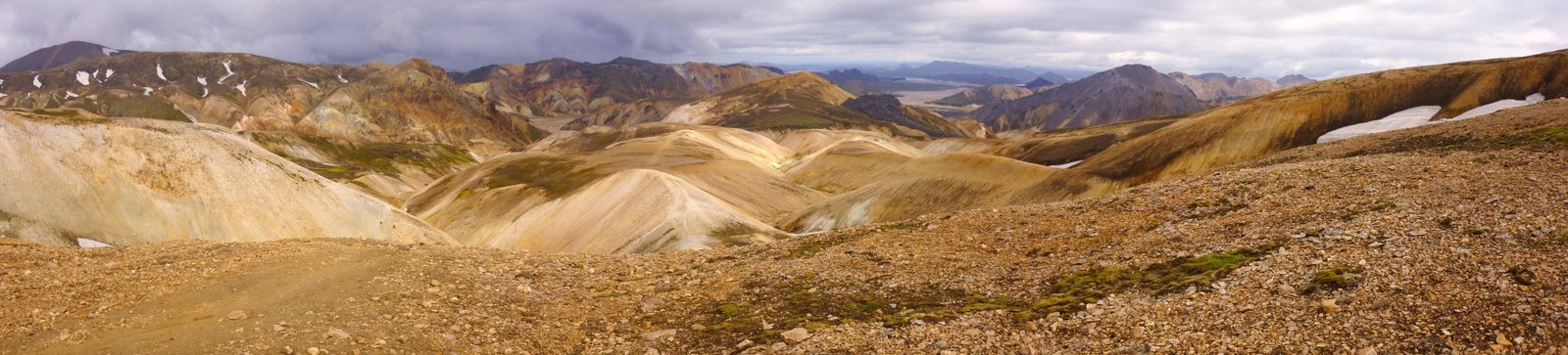
The first day starts in one of the most visually striking places in Iceland. Landmannalaugar is known for colourful rhyolite mountains, geothermal activity, black lava, and hot springs. It is also a busy trailhead in peak season, so do not expect a lonely wilderness start.
The trail leaves the campsite area and crosses through the Laugahraun lava field before climbing steadily into more open highland terrain. This is the section where many hikers first realise the Laugavegur is not difficult because of distance. It is difficult because the surface, weather, and exposure demand attention.
Expect geothermal vents, obsidian, coloured slopes, and potentially snow underfoot. The higher you climb toward Hrafntinnusker, the more exposed the route becomes. Fog is common here, and visibility can drop quickly. Follow the waymarkers carefully, even if the track feels obvious in good weather.
Hrafntinnusker is high, bleak, and often colder than people expect. Campers may be pitching on sand, gravel, or snow depending on the season. Practical tip: Do not rush day one just because it is only 12 km. Give yourself time for the climb, photos, hot spring logistics at Landmannalaugar, and weather delays.
Day 2: Hrafntinnusker to Álftavatn
Distance: 12 km | Typical time: 4 to 5 hours | Elevation: About 490 m descent | Terrain: Snow ravines, highland slopes, rocky descent, river crossing, lake approach
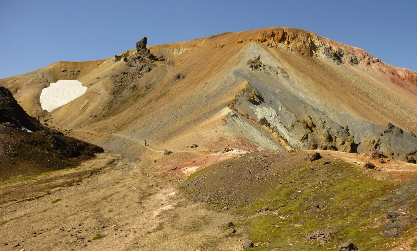
Day two starts on exposed high ground and moves toward the lake country around Álftavatn. This is one of the most weather-sensitive sections of the route. In clear conditions, the views can open toward glaciers and broad highland valleys. In fog, the same terrain can feel closed-in and disorienting.
The route crosses snow-filled ravines, and unstable snow bridges can be present early in the season. Do not assume every footprint marks a safe line.
As the track descends from the high section, the terrain becomes rocky and steeper. The descent toward Jökultungur and onward toward the river crossing requires patient footing, especially in rain. At the bottom, the Grashagakvísl river is commonly crossed on foot, though conditions vary.
Álftavatn is a much more open and scenic overnight stop, with lake views and a less severe feel than Hrafntinnusker. It can also be windy. If camping, think carefully about where and how you pitch.
Practical tip: Start with layers accessible, not buried. Day two can move from cold fog to exposed sun to rain without giving you much warning.
Day 3: Álftavatn to Emstrur
Distance: 16 to 17 km, depending on exact overnight stop | Typical time: 6 to 7 hours | Elevation: Mostly descending overall, with rolling terrain | Terrain: River crossings, Hvanngil, black sand desert, exposed volcanic plains, canyons near Emstrur
Day three is longer and more exposed. From Álftavatn, the route crosses open ground and reaches Hvanngil, which some hikers use as an alternative overnight stop. This can be a smart choice if hut availability or weather makes the standard itinerary awkward.
After Hvanngil, the trail crosses more austere terrain. A footbridge takes you over Kaldaklofskvísl, but Bláfjallakvísl usually needs to be crossed on foot. This crossing can be more serious after rain or snowmelt. Take your time, unbuckle your hip belt, use poles if you have them, and do not cross if the water is moving too fast for your group.
The route then moves into the black sand landscapes of Mælifellssandur, with little shelter from wind, rain, blown sand, or sun.
Closer to Emstrur, the landscape becomes more textured again, with canyons, mossy ridges, and distant glacier views. The Botnar huts at Emstrur can feel hidden until you are near them.
Practical tip: Treat day three as the “manage the elements” day. Have rain gear, gloves, warm layers, and snacks available, not packed at the bottom of your bag.
Day 4: Emstrur to Þórsmörk
Distance: 15 km | Typical time: 6 to 7 hours | Elevation: About 300 m descent overall | Terrain: Canyons, footbridge, rolling highland terrain, final river crossing, birch forest, Þórsmörk valley
The final day changes character again. From Emstrur, the trail drops toward canyon country, including the area around Fremri-Emstruá, then climbs out and continues across rolling terrain toward Þórsmörk.
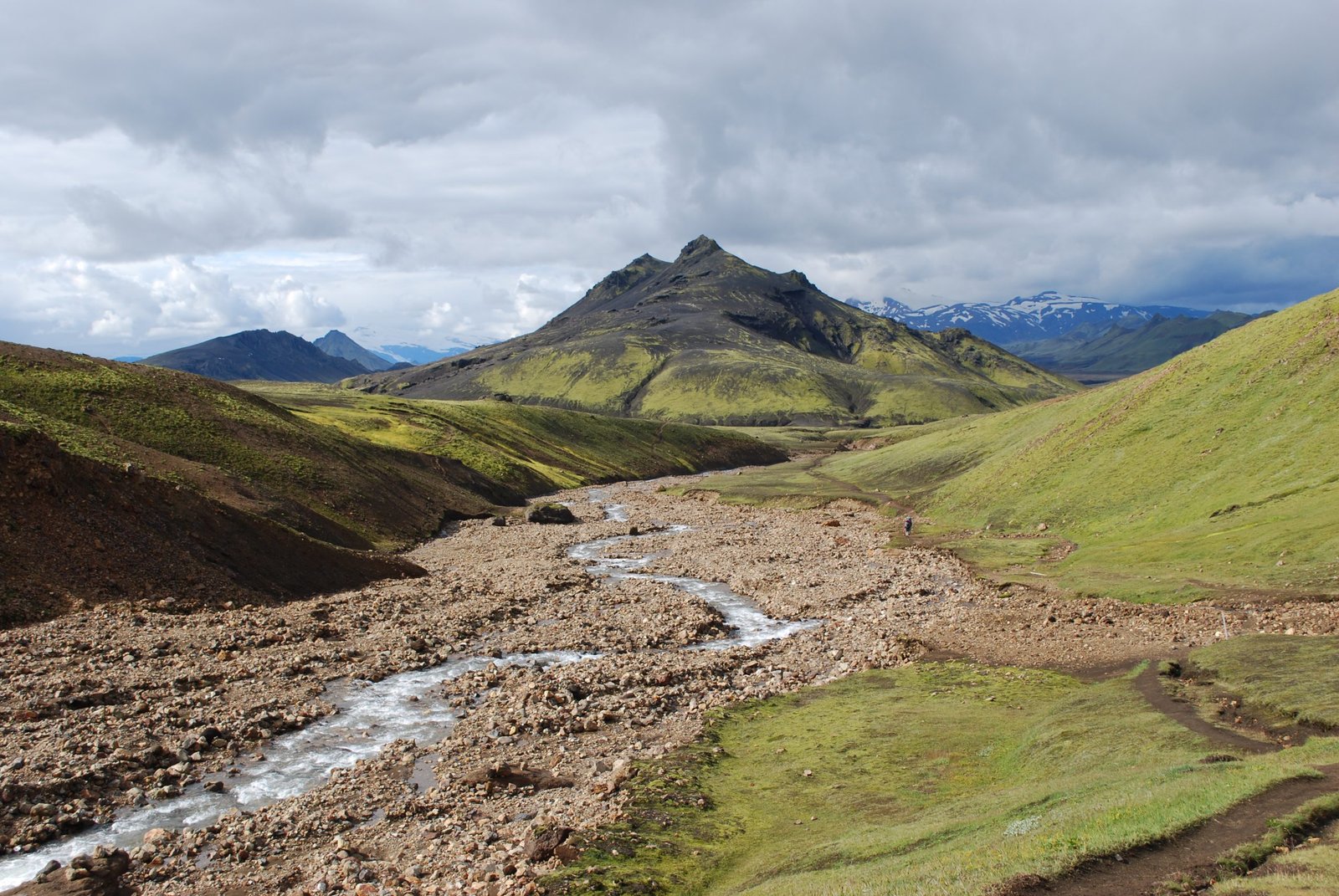
The big practical feature of the day is water. Some streams are bridged, but Þröngá is commonly crossed on foot before entering the greener Þórsmörk area. Like all glacial or highland river crossings, it can change with weather. If it has been raining, do not treat yesterday’s trip report as a guarantee.
After the river crossing, the trail enters a softer landscape. The birch woods and green valley of Þórsmörk feel almost surprising after the volcanic and desert sections that came before. The official Laugavegur route finishes around Langidalur, where the Skagfjörðsskáli hut and campsite are located.
Many hikers finish here and take the bus out. Others stay a night in Þórsmörk or continue to Skógar over Fimmvörðuháls if conditions are suitable.
Practical tip: Do not mentally finish the trail before Þröngá. Late-stage river crossings deserve the same care as early ones, especially when people are tired.
What to Expect
Terrain
Laugavegur is not technically difficult in the alpine climbing sense, but it is varied and exposed. You will walk over lava, loose gravel, snow patches, volcanic sand, rocky descents, stream crossings, and muddy or wet sections. The trail is marked, but the surface changes enough that footwear and foot care matter.
The major terrain risks are unstable snow early in the season, slippery descents, wind exposure, and river crossings. Trekking poles are very useful, particularly for balance on snow, loose descents, and fords.
Weather
Icelandic highland weather is the trail’s main difficulty. You should be ready for rain, wind, fog, cold nights, sudden temperature drops, and occasional snow, even in the main hiking season. The exposed sections around Hrafntinnusker and the black sand areas before Emstrur can feel very different in poor weather.
Check the forecast before starting and again whenever you have access. The SafeTravel app and Icelandic weather forecasts are worth using. If visibility is poor or rivers are unsafe, adjust the plan rather than forcing the itinerary.
Wildlife
This is not a wildlife-heavy trail. Expect birds, hardy vegetation, and the occasional sheep. The memorable natural features are geological: geothermal vents, coloured slopes, lava, canyons, glacial rivers, and Þórsmörk’s birch woodland.
Crowds
Laugavegur is popular. In peak season, huts and campsites can be busy, and you will see other hikers most days. That does not make it feel urban. The exposure, weather, and landscape still feel remote once you are between huts.
Signature Features
The big highlights are Landmannalaugar’s rhyolite mountains and geothermal activity, the high section around Hrafntinnusker, the lake setting at Álftavatn, the black sands before Emstrur, Markarfljótsgljúfur canyon as a side trip, and the green finish into Þórsmörk.
Water: sources, safety, and treatment
Water is available at the huts, and Ferðafélag Íslands states that the huts have cold running water that is safe to drink from the tap. Streams are also found along the route, but availability and clarity vary by section, weather, and season.
Most hikers can carry moderate water volumes rather than huge loads, refilling at huts and suitable streams. The more important issue is treatment judgement. Clear, cold water can still be affected by glacial silt, hut activity, storm runoff, or livestock upstream.
A conservative approach is to carry a lightweight filter or chemical treatment for stream water, especially away from hut taps or after heavy rain. Filters can clog in silty water, so let cloudy water settle if you can. For more on choosing a treatment setup, see Best Water Filters for Hiking.
Logistics
Book accommodation before you start. Ferðafélag Íslands operates the main huts and campsites along the route, and its booking system includes hut packages, camping packages, and individual campsite or hut options depending on availability.
A common four-day itinerary is Landmannalaugar to Hrafntinnusker, Hrafntinnusker to Álftavatn, Álftavatn to Emstrur, and Emstrur to Þórsmörk. A common variation uses Hvanngil instead of Álftavatn. Hut capacity is limited, so your itinerary may be shaped by availability. Campsites are not a free-for-all either. Use designated areas to protect fragile highland vegetation.
Do not rely on buying food on trail. Some locations may have limited food, drinks, or services in season, but you should carry the meals you need. Huts generally provide shelter and basic cooking facilities, not hotel-style service.
Mandatory Gear Checklist
Waterproof shell: Rain and wind are central risks, not minor inconveniences. See the best waterproof jackets for multi-day hiking.
Warm mid-layer and dry sleep clothes: Hrafntinnusker and exposed camps can be cold, even in summer.
Trekking poles: Useful for snow patches, loose descents, and river crossings.
River crossing footwear: Lightweight sandals or water shoes protect your feet on rocky riverbeds without soaking your hiking shoes.
Reliable boots or trail shoes: Choose based on your load and ankle needs, but prioritise grip, drainage, and comfort over showroom stiffness. See Best Lightweight Hiking Boots.
Offline navigation: Download the route, carry spare battery capacity, and bring a paper map or compass backup. A dedicated hiking GPS device is worth considering too, given how quickly fog and snow can make navigation serious here.
Wind-worthy tent if camping: Campsites can be exposed. A light tent is only useful if it stays standing.
Sleep system rated for cold nights: Do not pack for a mild coastal summer. Pack for highland weather.
Eye mask and ear plugs: Summer light and busy huts can make sleep harder than expected.
Dry bags or pack liner: Wet gear becomes a bigger problem on day two than it feels at the trailhead.
For a broader packing framework, see Multi-Day Hiking Gear: What You Actually Need.
Honest Assessment
The Laugavegur Trail is for hikers who want big landscape variety in a manageable four-day format and are willing to plan properly. It suits reasonably fit walkers with some experience carrying a pack, dealing with weather, and making sensible decisions when conditions change.
It is not ideal as your first ever overnight hike unless you are guided or very well prepared. The daily distances are approachable, but the combination of exposure, fog, river crossings, hut logistics, and Icelandic weather can punish casual planning.
If you want an easier taste, base yourself in Landmannalaugar or Þórsmörk and do day walks. If you want a harder trip, add Fimmvörðuháls from Þórsmörk to Skógar, but only if the weather and conditions support it.
The verdict: Laugavegur earns its reputation, but the best version of the trail goes to hikers who treat logistics and weather as part of the route, not admin before the real adventure.
Final Thoughts
Laugavegur is short enough to fit into a tight Iceland trip, but serious enough to feel like a real multi-day hike. That is the sweet spot. You get highland drama, geothermal colour, black sand, river crossings, huts, camps, and a finish in one of Iceland’s most loved valleys.
Plan early, book properly, carry the right layers, and leave enough margin for Iceland to be Iceland.
For next steps, read Plan Your First Multi-Day Hike, sharpen your trail judgement with Essential Skills for Multi-Day Hiking, and browse more destination guides in Wild Trails.
Frequently Asked Questions
How many days do you need for the Laugavegur Trail?
Most hikers take four days and three nights, usually stopping at Hrafntinnusker, Álftavatn or Hvanngil, and Emstrur before finishing in Þórsmörk. Strong hikers can move faster, but four days gives a better balance of scenery, weather margin, and river-crossing caution.
Is the Laugavegur Trail hard?
It is moderate to hard. The distance is not extreme, but the trail has exposed highland terrain, fast-changing weather, snow patches, loose descents, and unbridged river crossings. A fit hiker with overnight experience should find it manageable. A casual walker with poor gear may find it much harder than the numbers suggest.
Do you need to book huts on the Laugavegur Trail?
Yes, plan to book huts or campsites before starting. Ferðafélag Íslands expects hikers to have confirmed bookings for accommodation, and advance reservations help manage crowding and protect the fragile highland environment. Huts are limited and can book out in peak season.
Can you camp on the Laugavegur Trail?
Yes, but use designated campsites linked to the huts and book ahead through the official system. Camping reduces hut cost pressure but increases gear demands. Your tent, sleep system, and cooking setup need to handle wind, cold, wet ground, and exposed conditions.
What is the best month to hike the Laugavegur Trail?
July and August are the most reliable months for access, hut operations, and lower snow risk, though conditions still vary. Late June can have more snow, especially near Hrafntinnusker. September can be quieter and beautiful, but colder and more weather-sensitive.
