

Last updated: May 2026
Before You Go
The Presidential Traverse is not a casual ridge walk. It is a hard, exposed point-to-point route across the Presidential Range in New Hampshire’s White Mountains, with roughly 19 to 23 miles of hiking, about 9,000 feet of climbing, and long sections above treeline. Early summer is one of the best times to plan it because the AMC huts and shuttle system are operating, the alpine flowers are starting to show, and the worst of winter has usually backed off. Usually is the key word. Mount Washington can still deliver cold rain, wind, fog, ice, or even June snow.
Before you dive in: you do not need a permit or booking simply to hike the Presidential Traverse in New Hampshire’s White Mountains. The route itself is open as a hard, self-managed mountain traverse. The planning pressure comes if you want to sleep on the route. AMC huts and established campsites need to be booked in advance, especially once the early-summer hiking season begins. If you are planning a multi-day traverse, sort your overnight plan before you sort your packing list.
This is a trail where your plan needs a weather exit strategy, not just a start time.
Why This Trail
The Presidential Traverse has a particular kind of appeal. It is short enough to fit into a long weekend, but serious enough to feel like a proper mountain objective. You are not simply walking to one summit and back down. You are committing to a high ridge line that links some of the biggest names in the White Mountains: Madison, Adams, Jefferson, Washington, Monroe, Eisenhower, Pierce, and, if you choose the extended version, Jackson.
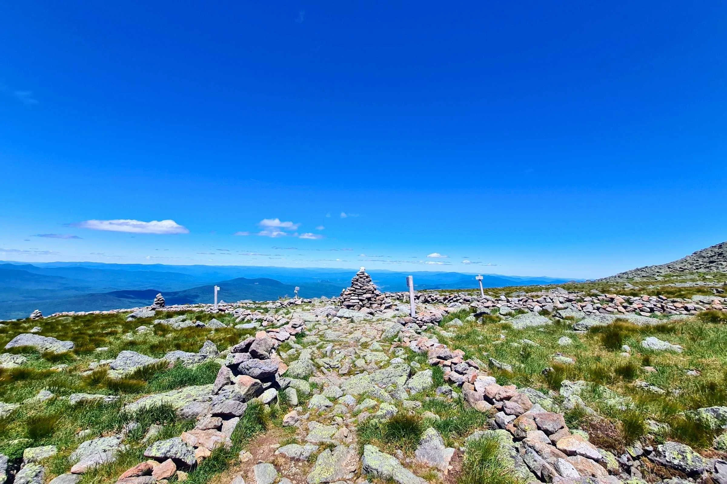
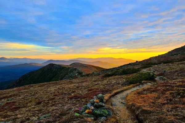
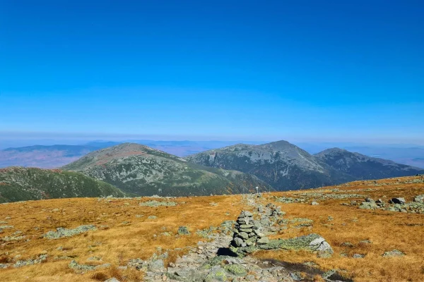
The draw is the exposure. Much of the route sits above treeline, with wide views across the Great Gulf, Crawford Notch, the Pemigewasset Wilderness, and the rolling layers of New Hampshire and Maine beyond. On a clear day, this is one of the best ridge walks in the eastern United States.
The other draw is the timing. Early summer gives you long daylight, open huts, working shuttle options, and a better chance of walking the route as a multi-day traverse rather than a survival exercise. The trade-off is that the mountains may still be shaking off winter. Snow patches can linger on shaded slopes, alpine plants are fragile, and cold wind can make a June day feel nothing like summer.
That mix is what makes the Presi Traverse worth writing about. It is beautiful, efficient, and accessible by road, but it still demands mountain judgement.
Trail at a Glance
Here is everything you need to plan the Presidential Traverse at a glance.
| Location | Presidential Range, White Mountain National Forest, New Hampshire, USA |
| Distance | About 19 to 23 miles, depending on route and summit side trips |
| Duration | 1 very long day for fit and experienced hikers, or 2 to 4 days hut-to-hut |
| Difficulty | Hard to expert |
| Total elevation gain | About 9,000 feet |
| Best season | Early summer to early fall. For this article: late June to early July is the sweet spot, once huts and shuttle services are running and before peak summer humidity and crowds |
| Permits | No hiking permit required. Hut bookings or campsite fees apply if staying overnight |
| Start trailhead | Appalachia Trailhead, Randolph, NH |
| End trailhead | Crawford Path Trailhead, Mt. Clinton Road, NH |
| Route type | Point-to-point |
| Highest point | Mount Washington, 6,288 feet |
| Category | Wild Trails |
Most hikers describe the route north-to-south, starting at Appalachia and finishing near the AMC Highland Center at Crawford Notch. You can go the other way, but north-to-south gives you the steepest climb early and lets you finish on the southern Presidentials.
Trail Map
View the Presidential Traverse map by GaiaGPS
View the Appalachian Trail interactive map from the Appalachian Trail Conservancy – useful for checking the Appalachian Trail sections across the Presidential Range.
Getting There and Away
Getting there
The usual northern start is Appalachia Trailhead on US Route 2 near Randolph, New Hampshire. Gorham is the nearest practical town on the northern side, about 5 miles east of the US 2 and NH 16 junction. Many hikers stage from Gorham, Pinkham Notch, or the AMC Joe Dodge Lodge, then shuttle or drive to Appalachia early.
If you are flying in, Boston Logan is the major international airport, but Manchester-Boston Regional Airport is often easier for a New Hampshire-focused trip. You will still need a car, shuttle, or private transfer. This is not a trail where public transport solves everything neatly.
Driving is straightforward on sealed roads. Parking at Appalachia can fill early in good weather, and cars often spill onto the shoulder. If you are leaving a car, make sure it is legally parked and fully off the road. For a hut-to-hut trip, the cleanest option is often to leave your car near the southern finish at the Crawford Path or Highland Center area, then use the AMC Hiker Shuttle to reach the northern end.
Getting away
The standard finish is near Crawford Notch, close to the AMC Highland Center and Route 302. If you left a car at the southern end, the finish is simple. If your car is at Appalachia or Pinkham Notch, plan your shuttle before you start.
The AMC Hiker Shuttle is the main scheduled option in season, with 2026 service running Friday to Sunday from early June to early July, daily during the core summer period, and then Friday to Sunday again into October. Reservations are strongly recommended. Private shuttles also operate in the White Mountains, but availability can change by season, so confirm before publishing or booking.
For staging, Gorham works well before a north-to-south start. Crawford Notch, the AMC Highland Center, or nearby towns such as Bartlett and North Conway work well after the hike, especially if you want a bed, food, and a low-effort recovery morning.
Day-by-Day Breakdown
This breakdown assumes a sensible early-summer hut-to-hut traverse over 3 to 4 days. Strong hikers often complete the Presi Traverse in a single day, but that is not the best frame for most Wild Trail Hiker readers. For multi-day hikers, the value is in slowing down enough to manage exposure, weather, and fatigue.
Day 1: Appalachia Trailhead to Madison Spring Hut
Approximate distance: 4 to 5 miles, depending on route and whether you summit Madison
Main climb: About 3,500 feet to Madison Spring Hut
Terrain: Steep forest climb, rocks, roots, waterfalls, then alpine exposure near the hut
The first day is short on mileage and heavy on climbing. From Appalachia, most hikers use Valley Way or Airline to reach Madison Spring Hut. Valley Way is the more sheltered and direct option. Airline is steeper and more exposed, with broader views toward King Ravine.
This is the day that tells you whether your legs are ready. Four miles does not sound like much, but gaining roughly 3,500 feet on White Mountains footing is not gentle. Expect rock steps, rooty sections, and a climb that keeps asking for more.
Madison Spring Hut sits high between Mount Madison and Mount Adams. If the weather is stable and you arrive with enough time, the out-and-back to Mount Madison is worth doing. If wind or cloud is building, skip the summit and save your margin. This is not a route where every optional peak is mandatory.
Practical tip: keep a warm layer and shell accessible before you leave the trees. You do not want to stop in exposed wind and dig through your pack with cold hands.
Day 2: Madison Spring Hut to Lakes of the Clouds Hut
Approximate distance: 7 to 9 miles, depending on summit side trips
Main summits: Adams, Jefferson, Clay, Washington
Terrain: Exposed ridge, boulder fields, alpine trail, steep summit spurs
This is the heart of the Presidential Traverse. You leave Madison Spring Hut already high, then follow the northern ridge toward Mount Washington. The Gulfside Trail carries much of the route, with optional or recommended side trips over Adams, Jefferson, Clay, and Washington depending on your definition of a complete traverse.
The hiking is slow for the distance. The rocks are rough, the footing is constant work, and the wind can turn an ordinary mile into a grind. On a clear early-summer day, this section is spectacular. You can see back toward Madison and Adams, across the Great Gulf, and ahead to the weather station and buildings on Mount Washington.
Mount Washington is the psychological centre of the traverse. It is also odd. After hours of exposed trail, you suddenly arrive at a summit with buildings, a road, the Cog Railway, and day visitors. Use the summit as a reset, not a reason to get casual. The descent from Washington to Lakes of the Clouds still needs care, especially in fog or wet rock.
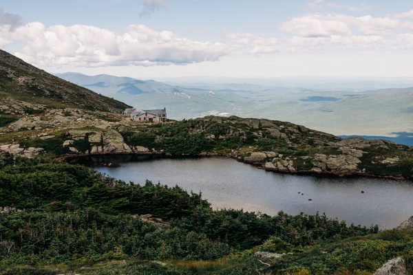
Lakes of the Clouds Hut is one of the best-placed huts in the White Mountains. It sits below Mount Washington and near Mount Monroe, with small alpine lakes and huge exposure to changing weather. In early summer, this can feel like a privilege: a high mountain night without carrying a tent into fragile alpine terrain.
Practical tip: do not let good views make you forget water and calories. The northern Presidentials are tiring because you are always balancing, stepping, and bracing on uneven rock.
Day 3: Lakes of the Clouds Hut to Mizpah Spring Hut
Approximate distance: 6 to 8 miles
Main summits: Monroe, Eisenhower, Pierce
Terrain: Alpine ridge, historic Crawford Path, open summits, gradual descent toward trees
From Lakes of the Clouds, the short climb to Mount Monroe comes early. It is one of the finest viewpoints on the route, especially looking back toward Mount Washington. From there, the Crawford Path carries you south along one of the most historic footpaths in the United States.
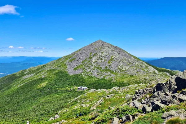
This section can feel gentler than the northern ridge, but it is still exposed. Mount Eisenhower is one of the standout summits, with a rounded dome and a broad sense of space. The side trail to the top is short, but it adds effort, and it can be windy.
The long above-treeline walking is the point of the route, but it is also the risk. In early summer, you have long days, but storms can still build. If visibility drops, navigation matters. If wind rises, the easy-looking ridge can become a serious place.
Near Mount Pierce, you start to feel the traverse changing. The route begins to lean back toward trees, shelter, and the end of the high ridge. Many hut-to-hut itineraries continue to Mizpah Spring Hut for a final night, which makes the last day short and relaxed.
Practical tip: keep the pace conservative in the morning. The southern Presidentials can tempt you into moving too fast because the terrain opens out, but tired ankles on wet rock are still tired ankles.
Day 4: Mizpah Spring Hut to Crawford Notch
Approximate distance: 2 to 3 miles for the direct finish, longer if adding Jackson or Webster
Terrain: Forest trail, descent, roots, rocks, and a return to the road
The direct finish from Mizpah Spring Hut to the Crawford Path Trailhead is short. Take the Mizpah Cutoff back to Crawford Path and descend toward Route 302 and the Highland Center area. After the exposure of the previous days, the forest can feel almost soft, although the White Mountains still make you work for the final miles.
Some hikers add Mount Jackson or Webster, especially if they are peak-bagging. That creates a longer, more rugged finish and is not necessary for a classic Presidential Traverse. If your goal is a clean multi-day crossing, finishing at Crawford Path is enough.
Practical tip: do not mentally finish at Mizpah. Most hiking accidents happen when people relax too early. Wet roots and tired legs near the end can still put you on the ground.
What to Expect on the Presidential Traverse
Terrain
Expect steep climbs, rocky trail, exposed ridge walking, and long stretches where your feet rarely land flat. The White Mountains are not high by western North American standards, but they are rough. The difficulty comes from the combination of elevation gain, uneven rock, exposure, and weather.
Above treeline, stay on marked trails. The alpine plants are fragile and grow slowly. Early summer is exactly when the alpine environment can look alive and tempting, but stepping off trail damages what makes the route special.
Weather
Weather is the main risk. The White Mountain National Forest warns hikers to carry warm clothing and rain gear even when the valley forecast looks good. Mount Washington Observatory also reminds hikers that higher-summit weather can change quickly and that the forecast is only one planning tool.
For an early-summer traverse, plan for sun, cold rain, fog, wind, and lingering snow or ice in shaded places. A warm day in Gorham or Crawford Notch does not guarantee warm conditions on Adams, Washington, or Monroe.
Wildlife
This is not a wildlife safari route, but you may see birds, small mammals, and alpine-zone life if you slow down. Black bears live in the broader White Mountains, but the more relevant wildlife issue for this route is food storage at huts or campsites. Follow hut and Forest Service instructions.
Crowds
Early summer is a good compromise. You avoid some of the peak summer crowds, but you also get hut access, shuttle access, long daylight, and a safer planning window than late spring. Mount Washington itself can feel busy because of the road and railway. The ridge between huts still feels like mountain country, especially early or late in the day.
Signature Features
The standout moments are the climb into the northern Presidentials, the ridge from Madison toward Washington, the strange contrast of Mount Washington’s summit, the lakes below the clouds, and the rolling southern ridge over Monroe, Eisenhower, and Pierce.
Water: Sources, Safety, and Treatment
Water planning is different on a hut-to-hut traverse than on a wild camping route. The AMC huts provide water in season, which makes the classic multi-day itinerary much easier. Natural water can also appear in streams and alpine drainages, but you should not assume reliable untreated water along the exposed ridge.
The safest practical approach is to fill at huts and treat any natural water you collect. Use a filter, chemical treatment, or UV purifier. In early summer, snowmelt and runoff may be present, but that does not automatically make it safe. Human use, hut proximity, animals, and trail traffic all increase contamination risk. If you use a squeeze filter, remember that silty or organic water can slow it down, so pre-filtering through a bandana can help.
Logistics
No hiking permit is required for the Presidential Traverse, but overnight planning matters. The classic hut-to-hut option uses Madison Spring Hut, Lakes of the Clouds Hut, and often Mizpah Spring Hut. These huts are popular, seasonal, and need advance booking.
For 2026, Madison Spring Hut and Lakes of the Clouds Hut list full-service seasons beginning on June 4, with different September closing dates. That supports the early-summer angle, but it also means you should not assume services outside the listed season.
Camping is more complicated than it looks. Much of the route is above treeline or close to sensitive alpine areas, huts, trails, and water sources. The practical answer for most hikers is: book huts, use designated campsites where appropriate, or plan a single-day traverse only if you have the fitness and experience.
A New Hampshire Hike Safe Card is worth considering. It supports search and rescue funding and may reduce the risk of being charged for rescue costs in some circumstances.
Mandatory Gear Checklist
This is a high-exposure route, so the gear list should be built around weather, footing, and self-rescue margin.
- Waterproof shell jacket: Essential for wind and cold rain above treeline. A light town rain jacket is not enough.
- Warm midlayer or active insulation: Early summer can still feel cold on the ridge, especially in wind or fog.
- Map, compass, and offline GPS: Do not rely on phone signal. Fog can make the ridge confusing. See the best hiking GPS devices for multi-day hiking and best hiking compasses.
- Headlamp with spare power: Even hut-to-hut hikers can be delayed by weather or slow rocky terrain.
- Trekking poles: Useful for the long climbs and knee-heavy descents.
- Trail runners or hiking boots with strong grip: Choose footwear you trust on wet rock. See best lightweight hiking boots or best breathable hiking shoes for options.
- Water filter or treatment: Carry it even if you plan to fill at huts.
- Emergency layer and small repair kit: The ridge is exposed, and waiting for help in wind or rain gets cold quickly.
- Sun protection: Above treeline means long exposure when the weather is clear.
- Pack that carries close: A sloppy pack is annoying on boulder fields. See best lightweight daypacks for options.
For broader planning, see Multi-Day Hiking Gear: What You Actually Need and Essential Skills for Multi-Day Hiking.
For the full kit list built specifically for this route, item by item and why each piece earns its place, see What to Pack for the Presidential Traverse.
Honest Assessment
The Presidential Traverse is for fit hikers who already know they can handle steep climbs, long rocky days, and exposed weather. It is an excellent objective if you want a compact multi-day route with big views, hut support, and a real mountain feel.
It is not ideal as a first overnight hike. It is also not a route for anyone who treats summer as a guarantee of easy conditions. If your navigation, layering, or pacing skills are still shaky, start with a less exposed White Mountains itinerary first.
The best version for most hikers is not the one-day sufferfest. It is the early-summer hut-to-hut traverse, walked with enough time to enjoy the ridge and enough humility to turn around if the weather changes.
Final Thoughts
Once you are sold on the route, get your kit sorted with the full What to Pack for the Presidential Traverse guide before you go.
The Presidential Traverse earns its reputation because it gives you so much mountain in such a short distance. Early summer is the right window to write and plan around: huts are opening, shuttle logistics become easier, daylight is generous, and the alpine zone is waking up.
But this is still the White Mountains. Build your plan around weather, not ego. If you get a clear ridge, the Presi Traverse can be one of the great above-treeline walks in the eastern United States. If the forecast turns, the smartest move may be to wait. The mountains will still be there.
Few routes in the eastern US match the Presidential Traverse for above-treeline distance in a long weekend.
For planning foundations, start with Plan Your First Multi-Day Hike and Essential Skills for Multi-Day Hiking. For another major destination guide, compare this with Torres del Paine O Circuit.
Frequently Asked Questions
How long is the Presidential Traverse?
Most route descriptions put the Presidential Traverse at about 19 to 23 miles, depending on whether you include all summit side trips and whether you finish at Crawford Path, Highland Center, or continue over Jackson and Webster. Do not judge it by distance alone. The route also includes about 9,000 feet of elevation gain and long exposed sections above treeline.
Is early summer a good time to hike the Presidential Traverse?
Yes, early summer can be one of the best times to hike it, especially from late June into early July. The huts and shuttle system are usually operating, daylight is long, and the alpine zone is active. The caution is lingering snow, cold rain, and wind. Check current trail conditions and the Mount Washington higher summits forecast before committing.
Do you need permits for the Presidential Traverse?
You do not need a hiking permit for the standard Presidential Traverse. You do need to book and pay for AMC huts if you are staying overnight, or follow White Mountain National Forest rules if camping. Above-treeline camping is heavily restricted to protect fragile alpine vegetation.
Can beginners hike the Presidential Traverse?
Not as a first serious hike. A strong beginner with good fitness, experienced partners, and a hut-to-hut plan may be able to complete it in good weather, but the route is better suited to hikers who already understand navigation, layering, pacing, and mountain weather. If you are new to multi-day hiking, build up on less exposed routes first.
Should you hike the Presidential Traverse in one day or over several days?
A one-day traverse is a classic challenge for very fit and experienced hikers, but a 3 to 4 day hut-to-hut traverse is the better fit for most multi-day hikers. It gives you more weather margin, less pressure, and more time to appreciate the ridge. The one-day version is more about endurance. The multi-day version is more about the place.
