

Last updated: August 2026
Wild Trail Hiker is reader-supported. We may earn a commission when you buy through links on this page, at no extra cost to you. We only recommend products we’d consider taking on a multi-day trip ourselves.
Before You Go
The Cirque of the Towers Loop needs no permit and no reservation, but do not let that fool you into treating it as easy. Roughly two miles of the route, over Texas Pass, is off-trail: a faint, cairn-marked path over scree and talus with no official tread. You will be above 10,000 feet for nearly the entire trip, camping is banned within a quarter mile of Lonesome Lake (the water there tested as some of the most fecally contaminated in the country), and both black bears and grizzly bears now range through this part of the Wind River Range. None of this should scare off an experienced backpacker. It should make you plan properly.
Why This Trail
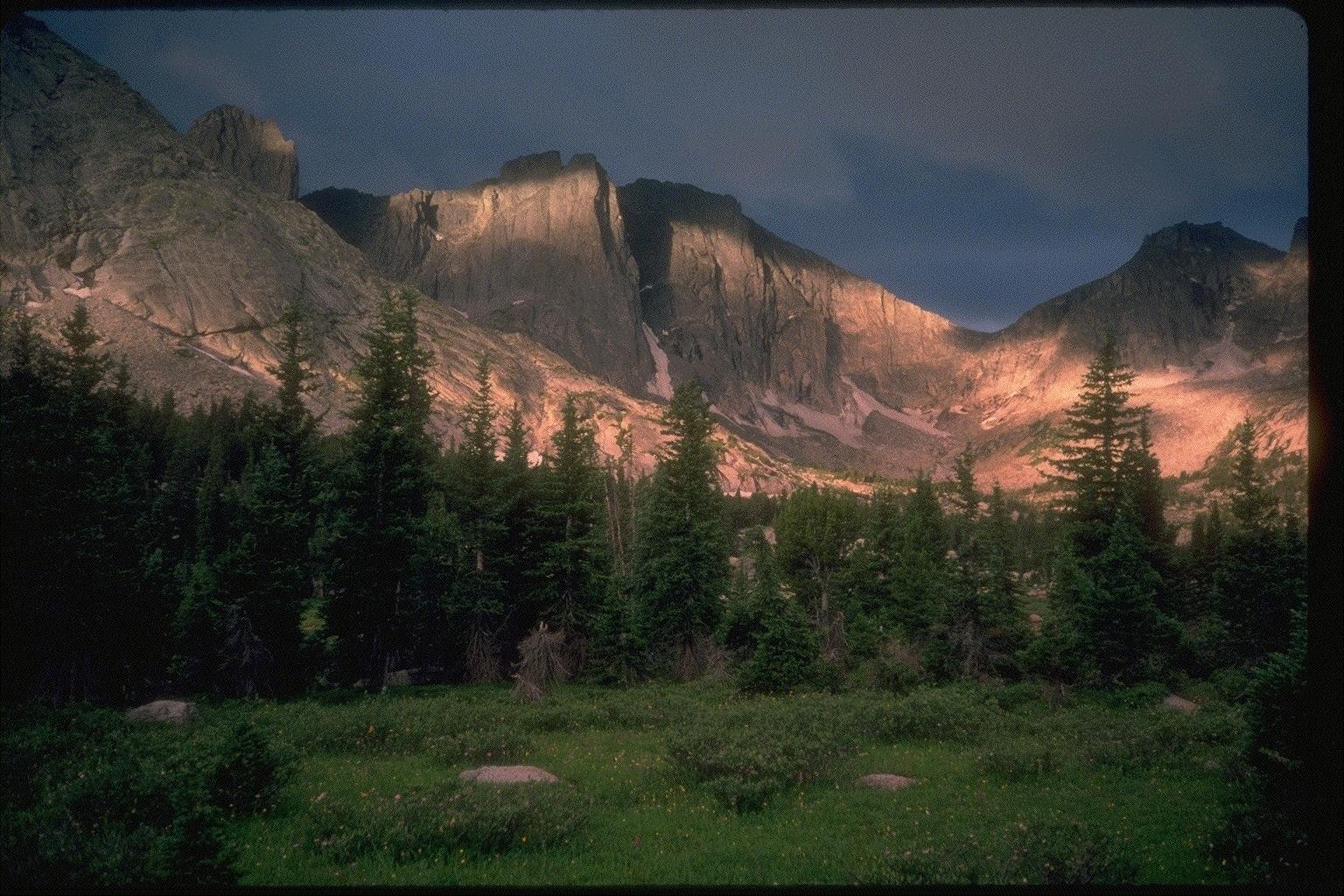
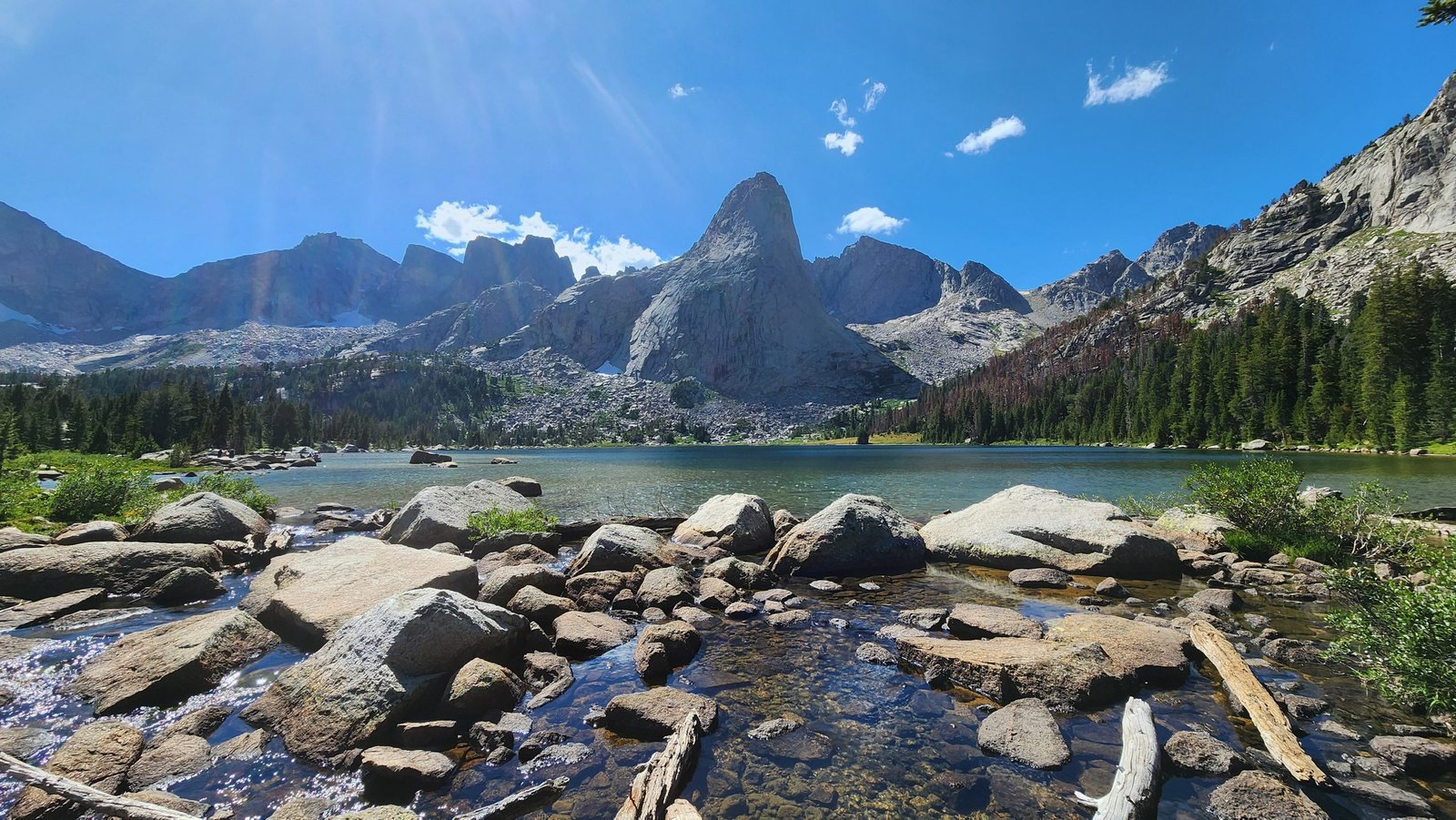
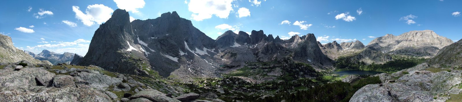
The Cirque of the Towers is the single most photographed corner of the Wind River Range, and once you stand at Jackass Pass looking down on it, it is obvious why. A near-complete ring of granite spires, among them Pingora Peak, Wolf’s Head, and War Bonnet, encloses Lonesome Lake like the walls of a natural amphitheater. Climbers have been drawn here for decades: Pingora alone is considered one of the finest moderate alpine rock climbs in North America. For hikers who have no interest in roping up, the loop around the outside of the Cirque delivers the same scenery from trail and near-trail terrain, no technical climbing required.
What makes this trail stand out against the rest of the Winds is how much reward it packs into a genuinely short trip. Where a full traverse of the range demands a week or more, the Cirque of the Towers Loop is commonly finished in two to four days, which puts world-class alpine scenery within reach of a long weekend. The route also happens to be a recognized alternate for Continental Divide Trail thru-hikers, so on a summer weekend you will likely cross paths with a few CDT hikers cutting through on their own multi-month trip, a reminder of how significant this stretch of terrain is within the broader Rockies.
The trade-off for that reward is real: an off-trail pass, sustained high altitude, and a trailhead that is itself a small adventure to reach. That combination is exactly what gives this loop its reputation among experienced hikers as one of the best short, hard trips in the Lower 48.
Trail at a Glance
| Spec | Detail |
|---|---|
| Distance | About 24 miles for the full loop. The Texas Pass section is off-trail and unmapped, so exact figures vary by source and by the line each hiker takes; some GPS-tracked trip reports report totals closer to 26 to 27 miles. |
| Duration | 2 to 4 days. Most backpackers take 3 days and 2 nights; fit, fast hikers sometimes do it in a single very long day, and anyone wanting a more relaxed pace, or planning a rest day at Lonesome Lake or Big Sandy Lake, should plan for 4. |
| Difficulty | Moderate to hard. The trail itself is well graded and not technically difficult, but the off-trail section over Texas Pass demands basic route-finding on loose rock, and the entire trip sits above 9,000 feet. |
| Best season | Mid-July through mid-September. Heavy snow years can keep Texas Pass unsafe well into July; light years can open the route in late June. Mid-August to mid-September is the sweet spot: mosquitoes have eased off and the July-August crowds have thinned, though nights get noticeably colder. |
| Permits | None required. Groups under 15 do not need a permit or pay a fee in either the Bridger Wilderness or the Popo Agie Wilderness, which together contain this loop. You will fill out a self-registration form at the trailhead, used by the Forest Service to track backcountry use, not to limit it. |
| Start / end trailhead | Big Sandy Trailhead (loop trail, same point both directions): Big Sandy Trailhead on Google Maps, coordinates confirmed via the Bridger-Teton National Forest’s official trailhead page. |
Because this is a loop, the trailhead you start from is the one you finish at. The standard direction, and the one this guide follows, goes counter-clockwise: up the gentler Big Sandy approach past a chain of lakes, over the harder off-trail Texas Pass, down into the Cirque itself, then out over the more established Jackass Pass trail back to Big Sandy Lake and the trailhead. Some hikers reverse this, tackling Jackass Pass on the way in and Texas Pass on the way out; both directions work, though climbing the loose scree of Texas Pass is generally considered easier than descending it.
Trail Map
View the Cirque of the Towers loop on AllTrails: listed as “Cirque of Towers, Bears Ears Trail, and Hailey Pass,” includes an elevation profile, recent trip reports, and user photos.
⚑ Trail map gap: no single official interactive map covers the full loop, since it crosses from Bridger-Teton National Forest into Shoshone National Forest partway around. The Bridger-Teton National Forest’s Maps and Guides page is the best official starting point; a paper topographic map (the Wind River Range topo map covering the Cirque of the Towers area) is genuinely worth carrying given the off-trail section, not just a phone screen.
Getting There and Away
Getting there: The town of Pinedale, Wyoming is the staging point for this trip. From Pinedale, the Big Sandy Trailhead is 57 miles away, about 1 hour 25 minutes of driving: south on US-191 for roughly 12 miles, then WY-353 (which becomes Big Sandy-Elkhorn Road/CR-118) for about 27 miles, then Lander Cutoff Road/CR-132 for 7 miles, then Forest Service Road 370850 for the final 9.7 miles to the trailhead. The last stretch is unpaved and rough, with potholes; a high-clearance vehicle is recommended, though a careful driver in a standard passenger car can usually make it. There is no cell signal once you leave pavement, so download offline maps or screenshot the directions before you set out.
The nearest airport with regular commercial service is Jackson Hole Airport (JAC), roughly 125 miles and 2.5 to 3 hours from the trailhead via Pinedale. Riverton Regional Airport (RIW) is a similar distance and offers a smaller-scale alternative with fewer flights. Rock Springs (RKS) is farther but sometimes cheaper to fly into. None of these airports are close enough to make flying in and out the same day practical; plan to overnight in Pinedale before and after the hike either way.
There is no public bus or shuttle service to the Big Sandy Trailhead. A private vehicle or rental car is standard. Pinedale-based outfitters, including the Great Outdoor Shop and GOTCO, run point-to-point shuttle services for hikers doing longer point-to-point routes elsewhere in the Wind River Range, but since the Cirque of the Towers Loop starts and finishes at the same trailhead, you will not need one for this trip.
Getting away: Same trailhead, since this is a loop. Once you are back at Big Sandy, it is the same 57-mile drive back to Pinedale.
Staging town: Pinedale has the closest lodging, outfitters, and last-chance supplies, including gear rental and topo maps if you did not bring your own. It is a small town, so book accommodation ahead in peak season (July and August).
Day-by-Day Breakdown
The breakdown below follows a 3-day, 2-night counter-clockwise itinerary starting and ending at Big Sandy Trailhead, the pace most commonly recommended for this loop. Mileage points are drawn from multiple independently reported trip logs and cross-checked against each other, since no single official source publishes exact cumulative mileage for the off-trail section.
Day 1: Big Sandy Trailhead (9,100 ft) to Shadow Lake (10,300 ft), about 10.9 miles
The day starts on genuinely gentle, well-graded trail, a gradual 1,200-foot climb through lodgepole forest opening into alpine terrain. You will pass Mirror Lake, Dad’s Lake, and Marm’s Lake before the turn-off toward Shadow Lake. This is the longest mileage day of the loop but also the easiest walking, so most hikers find it comfortable despite the distance. Camping options are plentiful and less crowded along this stretch than anywhere else on the route, since most hikers push on toward the Cirque itself. Shadow Lake makes a natural first-night camp, positioned right at the base of the harder terrain to come.
Day 2: Shadow Lake to Lonesome Lake via Texas Pass (11,500 ft), about 4 miles
This is the loop’s defining day. Past Shadow Lake, the official trail ends and the route becomes off-trail: a faint “goat trail” that climbs along a chain of small, mostly unnamed lakes (Billy’s Lake, Barren Lake, and Texas Lake) toward the base of Texas Pass. Follow rock cairns and keep your map and compass out, since the tread disappears in places and the exact line varies hiker to hiker. From Texas Lake (about 10,750 feet) the final push to the pass is short but steep, a scramble over loose rock and scree to the 11,500-foot summit, the high point of the entire loop.
The payoff is immediate: your first full view of the Cirque of the Towers, with Pingora Peak’s distinctive spire dominating the foreground. The descent toward Lonesome Lake follows a loosely marked path and loses elevation quickly. Remember that camping is prohibited within a quarter mile of Lonesome Lake’s shoreline, so continue past the lake to the established camping area on the slope above and to the southwest, where most parties stay. Budget extra time on this day. It covers the least distance of the trip but demands the most care, and afternoon thunderstorms are a real hazard on an exposed pass like this, so aim to be over Texas Pass well before early afternoon.
Day 3: Lonesome Lake over Jackass Pass (10,750 ft) to Big Sandy Trailhead, about 8 miles
The final day crosses easier, better-marked terrain. From the camping area above Lonesome Lake, an unmarked but well-used route climbs to a lower saddle southwest of Jackass Pass proper, then boulder-hops along the west side of Arrowhead Lake before rejoining the official trail. If you prefer to stay on maintained trail throughout, the official route to Jackass Pass runs along the east side of Lonesome Lake instead. Either way, the descent from Jackass Pass down to Big Sandy Lake is well graded and switchbacked, a welcome change after two days of rougher travel.
Big Sandy Lake itself, at 9,700 feet, is a scenic, easily accessible spot that makes a worthwhile rest stop, and a popular basecamp for hikers doing shorter trips into the area. From there, the final 5.6 miles back to the trailhead is gentle, well-traveled trail. Hikers who want a quieter, slightly longer alternative can add 0.4 miles by routing past Diamond Lake and V Lake instead of the direct trail, with no extra elevation gain.
4-day option: Split Day 1 into two shorter days by camping at Big Sandy Lake on the way in rather than pushing straight to Shadow Lake, or add a rest day at Lonesome Lake to explore the base of the Cirque and side-trip to Lizard Head Meadows (about 2 miles from the main camping area) without a full pack.
What to Expect
Terrain: A mix of well-graded, well-maintained trail (Days 1 and 3) and genuine off-trail travel over scree and talus (the Texas Pass section on Day 2). The off-trail portion is not technical climbing, but it does demand comfort with loose rock, exposed footing, and route-finding without a marked tread.
Weather: Afternoon thunderstorms build regularly through the summer months, particularly July and August, and are genuinely dangerous on an exposed pass. Plan to be off any high point by early afternoon. Nights drop below freezing at this elevation even in peak summer, and snow is possible at any time of year on the higher terrain.
Wildlife: Both black bears and grizzly bears now range through the southern Wind River Range, an expansion documented by Wyoming Game and Fish Department in recent years as the regional grizzly population has grown. Carry bear spray and know how to use it. Marmots, pikas, and mountain goats are common around the Cirque’s rocky basins.
Crowds: The Cirque of the Towers and Big Sandy Lake are among the most heavily visited destinations in the entire Wind River Range, popular with both backpackers and technical climbers. Expect company at Lonesome Lake and Big Sandy Lake especially during July and August weekends. The shoulder weeks in late June and mid-September are noticeably quieter, conditions permitting.
Signature features: The granite spires of the Cirque itself (Pingora Peak, Wolf’s Head, War Bonnet, and Warrior Peaks among them), the view from Texas Pass, Lonesome Lake, Jackass Pass, and Big Sandy Lake.
Water: sources, safety, and treatment
Water is genuinely abundant on this loop: a near-continuous chain of lakes and streams runs along almost the entire route, so carrying more than a liter or two at a time is rarely necessary. The one real gap is the off-trail Texas Pass stretch on Day 2, where sources thin out on the final climb to the pass; top up at Texas Lake before the summit push.
One source needs a specific warning: Lonesome Lake. A 2022 EPA national water quality survey found Lonesome Lake had the highest concentration of fecal indicator bacteria of any of the 981 lakes sampled across the country, a result widely attributed to how heavily used the shoreline and surrounding camping area are. Do not draw drinking water from Lonesome Lake or its outlet stream even if you plan to treat it, and pack out solid human waste while camped in the area rather than burying it, given how saturated the ground already is.
Everywhere else, water should still be treated. This is a busy backcountry corridor with significant stock and hiker traffic, and giardia risk is real even in water that looks pristine at altitude. A standard squeeze or gravity water filter is standard kit and handles this trail well.
Logistics
No permit or fee applies to this loop, but every party should complete the self-registration form at the Big Sandy Trailhead, which the Forest Service uses to monitor backcountry use. There is no potable water at the trailhead itself, only vault toilets, so arrive with your water plan already sorted for the first stretch of trail.
⚑ Check current food storage requirements before you go: Bridger-Teton National Forest has an active food storage order covering several ranger districts, including Pinedale, where the Big Sandy Trailhead sits, requiring food, garbage, and scented items to be stored in an IGBC-approved bear-resistant container or properly hung when not in immediate use. The exact terms of the order can shift year to year, so confirm current specifics with the Pinedale Ranger District or the forest’s alerts page before you finalize your gear list.
Camping restrictions are straightforward but worth knowing before you arrive: no camping within a quarter mile of Lonesome Lake’s shoreline, and no camping within 200 feet of other lakes or trails generally. Established, low-impact camping areas exist near Shadow Lake, above Lonesome Lake, and at Big Sandy Lake, and using them instead of picking a fresh spot each time helps limit the trail’s growing impact.
Mandatory Gear Checklist
For the full kit list with product picks and why each one matters on this specific route, see what to pack for the Cirque of the Towers Loop.
- A topographic map and compass. The Texas Pass section is off-trail with no dependable signage, and phone GPS alone is a poor backup at altitude with no signal. See best hiking compasses.
- A GPS device or satellite communicator, as a second layer of navigation and a way to call for help if something goes wrong on an exposed, lightly trafficked pass. See best hiking GPS devices.
- Bear spray. Non-negotiable given the confirmed grizzly presence in this part of the range. See best bear sprays.
- A bear-resistant food canister, both to comply with the Pinedale Ranger District’s food storage order and because proper storage matters in an area with growing bear activity. See best bear canisters for multi-day hiking.
- A reliable water filter, since even this water-rich trail needs every source treated. See best water filters for hiking.
- Trekking poles, genuinely useful on the scree and talus of the Texas Pass climb and descent. See best trekking poles.
- An insulated jacket for camp. Nights below freezing are normal at this elevation even in July and August. See best insulated jackets for hiking.
Honest Assessment
This loop suits hikers who already have multi-day backcountry experience, are comfortable navigating without a marked trail, and are fit enough to handle sustained days above 10,000 feet. The off-trail section over Texas Pass is the real gatekeeper here: it is not technical climbing, but it does demand genuine route-finding judgment on loose rock, and it is not the place to build those skills for the first time.
It is not a good choice for a first backpacking trip. Hikers who want the same scenery with an easier trail underfoot can do an out-and-back to Big Sandy Lake (about 18 miles round trip), which skips Texas Pass entirely and stays on maintained trail the whole way, trading the full Cirque circuit for a still-worthwhile taste of the range.
For hikers who finish this loop and want more, the full Wind River High Route, Andrew Skurka’s roughly 97-mile off-trail traverse of the entire range, uses some of this same corridor as one small piece of a much longer, far more serious undertaking: about two-thirds off-trail, multiple alpine passes, and rated for expert backpackers only. This guide covers the accessible loop, not that route, and the gap between the two is significant. Among experienced Wind River hikers, the consensus is that the Cirque of the Towers Loop is the single best short trip in the range: the highest scenery-to-effort ratio of anything in the Winds, without the multi-week commitment the High Route demands.
Final Thoughts
The Cirque of the Towers rewards hikers who take the off-trail section and the altitude seriously and treat the rest of the loop as the reasonably approachable trip it otherwise is. If you are still building toward a trip with this level of navigation and elevation demand, start with essential skills for multi-day hiking, which covers the navigation and trail-smarts groundwork this loop assumes you already have. If you want more high-altitude Rocky Mountain terrain without the off-trail commitment, our Teton Crest Trail guide covers a similarly short, high-reward trip a few hours north in Grand Teton National Park, and the Four Pass Loop is a comparable short, scenic alpine circuit one range over in Colorado. If you want the exact kit dialled for this route before you go, see what to pack for the Cirque of the Towers Loop.
Frequently Asked Questions
Do I need a permit for the Cirque of the Towers Loop?
No. Groups under 15 people do not need a permit or pay a fee to hike or camp in either the Bridger Wilderness or the Popo Agie Wilderness, which together cover this loop. You will fill out a free self-registration form at the Big Sandy Trailhead.
Is the Cirque of the Towers Loop suitable for beginners?
Not recommended as a first backpacking trip. The off-trail section over Texas Pass demands real route-finding on loose rock, and the entire loop sits above 9,000 feet. It suits hikers who already have multi-day backcountry experience.
What is the best month to hike the Cirque of the Towers Loop?
Mid-August to mid-September generally offers the best combination of a snow-free Texas Pass, thinning mosquitoes, and lighter crowds than peak July and early August. Confirm current snowpack conditions before an early-season trip.
How does this loop compare to the full Wind River High Route?
They are very different undertakings. The Cirque of the Towers Loop is a 2 to 4 day, roughly 24-mile trip suited to experienced backpackers. The Wind River High Route is a roughly 97-mile, largely off-trail traverse of the entire range rated for expert hikers only, typically taking 7 to 10 days. The High Route uses some of the same corridor but is a far more serious commitment.
Do I need a bear canister for this loop?
A bear-resistant canister or proper food hang is required under the Pinedale Ranger District’s food storage order, which covers the Big Sandy Trailhead. Both black bears and grizzly bears are present in this part of the range, so proper storage matters regardless of the exact current rule, which is worth confirming before you go.
