

Last updated: August 2026
Wild Trail Hiker is reader-supported. We may earn a commission when you buy through links on this page, at no extra cost to you. We only recommend products we’d consider taking on a multi-day trip ourselves.
Before You Go
⚑ Active closure as of August 2026: a wildfire (the Grasshopper Fire) has closed a large stretch of the Timberline Trail’s eastern side, and the US Forest Service’s own closure order names Trail #600 directly. The closure runs through December 31, 2026, or until rescinded. Do not plan a Timberline Trail trip without checking the Mount Hood National Forest’s current alerts page first; see also the note under Getting There and Away below. Outside of that, this is a 40-mile loop around an active volcano with several unbridged glacial river crossings, no permit lottery, and a free self-issued permit system, which makes it one of the more approachable big Pacific Northwest loops once conditions allow.
Why This Trail
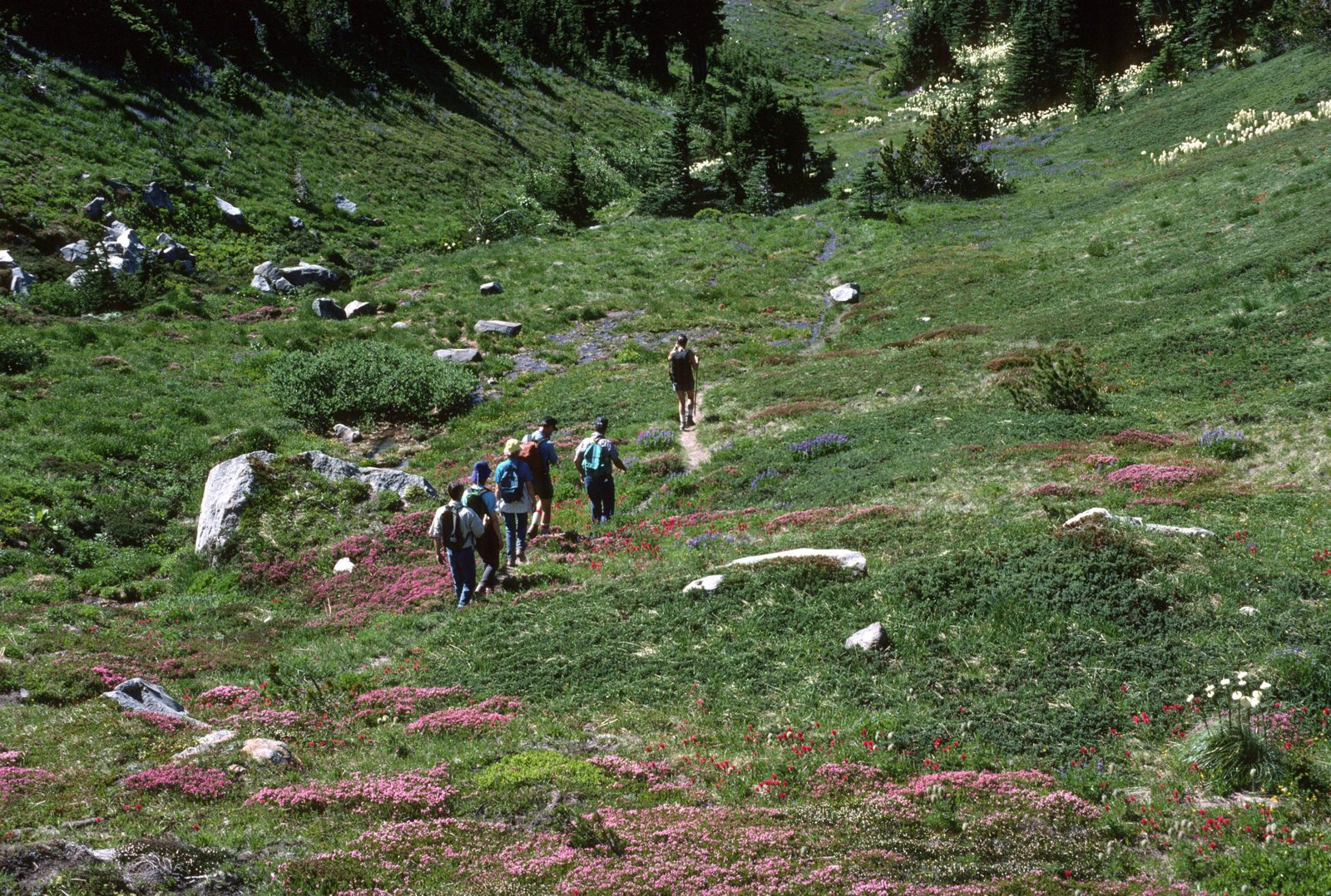
Mount Hood is the tallest peak in Oregon at 11,249 ft, and the Timberline Trail is the only route that takes you all the way around it. Built largely by the Civilian Conservation Corps in the 1930s, the trail alternates above and below the treeline as it circles the mountain, which means the scenery keeps shifting: open pumice slopes and glacier views on the exposed east side, deep old-growth forest and waterfalls on the wetter west side, and wildflower meadows at Paradise Park, Elk Cove, and Cairn Basin in between. The trail isn’t a single continuous tread for its whole length, either: the Forest Service’s own Trail #600 designation covers the northern and eastern arc, about 24.5 miles one-way, while the southwest segment between Timberline Lodge and Yocum Ridge, roughly 11 to 17 miles depending on the source and exact measurement point, runs on shared tread with the Pacific Crest Trail #2000. It’s also the only stretch of the loop open to stock. Experienced Pacific Northwest hikers often describe it as a smaller, faster, more accessible cousin of the Wonderland Trail around Mount Rainier: roughly 40 miles instead of 93, no permit lottery, and reachable in a long weekend rather than a week-plus commitment.
What sets the Timberline Trail apart from most big US loop hikes is how unregulated it still is. There is no reservation system, no lottery, and no quota. You self-register at the trailhead and go. That accessibility is also the trail’s defining risk: because there is no ranger checking your gear or your fitness before you start, hikers regularly underestimate the unbridged river crossings, particularly on the east and north sides where several forks run milky with glacial silt and can rise fast on a warm afternoon.
Trail at a Glance
- Distance: Approximately 40 miles (66 km), full loop. Sources vary from 38.3 to 41.5 miles depending on GPS track and which optional side loops (Paradise Park Loop, Eden Park) are included; the Forest Service’s own trail page describes it simply as “approximately 40 miles.”
- Duration: 3 to 4 days for most backpackers. Very fit, minimalist hikers sometimes push it in 1 to 2 days; a 5-day pace is a reasonable option if you want time for side trips to McNeil Point or Barrett Spur.
- Difficulty: Moderate to hard. The trail itself is well graded and mostly non-technical, but multiple unbridged glacial river fords, roughly 9,000 to 10,800 ft of cumulative elevation gain (source estimates vary), and genuine afternoon weather risk on the exposed east side put it above a first multi-day trip for most hikers.
- Best season: Mid-July through early October in a normal year. Snow can linger at the Timberline High Point (7,350 ft) and other exposed sections into July; the first serious fall snow usually arrives by mid-October. Wildfire season (typically August into September) is a second seasonal risk worth checking before you commit to dates.
- Permits: A free, self-issued Wilderness permit is required at trailhead portals from May 15 to October 15, no reservation or lottery. Some trailheads also require a paid day-use parking pass (see Logistics).
- Start / end trailhead: Timberline Lodge, Mount Hood National Forest (loop trail, same point both ways): Timberline Lodge on Google Maps
Timberline Lodge is the most heavily used access point because it has free parking, flush toilets, and a lodge restaurant at the start and end of your trip. Cloud Cap Trailhead (northeast) and Top Spur Trailhead (northwest) are the two other main access points, both practically on the trail itself, and either can be used to shorten or reshape your itinerary. ⚑ Cloud Cap Trailhead and the surrounding campground are within the current Grasshopper Fire closure area; confirm status before planning around it.
Trail Map
View the Timberline Trail on AllTrails: includes an elevation profile, recent hiker photos, and condition reports. Note that AllTrails is currently flagging this route as closed, consistent with the active 2026 fire closure below; check the listing’s current status alongside the official Forest Service alert.
Official Timberline Trail #600 Description and Map, Mount Hood National Forest (USFS) (PDF, opens in browser): the source-of-truth map, broken into ranger district sections with mileages and crossing notes.
Getting There and Away
Getting there: Because this is a loop, “getting there” and “getting away” both point back to Timberline Lodge. The nearest major hub is Portland, roughly 60 miles away via US-26, about a 90-minute to 2-hour drive depending on weekend traffic. The nearest airport is Portland International (PDX). The road to Timberline Lodge is sealed the entire way and no 4WD is needed for summer access. No parking pass is required at Timberline Lodge itself between May 1 and October 31.
If you are travelling without a car, the Mount Hood Express bus connects Government Camp and Sandy to Timberline Lodge; Portland-based hikers can reach it via TriMet to Gresham Transit Center, then a transfer to Sandy Area Metro, then the Mount Hood Express. This is the only trailhead with practical public transport access. The other two main trailheads, Cloud Cap (northeast, via roughly 9 miles of gravel Forest Service road) and Top Spur (northwest, mostly paved with a short gravel stretch), require a car.
Current conditions to check before booking anything: as of August 2026, the Grasshopper Fire has burned more than 43,000 acres on the east side of Mount Hood and prompted a Forest Service closure order (Order No. 06-06-01-26-08, effective August 4, 2026, running through December 31, 2026, or until rescinded) covering the Barlow and Hood River Ranger Districts. Trail #600, the Timberline Trail itself, is explicitly named in the closure, along with Cloud Cap Saddle Campground and numerous side trails on the mountain’s east and northeast flanks. This closure zone covers roughly the Elk Cove-to-Cloud Cap-to-Gnarl Ridge-to-Newton Creek arc of the standard route. ⚑ This is a live, safety-driven wildfire closure, not a routine trail maintenance note. Verify current status directly at the Mount Hood National Forest alerts page before finalising any itinerary, and do not enter closed National Forest System trails: violations carry real fines under federal law.
Every trailhead other than Timberline Lodge requires a Northwest Forest Pass ($5 per vehicle per day, or $30 annually) or an America the Beautiful annual pass ($80).
Day-by-Day Breakdown
The itinerary below is the most common 4-day, 3-night clockwise pace from Timberline Lodge, matching the pattern most trip reports and the Forest Service’s own district breakdown describe. Mileages are approximate and drawn from cross-referenced GPS tracks; treat them as planning estimates, not survey-grade figures. This describes the trail’s standard, evergreen route: check the active fire closure above before using it to plan an actual 2026 trip.
Day 1: Timberline Lodge to Ramona Falls area (about 10 miles)
Highlight: Zigzag Canyon overlook and the Paradise Park meadows.
From Timberline Lodge the trail heads west, crossing the small, easy Little Zigzag Canyon before reaching the Zigzag Overlook, a sudden, dramatic view down into Zigzag Canyon with Mount Hood’s western face behind you. The trail drops to the bridgeless but generally easy Zigzag River crossing, then climbs back up into the wildflower meadows of Paradise Park, the optional loop alternate through here adds a little elevation gain but is widely considered worth it. From Paradise Park the trail descends steadily to the Sandy River crossing at around mile 9, one of the more difficult fords on the west side with no bridge, then continues a short distance to camp near Ramona Falls, a broad, fan-shaped waterfall and one of the trail’s most photographed features.
Day 2: Ramona Falls area to Cairn Basin area (about 7 to 8 miles)
Highlight: Cairn Basin’s historic CCC stone shelter.
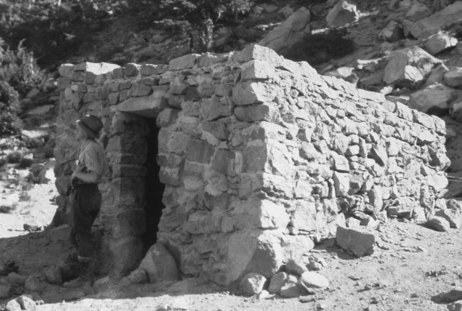
This is a shorter day by design, and a deliberately easier one after the previous day’s descents and the Sandy River crossing. The trail crosses the Muddy Fork of the Sandy River, historically one of the trickier fords on the whole loop due to variable channel braiding and blowdown in this stretch; many hikers detour via the Pacific Crest Trail between Bald Mountain and Ramona Falls to avoid the worst of it. From there the trail climbs steadily past Yocum Ridge and Bald Mountain toward McNeil Point country, reaching Cairn Basin, an alpine meadow at roughly 5,600 ft with one of the trail’s original 1930s CCC stone shelters still standing. Established campsites are plentiful here on both sides of the trail.
Day 3: Cairn Basin area to Gnarl Ridge (about 11 to 12 miles)
Highlight: Elk Cove’s meadows and the Eliot Branch crossing below Cloud Cap.
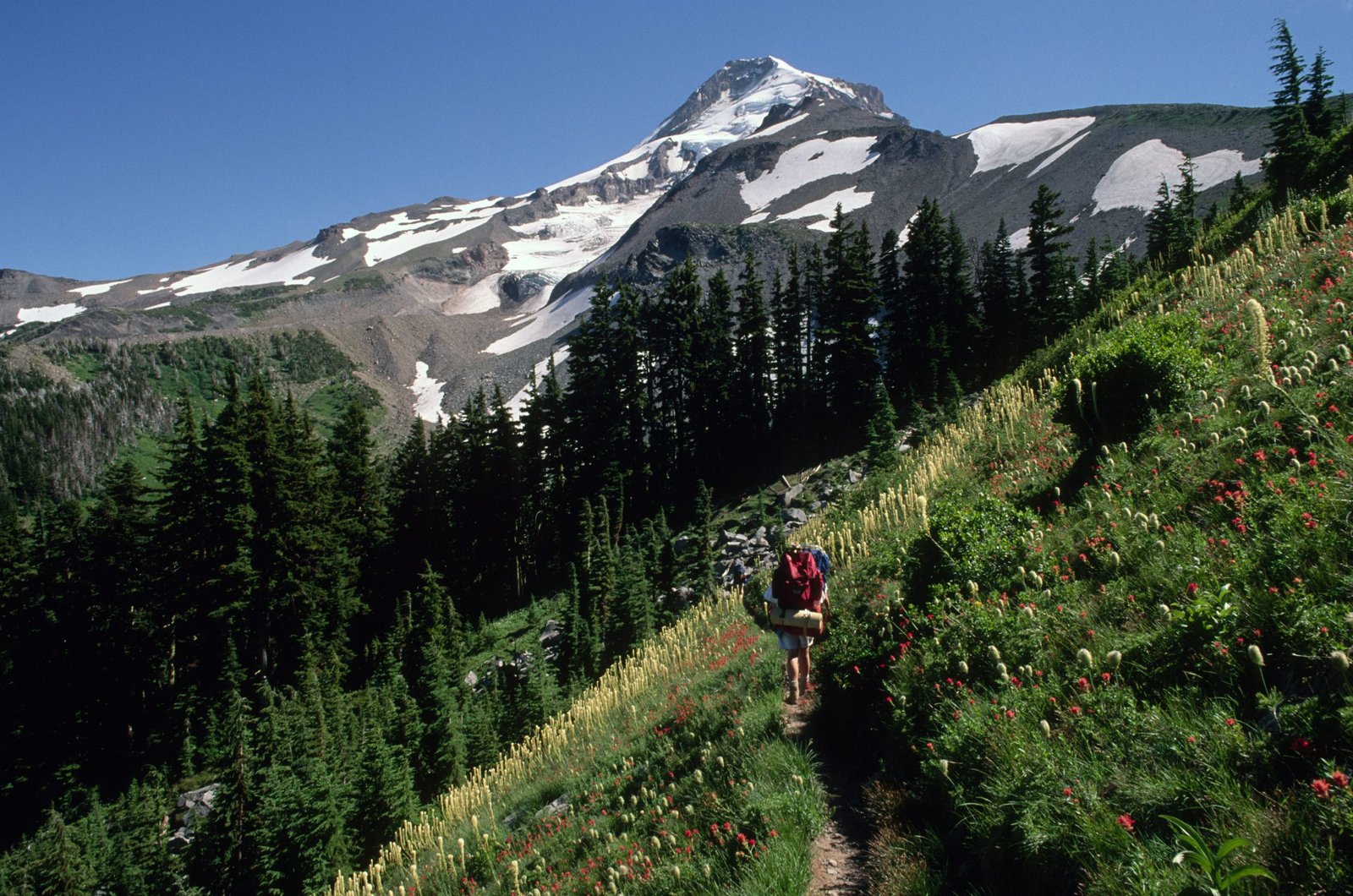
The east side of the loop is where the Timberline Trail earns its reputation. From Cairn Basin the trail passes through Wy’East Basin and reaches Elk Cove, a scenic alpine meadow with strong views up to Barrett Spur, before the difficult, unbridged Coe Branch crossing. The trail then continues through burn-scarred but fully passable terrain from the 2011 Dollar Lake Fire toward the Eliot Branch, the site of a major 2016 washout: the crossing was permanently rerouted roughly 700 ft lower down the canyon in the years after, and there is still no bridge, so expect to ford. From Cloud Cap, the trail climbs onto open pumice slopes past the historic Cooper Spur Shelter to the Timberline High Point at 7,350 ft, the highest point on the entire loop, then continues along scenic, exposed Gnarl Ridge to camp. ⚑ This entire day’s route, from roughly Elk Cove through Cloud Cap to Gnarl Ridge, falls inside the active 2026 Grasshopper Fire closure zone described above.
Day 4: Gnarl Ridge to Timberline Lodge (about 10 to 11 miles)
Highlight: Closing the loop past the White River’s volcanic outwash plain.
The final day drops off Gnarl Ridge to the difficult Newton Creek crossing, then continues through a further stream crossing at Clark Creek and past the waterfalls of Heather Canyon inside the Mount Hood Meadows ski area boundary, a novel change of scenery after three days of wilderness. The trail then descends to the White River crossing, one of the most difficult fords on the loop and too silty to drink from directly, before climbing back up past the White River Viewpoint, where hikers can look down on snags buried by a past Mount Hood eruption, and returning to Timberline Lodge. Fog can make the final half-mile above 6,000 ft genuinely hard to navigate: stay alert for cairns and trail markers if visibility drops.
What to Expect
Terrain: Constant climbing and dropping into glacial river canyons is the defining feature, similar in character to (though shorter than) the Wonderland Trail. Expect subalpine meadow, old-growth forest on the wetter west side, and barren pumice and lava terrain above 7,000 ft on the east side. Multiple unbridged or seasonally-improvised crossings of the Sandy, Muddy Fork, Coe Branch, Eliot Branch, Newton Creek, Clark Creek, and White River are the trail’s central technical challenge; river flow is generally lowest in the morning and rises through the afternoon as snowmelt peaks, so plan crossings early in the day where your itinerary allows.
Weather: Mount Hood generates its own localised weather, and the exposed east side (Timberline High Point, Gnarl Ridge) can turn cold, windy, and socked in with little warning even on a clear-looking morning. Daytime temperatures in peak summer commonly reach the 70s to low 80s°F, but nights at high camps can sit near freezing. Afternoon thunderstorms are a real risk in July and August; avoid being on exposed ridgeline terrain during one.
Wildlife: Black bears are present throughout the Mount Hood Wilderness (no grizzlies), along with deer, and occasionally elk at lower elevations. Standard food-storage practice (hang or use a canister) is sensible, though it is not a stated legal requirement on this trail the way it is on some Sierra Nevada routes.
Crowds: The west side (Paradise Park, Ramona Falls) and the section near Timberline Lodge see the heaviest day-hiker traffic, especially on summer weekends. The east side is quieter, partly because it demands more of hikers and partly because of periodic closures. Because there is no permit quota, popular campsites at Ramona Falls, Cairn Basin, and Elk Cove can fill on peak weekends: arrive with a backup site in mind.
Signature features: Zigzag Canyon, Ramona Falls, the Cairn Basin CCC shelter, Elk Cove’s meadows, the Timberline High Point, and the White River’s volcanic outwash plain are the features most hikers remember.
Water: sources, safety, and treatment
Water is genuinely abundant on the Timberline Trail: the route crosses a named creek or river roughly every one to three miles for most of its length. The trade-off is that many of the larger crossings, the Muddy Fork, Coe Branch, Eliot Branch, Newton Creek, and White River in particular, are direct glacial melt and run heavy with fine silt that can clog a standard filter fast. The Forest Service’s own guidance is blunt: treat all water on this trail before drinking, no exceptions.
For the silty glacial sources, either let water settle in a container before filtering, use a dedicated pre-filter to protect your main filter, or favour the trail’s clearer non-glacial sources when they’re available: Lost Creek in Paradise Park, McGee Creek near McNeil Point, and the small tributary streams at Cairn Basin and Wy’East Basin are all reliable, less silty options. A few seasonal streams, including the one just past the Timberline High Point, can reduce to barely a trickle by September and may need time to settle before filtering. A water filter rated for high-turbidity water, or one you’re prepared to backflush often, will save real frustration at the Muddy Fork and White River crossings especially.
Logistics
Permits are refreshingly simple on this trail compared with most big US loop hikes: a free, self-issued Wilderness permit, available at trailhead kiosks (or a short distance down the trail from some trailheads) between May 15 and October 15, with no reservation, lottery, or quota system. Maximum group size is 12. This is a genuine point of difference from a trail like the Wonderland, where permit competition is the main planning bottleneck; here, the planning bottleneck is river conditions and, in 2026, active fire closures.
Day-use parking fees apply at every trailhead except Timberline Lodge: a Northwest Forest Pass ($5 per vehicle per day, or $30 for an annual pass) or an America the Beautiful pass ($80) covers this. Campfires are prohibited within 500 ft of Ramona Falls and McNeil Point, within the tree-covered islands at Elk Cove and Elk Meadows, and throughout Paradise Park. Camping is prohibited in all meadows and within 500 ft of Ramona Falls; camp on durable surfaces at least 200 ft from lakes and streams elsewhere. There is no formal ranger check-in beyond the self-issued permit, so build in your own safety margin: leave a trip plan with someone at home, given the unbridged crossings and the current fire activity.
Mandatory Gear Checklist
This trail leans hard on a few categories: water treatment that handles glacial silt, footwear for seven unbridged fords, and warmth at the near-freezing high camps. For the exact kit dialled in for this trail, see what to pack for the Timberline Trail.
- Trekking poles, close to non-negotiable given the number of unbridged fords and the trail’s steep, CCC-era switchback grades. See best trekking poles.
- A water filter that tolerates silty glacial water, or a pre-filter to protect it. See best water filters for hiking.
- An insulated jacket for camp, even in August. High camps near Gnarl Ridge and the Timberline High Point sit close to freezing overnight. See best insulated jackets for hiking.
- A genuinely waterproof rain shell, not just water-resistant. Afternoon storms build fast on the exposed east side. See best waterproof jackets.
- Footwear you’ve already broken in, ideally with a grippy sole for wet rock and log crossings. This is not the trail to test new boots on. See best hiking boots.
Honest Assessment
This trail suits hikers who already have at least one multi-day trip behind them and are comfortable making their own judgment calls at an unbridged river crossing with no ranger or bridge to rely on. It rewards people who want a genuinely big Pacific Northwest volcano loop without the year-long permit planning that a trail like the Wonderland demands.
It is not the right choice for a first backpacking trip: the combination of route-finding at river fords, real elevation change, and fast-changing mountain weather asks more of a hiker than the modest headline mileage suggests. It is also, as of this writing, not currently walkable in full: check the active fire closure before you plan around it. For a gentler introduction to the same mountain, a day hike to Ramona Falls or Paradise Park from Timberline Lodge or the Ramona Falls trailhead gives a real taste of the terrain without the commitment or the ford risk.
Among experienced Pacific Northwest hikers, the consensus is that the east side of the loop, Cloud Cap through Gnarl Ridge, is the highlight of the trail and worth prioritising if a shortened or point-to-point itinerary is ever necessary.
Final Thoughts
The Timberline Trail packs a genuinely big mountain loop into a long weekend, without the permit-lottery planning that trails like the Wonderland demand. If you’re building toward a trip like this, start with how to plan your first multi-day hike to make sure your river-crossing judgment and fitness are dialled in first. If you’re deciding between this and a bigger Pacific Northwest volcano loop, our Wonderland Trail guide is the natural next step up in scale and commitment; if you’d rather sample a stretch of trail the Timberline shares its western miles with, see our guide to the best sections of the Pacific Crest Trail. Once your kit is sorted, our what to pack for the Timberline Trail guide covers the exact list, from water treatment for glacial silt to footwear for the fords.
Frequently Asked Questions
Do I need a permit reservation for the Timberline Trail?
No. Unlike many major US loop trails, the Timberline Trail uses a free, self-issued Wilderness permit available at trailhead kiosks between May 15 and October 15, with no lottery, reservation, or quota. This could change in the future if demand grows, but as of 2026 it remains one of the more accessible big loop hikes in the US.
How many days do I need for the Timberline Trail?
Most backpackers take 3 to 4 days. Very fit, minimalist hikers sometimes complete it in 1 to 2 days, and a 5-day pace leaves room for side trips to McNeil Point or Barrett Spur if you want them.
Is the Timberline Trail currently open?
Not in full, as of August 2026. A Forest Service closure order tied to the Grasshopper Fire has closed the trail’s eastern arc, roughly Elk Cove through Cloud Cap, Gnarl Ridge, and Newton Creek, through December 31, 2026, or until rescinded. Always check the Mount Hood National Forest alerts page before planning a trip.
What is the hardest part of the Timberline Trail?
The unbridged river crossings, particularly the Muddy Fork, Coe Branch, Eliot Branch, and White River, which run heaviest with glacial silt and highest in the afternoon. Most are no more than knee-deep in normal conditions, but all demand genuine route-finding and careful footing rather than a marked bridge crossing.
