

Last updated: July 2026
Wild Trail Hiker is reader-supported. We may earn a commission when you buy through links on this page, at no extra cost to you. We only recommend products we’d consider taking on a multi-day trip ourselves.
Before You Go
The Wonderland Trail is a 93-mile loop around Mount Rainier, and the mountain itself is the reason every mile of it is hard: you are constantly dropping into a river valley and climbing back out onto a ridge, over and over, for the length of the hike. A wilderness permit is mandatory for every night in the backcountry, demand is high enough that most hikers enter a lottery months ahead, and the itinerary you submit locks you into a specific camp for every night of the trip. This is not a trail you decide to walk next week.
Why This Trail
Most long trails in the US point you from one place to another. The Wonderland Trail points you around a single mountain, and that changes the character of the whole hike. Mount Rainier is visible from most high points on the route, but it looks different from every side: glacier-scarred and close from the Carbon River side, framed by wildflower meadows from Indian Henry’s Hunting Ground, a wall of ice above Summerland and Panhandle Gap. Experienced hikers who have done other Western US classics consistently rate the Wonderland Trail as harder, mile for mile, than the John Muir Trail or the PCT’s best sections, because it never settles into a long, gentle grade. It is a sequence of steep climbs and steep drops between glacial rivers, with almost no flat trail in between.
The other thing that sets this trail apart is how contested it is. Roughly 600 of more than 10,000 lottery entries win an early-access reservation each year, which means most people who eventually walk the Wonderland Trail spent a full year planning around a single narrow shot at a permit. That scarcity is part of the trail’s reputation, and it is worth knowing before you fall in love with the idea of hiking it this summer.
Trail at a Glance
| Spec | Detail |
|---|---|
| Distance | 93 miles (150 km), full loop |
| Duration | 7 to 12 days for most backpackers; 9 to 10 days is the average pace |
| Difficulty | Hard. Constant elevation change (roughly 22,000 to 25,000 ft of cumulative gain, depending on route variants and side trips), high altitude passes, and unbridged glacial river crossings put this well above a first multi-day trip |
| Best season | Mid-July through late September. Snow can linger at Panhandle Gap (6,750 ft, the trail’s highest point) into early July; the first serious fall snow usually arrives by early October |
| Permits | Required year-round for every backcountry night. Most hikers apply through the early-access lottery, which typically opens in February for that summer’s season |
| Start / end trailhead | Longmire, Mount Rainier National Park (loop trail, same point both ways): Longmire Wilderness Information Center on Google Maps |
This is a loop, so the trailhead you start at is also the one you finish at. Longmire is the most heavily used of several access points (others include Mowich Lake, White River/Sunrise, and Box Canyon), because it has the most reliable year-round road access and sits at the Nisqually entrance.
Trail Map
View the Wonderland Trail on AllTrails: the full-loop listing includes an elevation profile, current condition reports, and hundreds of recent hiker photos.
Official Wonderland Trail planning page, Mount Rainier National Park (NPS): the source of truth for permits, camp locations, and current closures.
Getting There and Away
Getting there: Because this is a loop, “getting there” and “getting away” both point at Longmire. The nearest major airport is Seattle-Tacoma International (SEA), roughly 65 to 80 miles from the park’s Nisqually entrance depending on the route, about a 2-hour drive in normal conditions. There is no public transit into the park. Renting a car in Seattle or Tacoma and driving in via WA-7 and WA-706 is the standard approach; the road is sealed the whole way and no 4WD is needed for summer access.
If you are flying in without a rental car, a rideshare from Tacoma to Longmire runs roughly $100, and roughly $150 from Sea-Tac or Seattle. A couple of dedicated shuttle operators serve hikers directly, including an airport-to-Longmire service that runs several hundred dollars one way, worth it mainly if you are travelling solo or want to avoid a rental altogether. In peak summer, a free weekend-only park shuttle also runs between Ashford (just outside the park boundary) and Longmire, useful if you are staging from a motel or campground in Ashford the night before you start.
Current conditions to check before booking transport: the Fairfax Bridge, which provides the main road access to the Carbon River and Mowich Lake area, has been closed to all vehicle and pedestrian traffic. This does not affect a Longmire-start loop hike on foot, but it does affect anyone planning to start or resupply via the Carbon River or Mowich Lake trailheads, or drive around to meet a hiker there. Verify current status with the park before finalising any itinerary that depends on that access point.
Every entrance requires a park pass: $30 per vehicle for 7 days as of 2026, or an America the Beautiful annual pass.
Day-by-Day Breakdown
The Wonderland Trail has 18 or so designated backcountry camps spaced 3 to 7 miles apart, and no two hikers walk exactly the same itinerary because your permit lets you choose your own camp-to-camp pace. The breakdown below is one common, well-documented 9-day pace starting and finishing at Longmire; it is a reasonable default for a fit multi-day hiker, not the only option.
Day 1: Longmire to Maple Creek Camp (about 11 miles)
Highlight: First real look at Rainier’s southern glaciers.
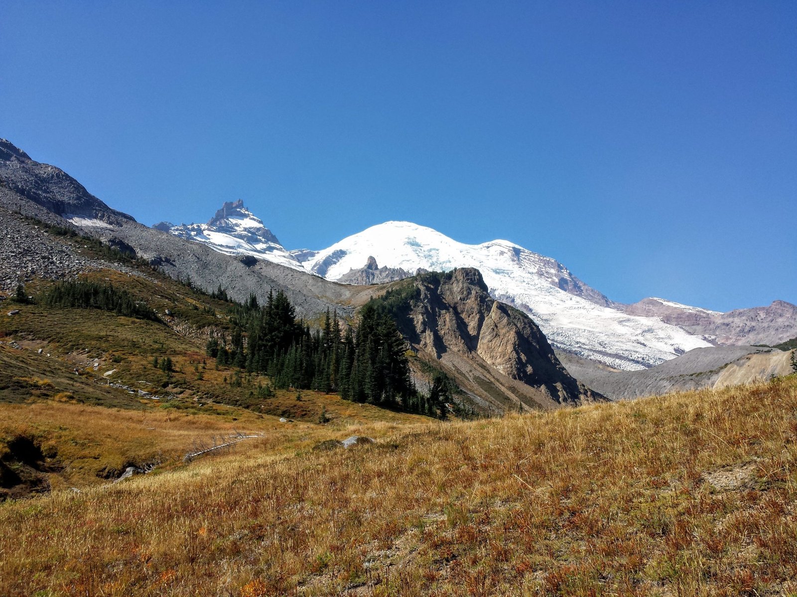
The gentlest day on the loop, and deliberately so: it eases you past Cougar Rock and along the Paradise River before the trail starts its real climbing. Forested most of the way, with your first real look at Mount Rainier’s southern glaciers as you gain elevation toward the afternoon.
Day 2: Maple Creek to Indian Bar (about 10 miles)
Highlight: Indian Bar’s stone shelter and open mountain views.
The trail crosses Nickel Creek and begins climbing in earnest toward the Cowlitz Divide. Indian Bar itself is one of the trail’s signature camps: a wide subalpine basin with a stone shelter, meadows, and a direct view up toward the mountain. Exposed to weather, so expect wind here even on a calm day lower down.
Day 3: Indian Bar to White River (about 12 miles)
Highlight: Panhandle Gap, the trail’s highest point and closest glacier views.
This is the day most hikers point to as the hardest single stretch on the loop. It climbs over Panhandle Gap, at 6,750 ft the highest point on the Wonderland Trail, where snow can persist well into July and the exposure is real: no trees, loose rock, and weather that changes fast. The payoff is the closest views of Rainier’s eastern glaciers on the whole route. After the gap, the trail drops steadily through Summerland’s meadows to the White River.
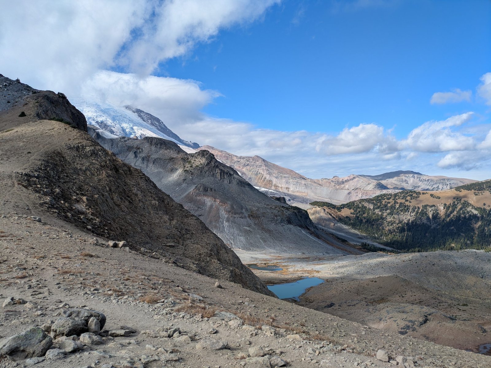
Day 4: White River to Mystic Lake (Granite Creek Camp) (about 8 miles)
Highlight: Carbon Glacier views from Mystic Lake.
A shorter day by design, climbing past the Sunrise area and over Skyscraper Pass into alpine meadow country. Mystic Lake camp sits below Mystic Peak with the Carbon Glacier visible from nearby viewpoints, one of the more photogenic camps on the loop.
Day 5: Mystic Lake to Ipsut Creek (about 13 miles, the longest day of the trip)
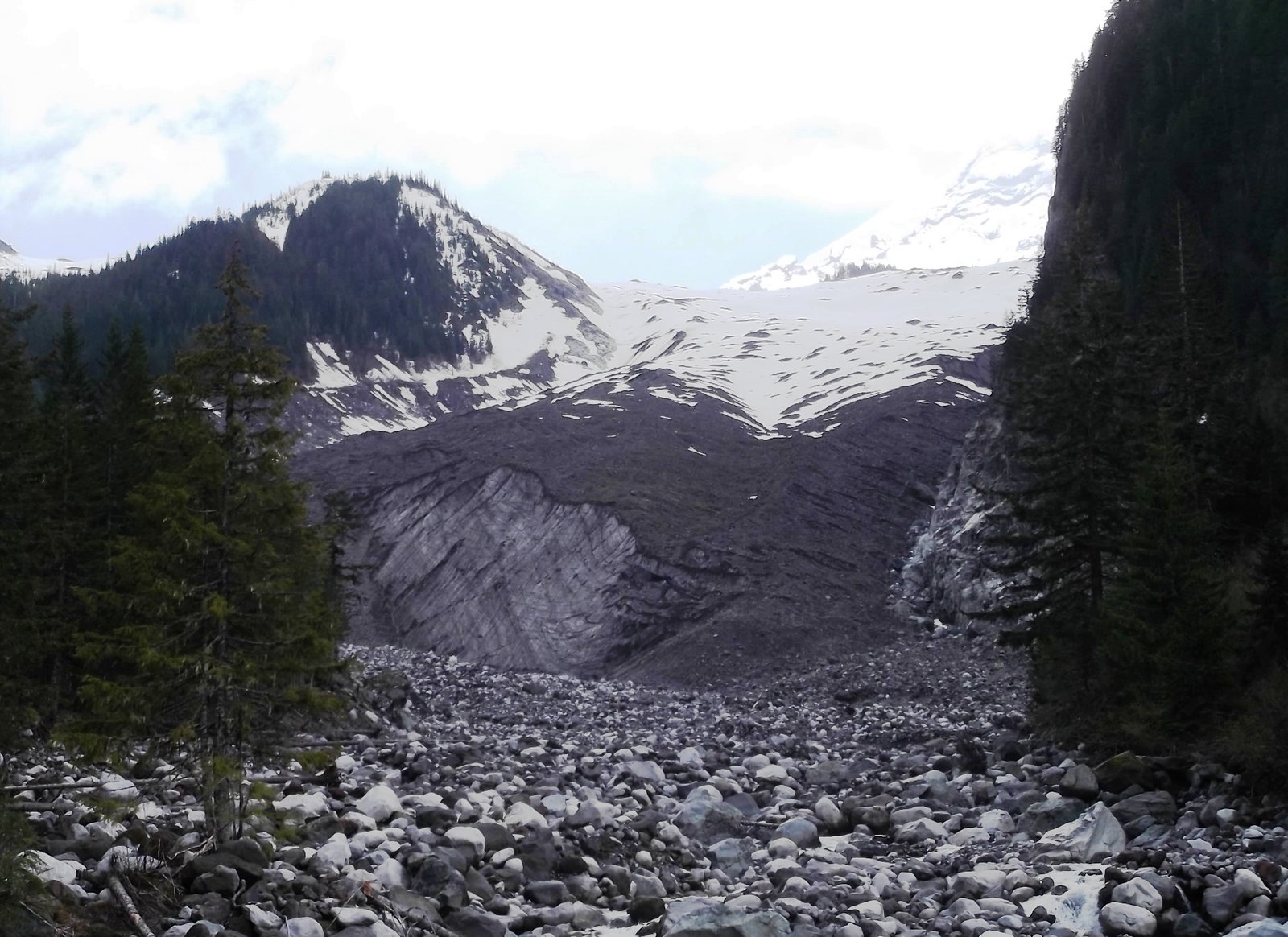
Highlight: Crossing the Carbon River at the glacier’s edge.
The trail drops to cross the Carbon River near its glacier, the lowest point on the loop and the most heavily glaciated corner of the route. Crossing points here are seasonal log bridges or engineered crossings that the park relocates as the glacier and river shift; check current conditions before you go. This is also the section most affected if you are trying to coordinate a resupply or pickup via the Carbon River road, given the Fairfax Bridge closure noted above.
Day 6: Ipsut Creek to South Mowich River (about 10 miles)
Highlight: Optional detour to Spray Park’s wildflower meadows.
Climbs back out of the Carbon River valley toward Mowich Lake, with an option to detour to Spray Park, one of the most photographed wildflower meadows on the mountain, if your itinerary and energy allow it. Drops back down to the South Mowich River to camp.
Day 7: South Mowich River to Golden Lakes (about 6 miles)
Highlight: Golden Lakes’ still-water reflections of Rainier.
The shortest day on this itinerary and a natural half-rest day after five days of big vertical. Golden Lakes camp sits in a genuinely different landscape from the rest of the loop: low, meadow-lined lakes rather than glacial river valleys, with good reflections of the mountain on a still morning.
Day 8: Golden Lakes to South Puyallup River (about 12 miles)
Highlight: Some of the largest old-growth trees on the loop.
Back into the pattern of climbing and dropping across the western side of the mountain. This section sees noticeably fewer hikers than the east side around Summerland and Indian Bar, and the forest here includes some of the largest old-growth trees on the route.
Day 9: South Puyallup River to Longmire (about 13 miles)
Highlight: Indian Henry’s Hunting Ground, one of the trail’s classic reflection shots.
The final push, climbing past Indian Henry’s Hunting Ground, a subalpine meadow with a historic patrol cabin and one of the classic reflection views of Rainier, before the long descent back to Longmire. It is a big final day after eight days of accumulated fatigue; some hikers split it into two shorter days if their permit allows.
What to Expect
Terrain: Constant elevation change is the defining feature of this trail. Expect forest, subalpine meadow, and short alpine stretches at the passes, plus multiple unbridged or seasonally-bridged crossings of glacial rivers (Nisqually, Cowlitz, White, Carbon, Mowich, Puyallup). These rivers run highest in the afternoon as the day’s snowmelt peaks, so plan crossings for morning where your itinerary allows.
Weather: Mount Rainier is large enough to generate its own weather, including a cloud cap that can sit on the summit while the surrounding valleys are clear. August offers the most reliable stretch of sun, often in the 70s°F during the day, but nights at high camps can sit near freezing even in mid-summer, and exposed passes like Panhandle Gap can turn cold, windy, and wet with little warning at any point in the season.
Wildlife: Black bears are present throughout the park (no grizzlies), along with mountain goats and marmots at higher elevations. All backcountry camps have bear wires, poles, or boxes for food storage.
Crowds: Because every camp is permit-controlled, you will rarely see more than a handful of other groups at any site. August is the busiest month and the hardest to get a permit for; September offers a quieter trail with a real chance of early snow.
Signature features: Panhandle Gap, the Carbon Glacier crossing, Indian Bar’s stone shelter, Spray Park, and Indian Henry’s Hunting Ground are the standout points most hikers remember.
Water: sources, safety, and treatment
Water is genuinely abundant on the Wonderland Trail, which is unusual for a trail this demanding, but it comes with a specific problem: the biggest rivers are direct glacial melt, and they run so silty that they can clog a standard filter within a few uses. Treat every water source on this trail; nothing here should be considered safe to drink untreated. For the silty glacial rivers, either let water settle in a container before filtering, use a dedicated pre-filter, or favour clearer side creeks and lake sources (Golden Lakes, Mystic Lake, and the smaller tributary creeks between camps) when they’re available. A water filter rated to handle high-turbidity water, or one you’re prepared to backflush often, will save you real frustration on the Carbon River and Mowich River sections in particular.
What Hikers Say About the Wonderland Trail
This section pulls together what people who have hiked the Wonderland wrote down afterwards, so the planning above is checked against real trips. The reports run from 2020 to 2026, so treat them as the trail’s character, not today’s conditions. Check the park’s current trail and bridge status before you go.
The trail itself is in good shape. A 2020 first-timer called it very well maintained, with only three fallen logs in 93 miles. A 2023 four-day hiker reported only a handful of passable blowdowns, and a 2025 hiker found fresh cuts where trees had come down. Rangers get repeated praise for helping with water, bridges and conditions. A 2024 hiker did hate one thing: a washed-out section of about 50 feet that had been rerouted, though they credited the crews for the work.
Crossings and bridges are where plans change. A ranger told the 2020 hiker not to cross where a bridge used to be, and noted that finding a safe crossing at South Mowich River or Kautz Creek can take hours. That hiker used an alternate log. In 2023 the Nickel Creek bridge had been knocked onto its side and was described as precarious; the same hiker managed all other crossings dry. In 2025 the South Mowich footbridge was the one that unnerved a hiker. Most crossings were manageable by following boot paths, flagging and cairns. Budget time and flexibility, not just fitness.
Climbing is the real price. The 2023 hiker did the loop in four days and wished for four and a half to five. A 2025 pair described days of about 14 miles and 5,000 feet of gain with 37 and 41 pound packs as exhausting. A 2024 hiker called the big days long and the Maple Creek to Indian Bar climb never-ending, but said the Indian Bar to White River stretch was perfect in clear weather.
Weather swings both ways. A 2024 September hiker had rain on several days, a battered single-wall tent on two nights and a pack made heavier by wet gear. A late-July 2026 group had light rain and chilly wind at Spray Park, then a very hot day later. A 2025 August hike had mild days, cool nights and almost no rain. Another account describes sudden thunderstorms with hail, which punished anyone with their rain jacket packed at the bottom.
Smoke and snow depend on the year. A late-July 2026 group watched smoke build on Day 6 after hearing about a nearby fire at Sunrise, and a fire reportedly closed the park shortly after they finished. In contrast, 2020 and 2025 hikers had no trouble with snow, and the 2023 hiker found only minor patches at Panhandle Gap and Spray Park that did not need traction.
Bugs vary a lot, so plan for the worst camp. A 2023 hiker found Maple Creek buggy by day but calm at night, and said bugs were milder than expected and a headnet went unused. A 2025 hiker found almost none, even at Devil’s Dream. Another account describes heavy mosquitoes at higher open terrain and used DEET in strategic spots. One hiker carried repellent and never opened it.
Camps: Indian Bar, Golden Lakes, Mystic and Summerland win. The 2020 hiker named Indian Bar, Golden Lakes and Mystic as favourites and wished they had stayed at Klapatche Park for the view. A 2026 group praised Summerland and Devil’s Dream, called North Puyallup the worst camp and Nickel Creek a letdown, and said several camps had water a ten-minute walk away. Wildlife is part of the deal: habituated deer at Sunrise, a bear near the Mowich Lake junction in 2023, and five black bear sightings for the 2026 group.
Water: mostly easy, with dry stretches. The 2023 hiker said a 1 litre capacity was enough, but Indian Bar to Nickel Creek is dry and South Puyallup was nearly dry in August. A 2025 hiker reported a long dry stretch north of South Mowich.
Permits and logistics. All three members of a 2026 group lost the lottery and still got their first-choice walk-up permits at Longmire, with about 10 parties in line by 7:30am. The 2020 hiker’s tip: if the ranger confirmation call does not come about a week out, call the park. Food caches at Longmire and Mowich Lake worked, though the Mowich one is reportedly raided at times, so pack a little spare food. Sunrise has only packaged snacks, not hot food or coffee.
What Hikers Say They Packed, Used and Wished They Had
- Rain gear within reach. The thunderstorm and hail reports all point to the same lesson: pack the jacket at the top. See best waterproof jackets.
- Bear canister: optional. The 2020 hiker carried canisters and would skip them next time to save weight, because every camp has bear poles. The park’s own rules and your itinerary decide this. See best bear canisters.
- Camp shoes and a warm hat or gloves. One mid-September hiker missed camp sandals and gloves for numb hands breaking camp, and needed a knit hat at night. See best hiking sandals.
- Trekking poles. Recommended by several hikers for knees, crossings and the long descents. See best trekking poles.
- Blister care that actually works. One 2026 hiker rated Aquaphor and lambswool far above moleskin, bandages or tape for hot spots. Another account switched to three sock pairs, with one kept dry for sleep. See best hiking socks.
- A shelter that handles rain. Single-wall tents struggled in two nights of heavy rain, while the 2023 hiker found a tarp enough in dry weather. See best lightweight tarps for camping.
- A lighter pack. Heavy packs were the main strain in 2025, and one account blames a 50 pound load for earlier blisters.
Sources (paraphrased, no text copied): Washington Trails Association trip report, August 2020; WTA report by valleyjo, August 2023; WTA report by Goforkayla, August 2025; Angry Weasel blog, September 2024; Ferdinand23 on Substack; Backpacking Light thread by AK Granola, October 2026; Where the Road Forks packing list.
Logistics
Permits are the main planning bottleneck on this trail. The park runs an early-access lottery, typically open for a few weeks in February, charging a non-refundable application fee per entry; roughly 600 of over 10,000 entries win a reservation window, putting the odds in the single digits. About a third of the season’s camp inventory is held back for walk-up permits, issued in person at a Wilderness Information Center on a rolling basis, which is the realistic path for hikers who miss the lottery and can be flexible on dates. Permit reservations carry a small per-person, per-night fee on top of the park entrance fee.
Your permit application requires a specific camp for every night of the trip, so build your itinerary before you apply, not after. Fires are prohibited at all backcountry camps (stove cooking only), and cross-country camping is not permitted anywhere on the standard loop: you camp at designated sites only.
Mandatory Gear Checklist
- Trekking poles, non-negotiable given the number of steep descents and unbridged river crossings. See best trekking poles.
- A water filter that tolerates silty glacial water, or a pre-filter to protect it. See best water filters for hiking.
- An insulated jacket for camp, even in August. Overnight temperatures at high camps sit close to freezing. See best insulated jackets for hiking.
- A genuinely waterproof rain shell, not just water-resistant. Weather at Panhandle Gap and the other high passes can turn fast. See best waterproof jackets.
- A bear canister or dry sack suitable for a bear wire. Established camps have bear poles or boxes, so a hard canister is not strictly required on the standard loop, but it is worth carrying if you plan any off-camp scrambling. See best bear canisters for multi-day hiking.
- Footwear you’ve already broken in. This is not the trail to test new boots on, given the daily elevation change. See best hiking boots.
For the full kit list built specifically for this route, item by item and why each piece earns its place, see What to Pack for the Wonderland Trail.
Honest Assessment
This trail is for experienced multi-day hikers who are comfortable navigating unbridged river crossings, managing 3,000+ ft of daily elevation change, and dealing with genuinely cold, wet, high-altitude conditions on short notice. It is not a good first backpacking trip, and it is not forgiving of underestimated fitness: the terrain does not let up the way a long flat trail does.
It is not the right choice if you want a mellow trip, if you are not prepared to plan a full year ahead around the permit lottery, or if unpredictable mountain weather at altitude is something you’d rather avoid. For a gentler introduction to multi-day hiking in the same region, a shorter Mount Rainier day-hike loop or a section of the trail (Summerland to Indian Bar and back, for instance) gives you a real taste without the full commitment.
Among hikers who have done it, the consensus is that the difficulty is real but so is the payoff: few trails put you this close to a major glaciated volcano for this many consecutive days.
Final Thoughts
Once you are sold on the route, build your kit with the full What to Pack for the Wonderland Trail guide before you apply for a permit.
The Wonderland Trail rewards the planning it demands. If you’re building toward a trip like this, start with how to plan your first multi-day hike to make sure your fitness and logistics are dialled in well before permit season opens. If you’re deciding between this and another big Western US loop, our John Muir Trail guide is the natural comparison point: similar ambition, very different terrain.
Frequently Asked Questions
How hard is it to get a Wonderland Trail permit?
Hard. The early-access lottery awards roughly 600 reservations from more than 10,000 entries, odds in the low single digits. About a third of camp inventory is held for walk-up permits issued in person, which is the realistic backup plan if the lottery doesn’t come through.
How many days do I need for the Wonderland Trail?
Most backpackers take 7 to 12 days, with 9 to 10 days being the most common pace. Very fit, minimalist hikers can do it faster; most first-timers are better served slowing down given the daily elevation change.
Do I need a bear canister on the Wonderland Trail?
Not strictly. Every designated camp has a bear pole, wire, or box for food storage, so a hard canister isn’t required on the standard loop the way it is on some Sierra Nevada trails. It’s still a reasonable extra layer of security if you’re carrying it anyway.
What is the biggest mistake first-time Wonderland Trail hikers make?
Underestimating the daily elevation change. The mileage numbers look moderate on paper, but climbing and dropping 3,000 or more feet between river valleys, day after day, is a different kind of tiring than covering similar mileage on flatter ground.
