

Last updated: August 2026
Wild Trail Hiker is reader-supported. We may earn a commission when you buy through links on this page, at no extra cost to you. We only recommend products we would consider taking on a multi-day trip ourselves.
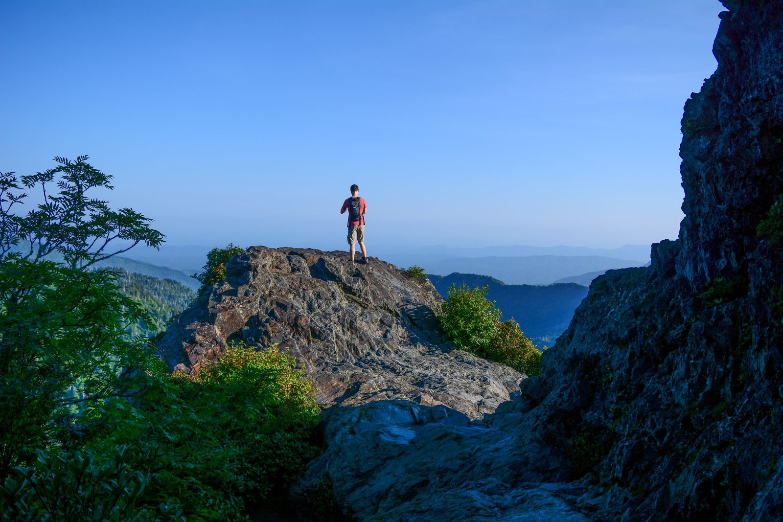
Before You Go
The Appalachian Trail runs 2,197 miles from Georgia to Maine, and almost everything written about it assumes you have five to seven months free. This guide does not. It covers three of the best Appalachian Trail sections you can hike in a long weekend or, in one case, a genuine week off work, no thru-hiker permit and no resignation letter required. Permit rules differ sharply by section, from a free self-issue slip to a paid reservation system, so check the specifics for whichever one you pick before you drive there. Two of the three sections cross bear country with mandatory food storage rules, covered in Logistics below.
Why This Trail
Section-hiking the AT gets you the trail’s character in doses that fit an actual calendar. Unlike a lot of Western trails built around one sustained wilderness experience (see our John Muir Trail guide for a contrast), the AT is really a long string of very different landscapes stitched together, so picking the right section matters more than it does on a single alpine loop.
This guide covers three sections chosen to show three genuinely different sides of the trail, and deliberately skips the White Mountains of New Hampshire, since our Presidential Traverse guide already covers that ground in depth. Instead: the high, grassy balds and wild ponies of Grayson Highlands in southwest Virginia, the relentless ridgeline of Great Smoky Mountains National Park on the Tennessee-North Carolina line, and the trail’s remote, roadless finale through Maine’s 100-Mile Wilderness to the summit of Katahdin. Among experienced AT section hikers, these three come up again and again as the sections worth planning a trip around specifically, rather than sections you simply pass through on the way to somewhere else.
Trail at a Glance
| Section | Location | Distance | Duration | Difficulty | Best season |
|---|---|---|---|---|---|
| Grayson Highlands / Mount Rogers Loop | Southwest Virginia | ~21.5 miles, loop | 2 to 3 days | Moderate | May to October |
| Newfound Gap to Davenport Gap | Great Smoky Mountains NP, TN/NC | ~31 miles, point-to-point | 3 to 4 days | Moderate to hard | April to June, September to October |
| 100-Mile Wilderness to Katahdin | Maine | ~114 miles, point-to-point | 7 to 9 days | Hard | Mid-June to early October |
Trailheads:
- Grayson Highlands: Start and finish at Massie Gap, Grayson Highlands State Park on Google Maps (loop, same trailhead both ends)
- Smokies: Start at Newfound Gap on Google Maps, finish at Davenport Gap Trailhead, verified coordinates 35.77055, -83.11114 on Google Maps
- 100-Mile Wilderness: Start at Monson Appalachian Trail Visitor Center, Monson, Maine on Google Maps, finish at Katahdin Stream Campground, Baxter State Park on Google Maps (plus the Katahdin summit spur from there)
Permits: Grayson Highlands requires a reserved overnight backpacker parking spot at the state park (no separate backcountry permit once you are on Forest Service land); the Smokies section requires an advance backcountry permit through Recreation.gov; the 100-Mile Wilderness itself needs no permit, but the final approach to and summit of Katahdin inside Baxter State Park requires a reserved parking pass and, for thru- and long-distance hikers, a free in-person Long-Distance Hiker Permit. Full detail in Logistics below.
Trail Map
Appalachian Trail Conservancy trail maps and section guides covers the full 2,197-mile corridor and links out to official section maps.
- Grayson Highlands: Mount Rogers and Appalachian Trail Loop on AllTrails
- Smokies: Appalachian Trail: Newfound Gap to Davenport Gap on AllTrails
- 100-Mile Wilderness: Appalachian Trail: 100 Mile Wilderness on AllTrails and the Maine Appalachian Trail Club official 100-Mile Wilderness map bundle (paid digital maps, the standard reference for this section)
Getting There and Away
Grayson Highlands (Virginia): The nearest airports are Tri-Cities (TRI), about 1.5 hours away, or Roanoke (ROA), about 2 hours. Damascus and Marion are the closest staging towns, both with outfitters that also run shuttles. Because this is a loop starting and finishing at Massie Gap, you only need one vehicle; reserve the overnight backpacker parking lot in advance at reservevaparks.com, since it fills on weekends. If full, alternate parking is available at Elk Garden or Fox Creek, both a short walk onto the loop.
Great Smoky Mountains (Tennessee/North Carolina): McGhee Tyson Airport (TYS) in Knoxville is the practical air hub, about 45 minutes to Gatlinburg. This is a point-to-point hike, so you need a shuttle or two vehicles. NOC (Nantahala Outdoor Center) and A Walk in the Woods both run scheduled shuttles from Gatlinburg to Newfound Gap for a fee. The Davenport Gap end is reached via Waterville Road on the park’s eastern boundary, near Cosby, Tennessee; park a second vehicle at the Waterville School Road parking area or arrange a pickup there. Gatlinburg is the obvious staging town; Cherokee, North Carolina is a quieter alternative on the south side.
100-Mile Wilderness and Katahdin (Maine): Bangor International Airport (BGR) is the main air hub, roughly 1.5 to 2 hours’ drive to Monson via ME-15 through Guilford. Monson is the essential staging town: last real resupply and lodging before the wilderness, plus the Appalachian Trail Conservancy’s own Monson Visitor Center (open late May through mid-October) for current trail conditions. This is a one-way hike finishing deep inside Baxter State Park, so plan a shuttle: several Maine-based outfitters run scheduled or on-demand shuttles between Monson, Abol Bridge, and the Togue Pond Gate area near Millinocket, the natural post-trail recovery town, about 45 minutes from Katahdin Stream Campground.
Day-by-Day Breakdown
Grayson Highlands / Mount Rogers Loop (~21.5 miles, 2 to 3 days)
Day 1: Massie Gap to Wilburn Ridge and Thomas Knob (about 7 to 8 miles). From the Massie Gap parking area, the trail climbs quickly onto Wilburn Ridge, open grassy highland with rock outcrops and, most likely, a look at the park’s wild pony herd grazing the balds. The ponies were introduced in 1974 specifically to keep the highland balds from reforesting, and they wander freely; admire them from a distance and never feed them, they bite and kick when they feel crowded. The trail continues past Rhododendron Gap toward Thomas Knob Shelter, a reasonable first night’s camp with a side trail to the summit of Mount Rogers close by.
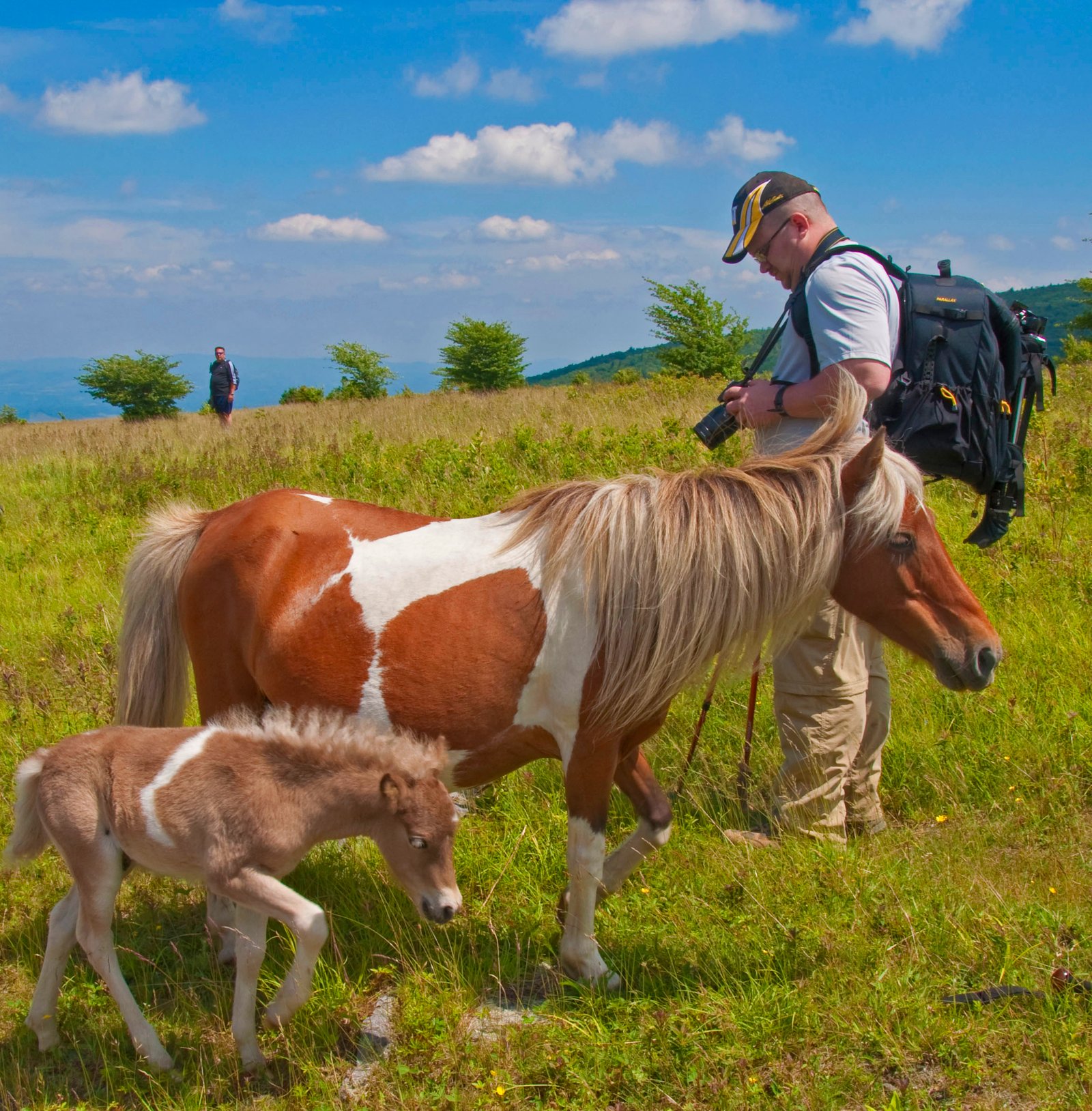
Day 2: Thomas Knob and Mount Rogers summit, onward to the Lewis Fork Wilderness loop leg (about 8 to 9 miles). A short spur climbs to the wooded, viewless summit of Mount Rogers, Virginia’s highest point at 5,729 feet; most hikers are more impressed by the open balds they just walked through than the summit itself. The loop then swings back south through Lewis Fork Wilderness, quieter and more forested than the highland balds of day one, a real contrast within a short distance.
Day 3: Back to Massie Gap (about 5 to 6 miles). A shorter final push back across the open highland to the trailhead, with another likely pony sighting on the way out. Fit hikers with an early start can compress this into a two-day trip by combining days two and three.
Great Smoky Mountains: Newfound Gap to Davenport Gap (~31 miles, 3 to 4 days)
Day 1: Newfound Gap to Icewater Spring Shelter and Charlies Bunion (about 5 to 6 miles). The trail leaves the crowds at the Newfound Gap parking lot behind within the first mile and climbs along the state-line ridge. Charlies Bunion, a rocky, exposed outcrop about 4.4 miles in, delivers one of the best views in the Smokies for very little extra effort, a short side scramble off the main trail. Icewater Spring Shelter, just before the Bunion, is a natural first-night stop.
Day 2: Icewater Spring to Tricorner Knob (about 11 to 12 miles). The longest day of the section, following the high ridge past Pecks Corner Shelter and through classic Smokies spruce-fir forest. Expect steady climbs and descents rather than one sustained grade, this section has a reputation for punishing climbs and drops that add up more than the mileage alone suggests.
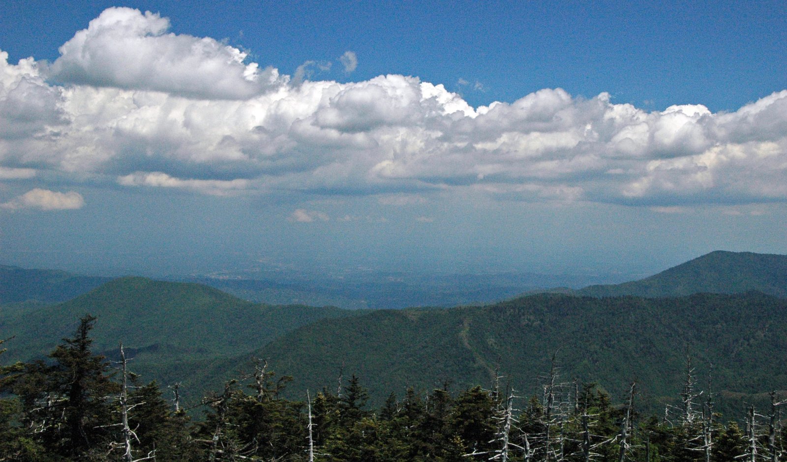
Day 3: Tricorner Knob to Cosby Knob, with the Mount Cammerer fire tower detour (about 7 to 8 miles). A worthwhile side trip climbs to the restored 1937 stone fire tower atop Mount Cammerer, one of the best 360-degree views on the entire Appalachian Trail and a strong argument for building slack into this day’s schedule rather than rushing past it.
Day 4: Cosby Knob to Davenport Gap (about 5 to 6 miles). A steady descent off the ridge to the park boundary at Davenport Gap and your second vehicle or shuttle pickup. An easier final day after three days on the high ridge.
100-Mile Wilderness to Katahdin (~114 miles, 7 to 9 days)
Days 1 to 2: Monson to Wilson Valley / Long Pond Stream area (about 30 miles). From the AT trailhead outside Monson, the trail settles into the character that defines this whole section: dense forest, frequent stream crossings, and no road access for a very long way. Long Pond Stream and its falls are a strong early highlight. Load up fully in Monson; there is genuinely nowhere substantial to buy food again until near the very end.
Days 3 to 4: Wilson Valley to the Chairback and White Cap ranges (about 25 to 30 miles). The trail’s most demanding terrain inside the wilderness, a string of steep, rocky climbs over the Chairback Range and then White Cap Mountain, the last real elevation before Katahdin comes into view for the first time from White Cap’s summit, a genuinely emotional moment for northbound thru-hikers and section hikers alike.
Days 5 to 6: White Cap descent to the Rainbow Lake and Nahmakanta Lake corridor (about 25 miles). A gentler stretch through lake country, with Cooper Brook Falls Lean-to widely regarded as the best swimming hole on the AT. The optional side trip to White House Landing, a reservation-only wilderness lodge reached by a signed spur and a call for a canoe pickup, is a popular resupply stop around the midpoint.
Days 7 to 8: Rainbow Ledges to Abol Bridge and into Baxter State Park (about 25 to 30 miles). The trail crosses Rainbow Ledges with the first sustained views of Katahdin’s full bulk, then descends to Abol Bridge on the Golden Road, the boundary of the 100-Mile Wilderness proper and a small store with limited resupply (not a substitute for stocking up in Monson). From here the trail continues into Baxter State Park itself to Katahdin Stream Campground, where reserved camping or a Long-Distance Hiker Permit is required.
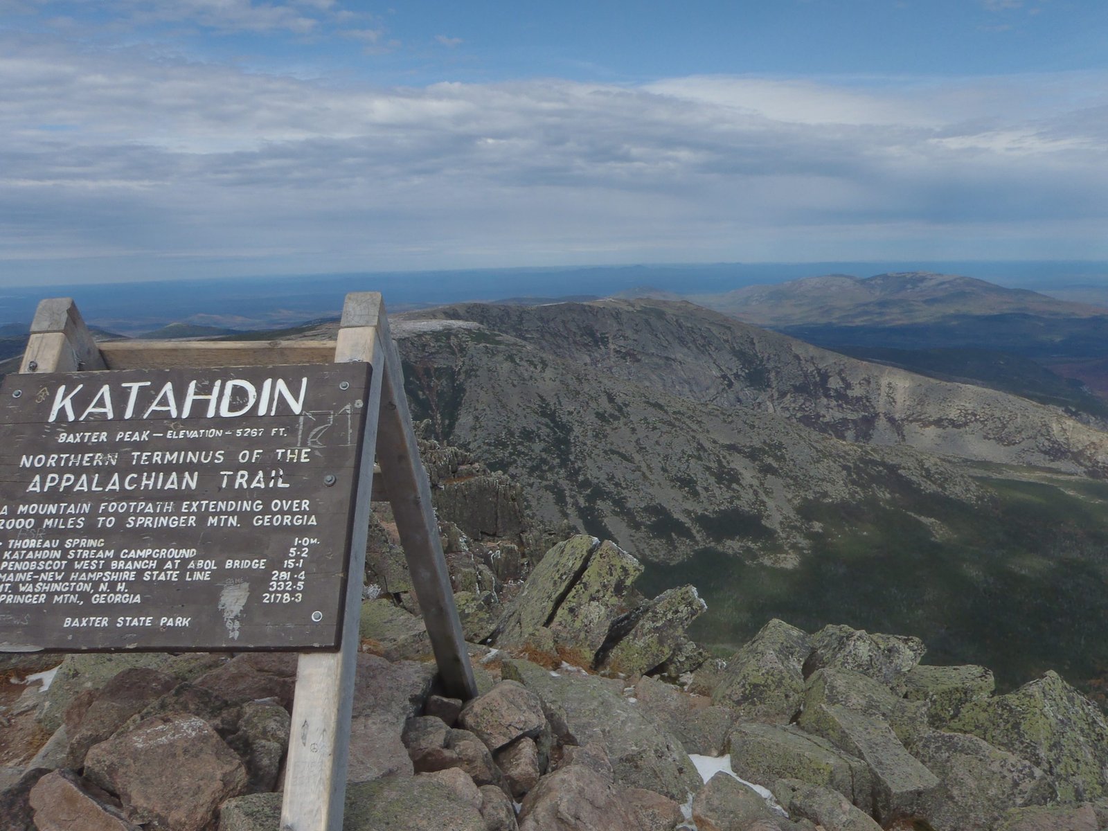
Day 9: Katahdin Stream Campground to Baxter Peak and back (about 10 miles round trip). The summit day, via the Hunt Trail, gains roughly 4,000 feet over 5.2 miles one way, including a genuinely difficult boulder scramble above treeline with rebar handholds bolted into the rock. Weather on Katahdin turns fast and the trail closes above treeline in poor conditions, so build a weather buffer day into the schedule rather than treating this as a fixed appointment.
What to Expect
Terrain: Grayson Highlands is open, rolling highland with rock outcrops, easy underfoot compared to the other two. The Smokies section is classic AT ridge walking, well graded but relentless, with frequent short, steep pitches. The 100-Mile Wilderness ranges from easy lakeside walking to genuinely rugged climbs over the Chairback and White Cap ranges, and the Katahdin summit day is the hardest single day of any of the three sections, with real scrambling above treeline.
Weather: Grayson Highlands’ open balds mean real wind exposure and fast-changing weather even in summer; a clear morning can turn to fog and cold within an hour. The Smokies swing from warm, humid valleys to genuinely cold, wet ridgeline weather, and afternoon thunderstorms are common in summer. Maine’s 100-Mile Wilderness has a short reliable season: black flies make late May and early June miserable, and the first snow is a real possibility by early-to-mid October, especially at Katahdin’s elevation.
Wildlife: Black bears are present in meaningful numbers on all three sections; mandatory food storage rules apply in the Smokies and are strongly recommended throughout Maine. Grayson Highlands’ wild pony herd is the section’s signature wildlife encounter, generally low-risk but not tame. Moose are a real possibility in the 100-Mile Wilderness, especially near ponds at dawn or dusk.
Crowds: Grayson Highlands is popular on weekends, particularly for the pony sightings, quieter on weekdays. The Smokies section sees moderate traffic, heavier near Newfound Gap and Charlies Bunion where day hikers overlap with backpackers, thinning noticeably further from the road. The 100-Mile Wilderness is genuinely remote outside of thru-hiker season (roughly July through September, when northbound thru-hikers pass through in a wave); expect real solitude on many stretches.
Signature features: Wild ponies and open balds in Grayson Highlands; Charlies Bunion and the Mount Cammerer fire tower in the Smokies; Cooper Brook Falls, the first Katahdin views from Rainbow Ledges, and the Baxter Peak summit itself in Maine.
Water: sources, safety, and treatment
Availability differs a lot by section, and it is worth planning around specifically rather than assuming.
Grayson Highlands’ open balds have thinner water than the surrounding forest; reliable sources cluster near Old Orchard Shelter and Thomas Knob Shelter, so plan your camps around them rather than assuming a stream will appear when you need one. The Smokies section is genuinely water-rich, with springs at or near every shelter along the route, though quality varies with recent rainfall and nearby wildlife activity. The 100-Mile Wilderness has abundant water for most of its length, streams, ponds, and lakes at frequent intervals, with the main exceptions being the ridge stretches over the Chairback and White Cap ranges, where you should top up before climbing.
None of these sources should be treated as safe to drink untreated. Beaver activity is common along Maine’s ponds and slow streams and is a specific giardia risk worth knowing about; the Smokies’ heavier human and wildlife traffic near shelters raises contamination risk close to camps. A water filter rated for variable water quality, and one you have actually used before you rely on it in the field, is standard kit on all three sections.
Logistics
Grayson Highlands: Reserve the overnight backpacker parking lot in advance at reservevaparks.com; it is the main constraint, not a formal backcountry permit. Once you cross onto Jefferson National Forest land outside the state park boundary, no separate wilderness permit is required, and dispersed camping is allowed (backcountry camping is prohibited inside the state park itself, so plan your first camp accordingly).
Great Smoky Mountains: As of April 30, 2026, backcountry permits for the Smokies are booked through Recreation.gov rather than the park’s previous in-house system, with a $6 non-refundable reservation fee plus the standing $8 per person, per night camping fee. Permits are shelter- and site-specific: you can book up to one month before the first night of your trip, not further out, so plan your exact itinerary before you try to reserve. A separate parking tag is required to leave a vehicle at any trailhead, and dogs are not permitted in the backcountry. This system changed only months before this guide was written; confirm it is stable before you rely on it, since new government reservation systems sometimes see early hiccups.
100-Mile Wilderness and Katahdin: No permit is required to walk the 100-Mile Wilderness itself. Baxter State Park is a different matter: a $10 day-use parking reservation is required for the Katahdin trailhead lots, and campsite space at Katahdin Stream Campground should be booked ahead where possible. Northbound thru- and long-distance section hikers who have walked at least 100 continuous miles can use “The Birches,” a first-come lean-to area held back for exactly this purpose. All AT hikers summiting Katahdin need a free Long-Distance Hiker Permit, obtained in person at the Katahdin Stream Campground ranger station up to seven days ahead of your summit attempt, not bookable remotely.
Mandatory Gear Checklist
- Broken-in hiking boots or trail runners with good grip. The Smokies’ rocky, root-woven tread and the boulder scramble on Katahdin’s Hunt Trail both punish weak ankles and worn-out soles. See best hiking boots.
- A reliable water filter, given the variable water quality across all three sections and the beaver-related giardia risk in Maine specifically. See best water filters for hiking.
- An insulated jacket, genuinely necessary on the exposed balds of Grayson Highlands, the Smokies ridgeline, and especially the Katahdin summit day, where conditions can be dramatically colder and windier than the trailhead. See best insulated jackets for hiking.
- A genuinely waterproof rain shell. The Southern Appalachians and Maine both see fast-arriving rain regardless of forecast; the AT’s nickname among some hikers, “the green tunnel,” is partly a reference to how much of it is walked in wet, humid forest. See best waterproof jackets.
- Trekking poles, useful on all three sections but especially the sustained descents in the Smokies and the approach to the Hunt Trail’s boulder field. See best trekking poles.
- Bear-resistant food storage. Mandatory in the Smokies (use the provided cables at every shelter) and strongly recommended throughout the 100-Mile Wilderness, where cables are less consistently available. See best bear canisters for multi-day hiking if you would rather carry your own than rely on shelter infrastructure.
- Insect protection for the Maine section specifically. Black flies in late May and June are a real quality-of-life issue in the 100-Mile Wilderness; a head net and repellent are not optional gear in that window. See best bug nets for camping.
For the full kit list, including how food storage rules change between the three sections and what actually earns its place on a nine-day Maine carry, see what to pack for the best Appalachian Trail sections.
Honest Assessment
These three sections suit a reasonably fit multi-day hiker who wants the Appalachian Trail’s real character without the five-to-seven-month commitment of a thru-hike, and who is comfortable with the very different logistics each one demands, a simple loop hike in Virginia, a shuttle-dependent ridge walk in the Smokies, and a genuinely remote week-plus expedition in Maine.
They do not suit hikers looking for one uniform difficulty across all three, or anyone assuming the 100-Mile Wilderness fits into a long weekend the way the other two do; it is a full backcountry expedition with real resupply constraints. For a shorter first taste of the AT, Grayson Highlands is the clear starting point.
Among experienced AT section hikers, all three consistently rank among the sections worth building a dedicated trip around, precisely because each one shows a genuinely different face of a trail that changes character constantly along its length.
Final Thoughts
The Appalachian Trail rewards hikers who treat it as a series of distinct trips rather than one long, uniform slog. Start with how to plan your first multi-day hike if you are still building toward a trip like one of these, or multi-day hiking skills for water treatment and navigation basics before you go. If you want the White Mountains’ answer to the Smokies’ ridge walking, our Presidential Traverse guide covers New Hampshire’s stretch of the trail in full. For a comparable big Western multi-day trip, see our Pacific Crest Trail best sections guide, or our John Muir Trail guide for a longer single-corridor alternative.
Frequently Asked Questions
Do I need a thru-hiker permit for any of these three sections?
No. Thru-hiker registration through the Appalachian Trail Conservancy is voluntary and aimed at hikers walking the trail’s full length or very long stretches of it. Each of these three sections uses its own local permit or reservation system instead, covered in the Logistics section above.
Which of these three sections is best for a first multi-day trip?
Grayson Highlands. It is a single-car loop with no shuttle logistics, moderate terrain, and one of the AT’s most memorable, low-effort payoffs in the wild pony herd on the open balds. The Smokies section is a reasonable step up once you have one multi-day trip behind you; the 100-Mile Wilderness is best saved for after you have at least one week-long trip under your belt.
Can I hike just part of the 100-Mile Wilderness instead of the whole thing?
Mid-wilderness road access is genuinely limited, which is the point of the section’s name. Realistic shorter options mean treating it as its own dedicated trip rather than trying to sample a piece of it the way you might with a shorter, road-accessible section elsewhere on the trail.
Is the Katahdin summit day dangerous?
It demands real care rather than technical climbing skill: the Hunt Trail’s boulder scramble above treeline has bolted rebar handholds for a reason, and weather on Katahdin changes fast enough that the park closes the trail above treeline in poor conditions. Build a weather buffer day into your schedule and check conditions at the ranger station before you start.
Do I need bear canisters on all three sections?
The Smokies require food storage on the cables provided at every shelter, not a personal canister. The 100-Mile Wilderness has fewer consistent cable systems, so a bear canister or a well-executed bear hang is a sensible precaution. Grayson Highlands sees lower bear pressure than the other two, though standard food storage practice still applies.
