

Last updated: August 2026
Before You Go
The Pacific Crest Trail runs 2,650 miles from the Mexican border to the Canadian border, and most of what gets written about it is aimed at the roughly five-month thru-hike. This guide is not that. It covers the best Pacific Crest Trail sections you can hike in three to four days each, no permit lottery and no six-month leave of absence required. Permit rules differ by section, from a free self-issue slip at the trailhead to an advance reservation system, so check the specifics for whichever section you pick before you drive there. Wildfire closures are a real possibility on the PCT in any given season, more so in Southern California and Oregon in late summer, so verify current trail status close to your date.
Why This Trail
Section-hiking the PCT gets you the trail’s real character without the thru-hike commitment. It is the difference between reading a whole novel and reading three of its best chapters: you still get the writing, just not the six months.
This guide covers three sections chosen deliberately outside California’s High Sierra, since that stretch (Yosemite to Mount Whitney) is largely the same corridor as the John Muir Trail, and our John Muir Trail guide already covers it in depth. Instead, these three sections spread across all three PCT states and show three genuinely different sides of the trail: high desert giving way to alpine forest in Southern California’s San Jacinto Wilderness, volcanic Cascades scenery in Oregon’s Three Sisters Wilderness, and the single most photographed ridgeline on the entire PCT in Washington’s Goat Rocks Wilderness. Among experienced PCT section hikers, these three come up again and again as the best return on a long weekend or a short week off work.
Trail at a Glance
| Section | Location | Distance | Duration | Difficulty | Best season |
|---|---|---|---|---|---|
| San Jacinto Wilderness | Southern California | ~20 miles, point-to-point | 3 days / 2 nights | Moderate to hard | Late spring to fall |
| Three Sisters Wilderness | Central Oregon | ~19 miles, point-to-point | 3 days / 2 nights | Moderate | Mid-July to mid-October |
| Goat Rocks Wilderness | Washington | ~27 miles, point-to-point | 4 days / 3 nights | Moderate to hard | Mid-July to September |
Trailheads (all point-to-point, car shuttle or two vehicles required):
- San Jacinto: Start at Humber Park (Devil’s Slide Trailhead), Idyllwild on Google Maps, finish at Fuller Ridge Trailhead on Google Maps
- Three Sisters: Start at Dee Wright Observatory, McKenzie Pass on Google Maps ⚑ confirm this is the correct PCT parking area before publishing, see Notes, finish at Pacific Crest Trailhead, Santiam Pass on Google Maps
- Goat Rocks: Start at White Pass PCT North Trailhead on Google Maps, finish at Tipsoo Lake, Chinook Pass on Google Maps
Permits: San Jacinto Wilderness requires a free self-issue permit (federal) or a $5 permit (state side); Three Sisters requires an advance Central Cascades Wilderness Permit through Recreation.gov; Goat Rocks requires only a free self-issue permit at the trailhead with no quota. Full detail in Logistics below.
Trail Map
Pacific Crest Trail overview map (PCTA, official) covers the full 2,650-mile corridor and links out to detailed section maps.
- San Jacinto: San Jacinto Peak via Fuller Ridge Trail on AllTrails
- Three Sisters: PCT: McKenzie Pass to Santiam Pass on AllTrails
- Goat Rocks: PCT: White Pass to Chinook Pass on AllTrails
Getting There and Away
San Jacinto Wilderness (Southern California): The nearest airport is Palm Springs International (PSP), about an hour’s drive from Idyllwild via Highway 74 (the Palms to Pines Scenic Byway) through Mountain Center. From Los Angeles, it is roughly 120 miles: take I-10 east to Banning, then Highway 243 south, 25 miles of switchbacks gaining about 4,000 feet into Idyllwild. Park at Humber Park for the start. The finish at Fuller Ridge Trailhead is a different story: it sits at the end of Black Mountain Road, a rough forest road requiring 4WD or high clearance, roughly eight miles off Highway 243 south of Idyllwild, and it is typically closed by snow from November through May. This is a genuine two-car or shuttle-arranged hike; there is no public transport option. Stage the night before in Idyllwild, which has motels and cabins.
Three Sisters Wilderness (Central Oregon): The nearest commercial airport is Redmond’s Roberts Field (RDM), about 45 minutes from Sisters, Oregon, which is itself the natural staging town. Both trailheads sit on the McKenzie Pass–Santiam Pass Scenic Byway. Santiam Pass, on Highway 20, is open year-round and easy to reach. McKenzie Pass, on Highway 242, is seasonal, typically opening the third Monday in June and closing with the first significant snow, so the western trailhead is only reachable roughly June through October or November. Portland (PDX) is the major air hub if you are flying in from further afield, about a 3-hour drive to Sisters. This is another two-car or shuttle hike; Sisters has a small network of local shuttle operators worth checking closer to your date, but nothing scheduled and reliable enough to name here with confidence.
Goat Rocks Wilderness (Washington): White Pass sits on US-12, open year-round (an occasional winter closure aside), reached from Yakima to the east (about an hour) or from Packwood and the I-5 corridor to the west. Chinook Pass, on SR-410, is seasonal and typically closed by snow from around November through May or June, so this section is only walkable end-to-end within that same rough window most other high-Cascade trails share. Seattle-Tacoma International (SEA) is the practical air hub, roughly 2.5 to 3 hours’ drive to White Pass via Highway 12. Packwood is the closest staging town with lodging; Yakima is a reasonable alternative on the east side. As with the other two sections, plan for two vehicles or a private shuttle, since there is no scheduled public transport linking the two passes.
Day-by-Day Breakdown
San Jacinto Wilderness: Humber Park to Fuller Ridge (~20 miles, 3 days)
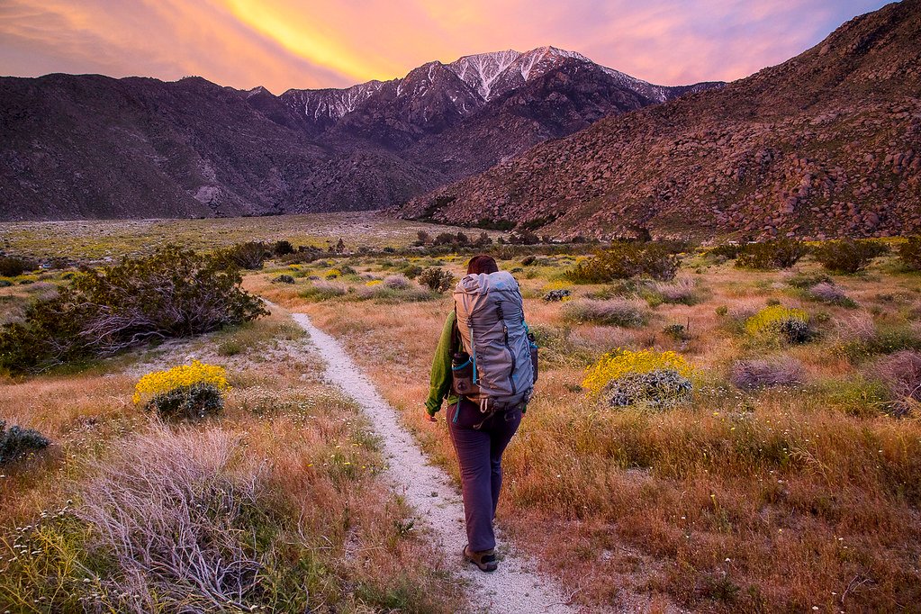
Day 1: Humber Park to Wellman Divide (about 8 miles). From Humber Park (6,500 feet) the Devil’s Slide Trail climbs steadily to Saddle Junction, meeting the PCT itself. The trail continues up through pine and fir forest toward Wellman Divide, gaining roughly 2,700 feet over the day. Camp near the divide, with views back down toward the desert floor.
Day 2: Wellman Divide to Fuller Ridge, with a San Jacinto Peak side trip (about 7 miles plus the peak spur). Bring for this stretch: extra water. This run can be dry by late summer with no reliable refill before the trailhead, so top up before you leave Wellman Divide. Most hikers detour up the spur trail to San Jacinto Peak (10,834 feet), the high point of the whole wilderness and, on a clear day, a view stretching from the Salton Sea to the San Bernardino Mountains. Back on the PCT, the trail drops onto Fuller Ridge, a narrow, timbered ridgeline with the desert falling away sharply to the north. This is genuinely exposed terrain in wind or storm; check forecasts before committing to camp up here, and keep your insulated layer and wind shell within reach on the ridge itself.
Day 3: Fuller Ridge to Fuller Ridge Trailhead (about 5 miles). A steady descent off the ridge to the trailhead and your shuttle vehicle. Short day, easy pace, good for a mid-morning finish.
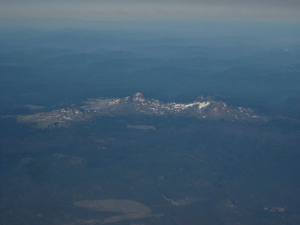
Three Sisters Wilderness: McKenzie Pass to Santiam Pass (~19 miles, 3 days)
Day 1: McKenzie Pass to Obsidian area approach (about 7 miles). The trail leaves the black lava fields around Dee Wright Observatory and climbs into forest and open meadow with the North and Middle Sister volcanoes dominating the skyline. Camp short of the Obsidian Limited Entry Area if you do not hold a permit for it (see Logistics; you can walk through without stopping to camp).
Day 2: Through the Obsidian area to Minnie Scott Spring / Rockpile Lake area (about 7 miles). This is the scenic core of the section: black obsidian glass fields, wildflower meadows fed by snowmelt, and close-up views of Middle Sister and Collier Glacier. Water is generally reliable here in mid-summer from named creeks and springs, less so by late September.
Day 3: To Santiam Pass Trailhead (about 5 miles). The trail eases down through forest to the highway, a gentler final day than the two before it.
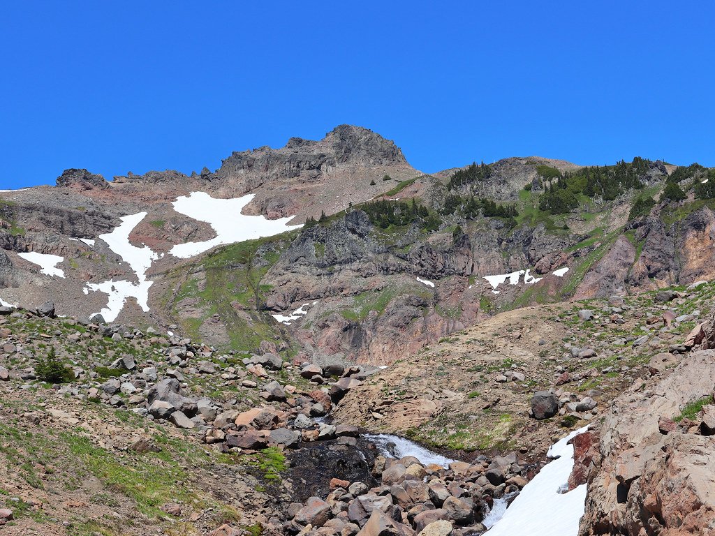
Goat Rocks Wilderness: White Pass to Chinook Pass (~27 miles, 4 days)
Day 1: White Pass to Sand Lake area (about 7 miles). A gradual climb from the highway through subalpine forest and past a string of small lakes, a gentle introduction before the terrain opens up.
Day 2: Sand Lake area to Cispus Basin (about 7 miles). The trail climbs into more open, rocky terrain with Mount Adams increasingly visible to the south. Cispus Basin is a popular, exposed camp with views toward Old Snowy Mountain, tomorrow’s centrepiece.
Day 3: Cispus Basin to Sheep Lake area via the Knife’s Edge (about 7 miles). Bring for this stretch: your wind shell and insulated layer, on your body or immediately accessible, and top up water before you start, there is none on the traverse itself. The reason most hikers do this section. The trail climbs to around 7,000 feet at the base of Old Snowy, then follows the Knife’s Edge, a narrow, scree-flanked ridge with drop-offs on both sides and close to a mile of completely exposed walking with no shelter from weather. Fit hikers with a head for exposure find it exhilarating rather than frightening, but this is not the day to be up there in a thunderstorm or high wind. South to north is the recommended direction, since the views open up progressively rather than hiking into them backwards.
Day 4: Sheep Lake area to Chinook Pass (about 6 miles). A comparatively easy final day dropping toward Tipsoo Lake and the Chinook Pass trailhead, with Mount Rainier increasingly dominant ahead of you.
What to Expect
Terrain: All three sections are well-graded, well-maintained trail built for stock and pack animals as much as hikers, so there is no scrambling in the conventional sense. The exception is the short scree traverse on Old Snowy’s shoulder in Goat Rocks and the exposed ridge walking on the Knife’s Edge itself, both of which demand sure footing and good conditions rather than technical skill.
Weather: San Jacinto swings from desert heat at the lower trailheads to genuinely cold, exposed conditions on Fuller Ridge; afternoon thunderstorms are a summer risk. Three Sisters sits at moderate elevation with a shorter snow-free window (roughly mid-July to mid-October at higher points) and can see sudden weather changes near the peaks. Goat Rocks is the most exposed of the three: the Knife’s Edge has no shelter for close to a mile in either direction, and Cascade weather can turn quickly even in August.
Wildlife: Mule deer and black bears across all three areas; mountain goats are a genuine possibility in Goat Rocks, which takes its name from them. Rattlesnakes are a lower-elevation risk on the San Jacinto approach.
Crowds: All three are popular, well-known sections, busiest on summer weekends. Goat Rocks in particular has a strong reputation among Washington hikers and fills up fast on clear-weather weekends; weekday starts are noticeably quieter on all three.
Signature features: San Jacinto Peak and the desert-to-alpine transition on Fuller Ridge; the Obsidian fields and volcano views in Three Sisters; the Knife’s Edge and Old Snowy in Goat Rocks.
Water: sources, safety, and treatment
Water availability differs meaningfully by section and by month, and it is worth planning around specifically rather than assuming.
In the San Jacinto section, reliable water is thinner than the other two: Saddle Junction and the Idyllwild side have seasonal sources, but the stretch from Wellman Divide across Fuller Ridge can run dry by late summer, so carry enough to cover a long, exposed dry stretch and check a current water report before you go. In Three Sisters, snowmelt creeks and named springs (Minnie Scott Spring among them) are generally reliable through mid-summer but thin out by late September; the volcanic, porous ground here means some drainages that look promising on a map simply are not there on the ground. Goat Rocks is the most water-rich of the three, with creeks off Old Snowy and around Cispus Basin generally dependable through the season, though the Knife’s Edge traverse itself has none, so fill up before you start it.
None of these sources should be treated as safe to drink untreated. A filter rated for variable water quality (glacial silt in Goat Rocks, sediment after rain anywhere) is the practical standard; a water filter you trust and know how to use in the field is not optional gear on any of these three sections.
Logistics
San Jacinto Wilderness: Self-issue wilderness permits are free through the San Bernardino National Forest for the federal portion of the wilderness, or $5 through Mt. San Jacinto State Park for the state portion; pick up whichever applies to where you plan to camp, available at ranger stations and trailhead permit boards. Day-hike quotas apply on the busiest approach trails; overnight backpackers generally are not turned away but should check current rules before relying on that.
Three Sisters Wilderness: This section falls inside the Central Cascades Wilderness Permit area, covering Three Sisters, Mount Jefferson, and Mount Washington. Overnight permits must be reserved in advance through Recreation.gov for the June 15 to October 15 season: about 40 percent of each day’s permits release on a fixed date in early April, with the remainder released on a rolling seven-day basis. There is a $6 processing fee per group for overnight permits. The Obsidian Limited Entry Area within this section has its own separate, additional permit if you want to camp inside it; without one you can walk through but not stop overnight there. ⚑ Reservation dates shift slightly year to year, confirm the current season’s release date on the Deschutes/Willamette National Forest site before planning around it.
Goat Rocks Wilderness: No advance reservation and no quota. A free, self-issue permit is available at the trailhead. This is the simplest of the three to plan around from a permit standpoint, though the popularity of the Knife’s Edge means weekend parking at both trailheads fills early.
None of these three sections require the PCT Long-Distance Permit, which only applies to trips of 500 continuous miles or more.
Mandatory Gear Checklist
- Trekking poles. All three sections carry sustained elevation change, and the scree on Old Snowy’s shoulder and the Fuller Ridge descent both reward the extra stability. See best trekking poles.
- A reliable water filter, given the dry stretches on San Jacinto and Three Sisters and the sediment risk in Goat Rocks. See best water filters for hiking.
- An insulated jacket, genuinely necessary on Fuller Ridge and the Knife’s Edge, both cold and exposed even when the trailheads are warm. See best insulated jackets for hiking.
- Broken-in hiking boots with good ankle support, for the loose scree sections in Goat Rocks and the rocky descent on Fuller Ridge. See best hiking boots.
- Sun protection: wide-brim hat, sunglasses, high-SPF sunscreen. San Jacinto’s lower approach is genuine desert; all three sections have long stretches with no shade above treeline.
- A wind shell or hard shell, not just an insulated layer, for the fully exposed ridge walking on the Knife’s Edge and Fuller Ridge.
- A wearable head net, for the Three Sisters section specifically. Mosquitoes are a real, seasonal problem there through June and July, easing by mid-August. See best bug nets for camping.
- A printed or downloaded offline map. Cell coverage is unreliable to nonexistent on all three sections, and the Central Cascades and Goat Rocks stretches in particular see fast weather changes where you want to know your bailout options.
For the full kit, picks, and section-specific gear calls, see what to pack for the best Pacific Crest Trail sections.
Honest Assessment
These three sections suit a reasonably fit multi-day hiker who wants the Pacific Crest Trail’s real character without the thru-hike, and who is comfortable arranging a car shuttle or two vehicles, since all three are point-to-point with no scheduled public transport at either end. Goat Rocks demands the most respect: the Knife’s Edge is not technical, but it is exposed enough that hikers uneasy with heights or drop-offs should think carefully before committing to it in poor visibility.
They do not suit hikers looking for a loop they can do with one car, or anyone hoping to string all three together into a single trip without serious logistics planning; the three sections are hundreds of miles apart in three different states. For a genuinely different style of PCT section, hikers with more time and a permit for the High Sierra should look at the John Muir Trail instead, which largely overlaps the PCT corridor through Yosemite, Kings Canyon, and Sequoia.
Among experienced PCT section hikers, these three consistently rank among the best return on a long weekend or a short week, precisely because each delivers a distinct, complete experience rather than a fragment of a much longer trail.
Final Thoughts
The Pacific Crest Trail rewards hikers who treat it as a menu rather than an all-or-nothing commitment. Start with how to plan your first multi-day hike if you are still building toward a trip like one of these. For another big Western multi-day trip at a similar level of commitment, our Teton Crest Trail guide covers a shorter, high scenery-to-effort alternative. A Grand Canyon Rim-to-Rim guide is also in the works for hikers who want heat and canyon geology instead of alpine ridgelines.
Frequently Asked Questions
Do I need a PCT Long-Distance Permit to hike one of these sections?
No. The PCT Long-Distance Permit only applies to continuous trips of 500 miles or more. For trips under that distance, each of these three sections uses its own local permit system instead, ranging from a free self-issue slip to an advance reservation, detailed in the Logistics section above.
Which of these three sections is best for a first multi-day trip?
The Three Sisters Wilderness section is the most forgiving of the three: well-graded trail, generally reliable water in summer, and no sustained exposure comparable to the Knife’s Edge. San Jacinto is a close second if you are comfortable with a rougher shuttle logistics.
Why does this guide skip the High Sierra section of the PCT?
The PCT’s route through the High Sierra (Yosemite to Mount Whitney) runs largely on the same corridor as the John Muir Trail, which we cover as its own dedicated guide. Repeating that ground here would not add anything a hiker researching either trail needs.
Can I combine two of these sections into one trip?
Not practically. San Jacinto (Southern California), Three Sisters (Central Oregon), and Goat Rocks (Washington) are hundreds of miles apart by road, in three different states. Each is best treated as its own standalone trip.
Is the Knife’s Edge in Goat Rocks dangerous?
It is exposed rather than technical: a narrow scree ridge with drop-offs on both sides and close to a mile with no shelter from weather. Experienced hikers generally rate it as a highlight rather than a hazard, but it is not the place to be in a thunderstorm, high wind, or low visibility, and hikers uneasy with heights should research it carefully before committing.
