

Last updated: June 2026
Before You Read This
The Overland Track is a booked, one-way alpine walk during Tasmania’s main walking season. From 1 October to 31 May, independent walkers need an Overland Track Pass, must walk north to south, and should not assume hut space will be available. Huts are first-come, first-served, so you still need to carry a tent.
The track is famous, but it is not casual. Tasmania Parks and Wildlife describes it as a serious Grade 4 bushwalk for well-prepared, fit walkers with remote alpine experience recommended. Cold, wet, windy weather can happen at any time, including summer.
Why Walk the Overland Track?
The Overland Track, Tasmania, is one of the few multi-day walks in Australia that feels both accessible and properly wild.
It is not long by global trekking standards. The standard route is 65 km from Ronny Creek near Cradle Mountain to Narcissus Hut at Lake St Clair. Most walkers take six days, with the option to add a seventh day by walking the 17.5 km Lake St Clair shoreline section to Cynthia Bay.
The appeal is not distance. It is the sequence of landscapes.
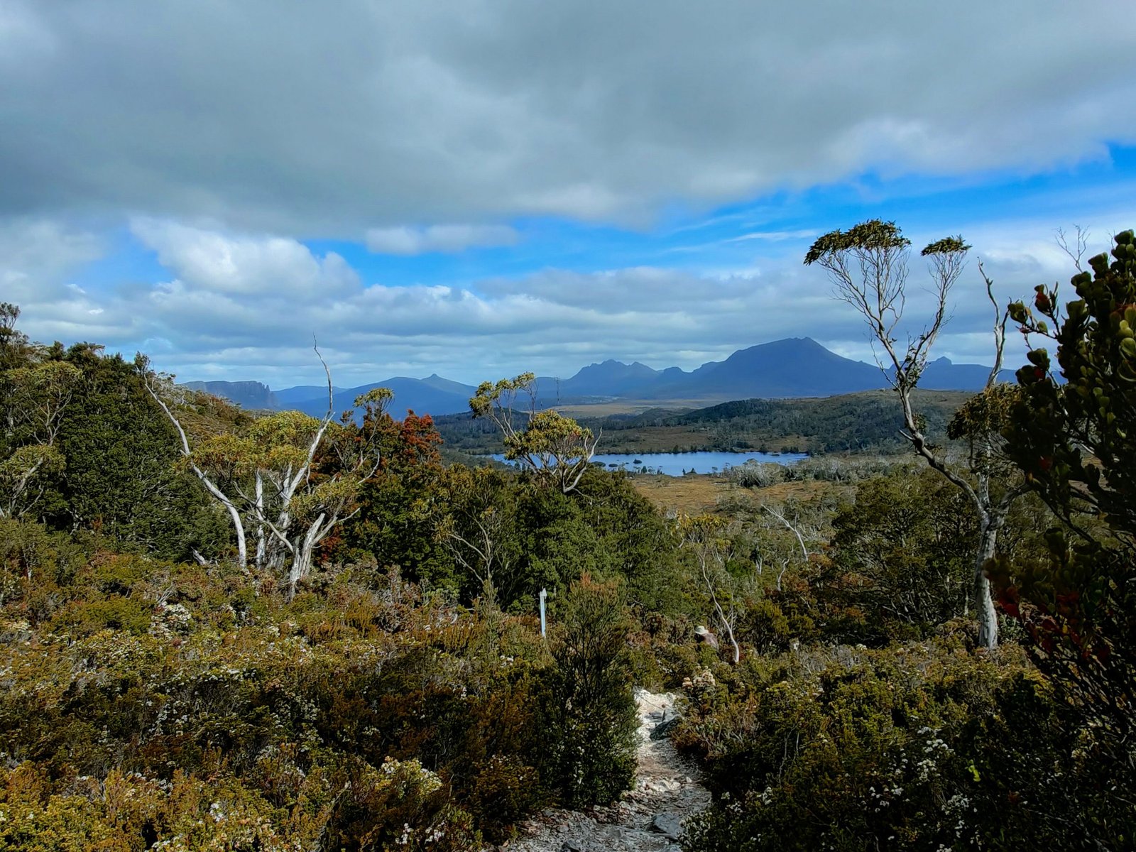
You start in the high drama of Cradle Mountain country, climbing past Crater Lake and Marions Lookout before crossing exposed alpine ground toward Waterfall Valley. From there the track moves through open buttongrass plains, glacial valleys, tarns, eucalypt forest, myrtle-beech rainforest, waterfall country, and the long descent toward Lake St Clair.
On a clear day, the side trip to Mount Ossa gives you the highest point in Tasmania. On a wet day, the track reminds you that alpine Tasmania is not a theme park. Mud, wind, cold rain, wet boardwalk, and full huts are part of the experience.
That is the point. The Overland Track is managed and well known, but it still asks you to behave like a real multi-day hiker.
Trail at a Glance
| Location | Cradle Mountain-Lake St Clair National Park, Tasmania, Australia |
| Category | Wild Trails |
| Distance | 65 km to Narcissus Hut, or about 82.5 km if walking out to Cynthia Bay |
| Duration | 6 days standard, 7 days with Lake St Clair walk-out |
| Difficulty | Hard for most hikers, Grade 4 bushwalking |
| Best season | December to March for most walkers, with the managed booking season from 1 October to 31 May |
| Permits | Overland Track Pass required during booking season |
| Direction | North to south during booking season |
| Start trailhead | Ronny Creek, Cradle Mountain, Google Maps |
| Standard end point | Narcissus Hut, Lake St Clair, Google Maps |
| Full walk-out end point | Cynthia Bay, Lake St Clair Visitor Centre, Google Maps |
| Highest optional summit | Mount Ossa, 1,617 m |
| Hut system | Public huts and tent platforms, huts cannot be booked |
| Water | Hut tanks and natural sources, treat or boil before drinking |
Trail Map
Official Overland Track information and route notes, Tasmania Parks and Wildlife
Official Overland Track walk notes, Tasmania Parks and Wildlife
TASMAP Cradle Mountain-Lake St Clair map and notes (recommended by Tasmania Parks and Wildlife for walkers)
Do not rely on a phone-only map for this walk. Carry offline mapping and a paper map. The track is popular, but visibility can disappear quickly on exposed sections.
Getting There and Away
Getting there: Cradle Mountain and Ronny Creek
Most walkers stage through Launceston, Hobart, or Devonport, then travel to Cradle Mountain by bus, shuttle, private transfer, or hire car.
Launceston is the most common practical hub because it is closer to Cradle Mountain than Hobart. Devonport can also work well if you are arriving by ferry or flight. Hobart is possible, but it usually means a longer transfer day.
During the booking season, you check in at the Cradle Mountain Visitor Centre, attend the walker briefing, collect your pass, and then use the Cradle Mountain shuttle bus to reach Ronny Creek. Tasmania Parks advises that the shuttle from the visitor centre to the park stops takes about 20 minutes to Dove Lake, with Ronny Creek on the route.
Private vehicle access into the park is restricted during shuttle operating times, so do not build your plan around simply driving to the track start. If you have a hire car, most walkers still park at or near the visitor centre and use the shuttle system.
Named transport operators listed by Tasmania Parks include Overland Track Transport, Cradle Mountain Coaches, McDermotts Coaches, eGuide, Outdoor Tasmania, Wild Island Adventures Transport, Tasmanian Wilderness Experiences, and Wilderness Expeditions. Overland Track Transport advertises regular services from Launceston to Cradle Mountain and return services from Lake St Clair to Launceston or Hobart.
The safest plan is to arrive at Cradle Mountain the day before your walk. This gives you time to check in, solve gear problems, buy fuel if needed, and avoid starting the first day tired from travel.
Getting away: Narcissus, Cynthia Bay, Launceston, or Hobart
The standard finish is Narcissus Hut at the northern end of Lake St Clair. From there, most walkers take the Lake St Clair ferry to Cynthia Bay and the Lake St Clair Visitor Centre. This ferry is privately operated, costs extra, and must be booked separately before you start the walk. When you reach Narcissus Hut, use the hut radio to reconfirm your ferry booking.
If you do not take the ferry, you can walk the 17.5 km Lake St Clair shoreline track to Cynthia Bay. This adds a full walking day and changes the trip from the standard 65 km route to about 82.5 km.
From Cynthia Bay, book onward transport to Launceston, Hobart, Devonport, or back toward Cradle Mountain. Do not leave this until the end of the walk and hope it works out. Services are seasonal, finish times can shift, and a delayed ferry can affect your connection.
Best Time to Hike the Overland Track
For most hikers, the best time to walk the Overland Track is December to March.
This period gives you longer daylight, generally more settled conditions, and the best chance of using side trips such as Mount Ossa, Barn Bluff, and the waterfalls without fighting the clock. It is also the busiest period, so popular departure dates can sell out quickly.
October and November can be beautiful, but expect colder, wetter, less predictable conditions. April and May can be excellent for quieter walking and autumn colour, but nights are colder and daylight is shorter.
Winter is a different undertaking. The track may be quieter, but snow, ice, short days, and severe weather change the risk profile. Winter walking is for experienced alpine hikers with suitable cold-weather gear, navigation skills, and conservative decision-making.
The key point is simple: summer reduces some risk, but it does not remove alpine weather. Pack for cold and wet conditions in any month. See our full Overland Track packing list for the exact gear to bring.
Day-by-Day Breakdown
Day 1: Ronny Creek to Waterfall Valley
Distance: 10.7 km
Typical time: 4 to 6 hours
Terrain: Climb past Crater Lake and Marions Lookout, then exposed alpine walking
Overnight: Waterfall Valley Hut and camping platforms
Day one is the shock absorber.
The distance looks short, but the climb from Ronny Creek toward Marions Lookout is a real introduction to walking with a multi-day pack. The track rises past Crater Lake, climbs steeply, then opens onto exposed alpine country. In clear weather, this is one of the most memorable starts to any Australian walk. In poor weather, it can be cold, windy, and slow.
Do not treat day one as a warm-up stroll. Start early enough, keep waterproof layers accessible, and give yourself time to move carefully if the track is wet.
Cradle Mountain and Barn Bluff are major side-trip options in this northern section, but both need good weather, enough daylight, and the right group. If conditions are poor, skip them. A summit is never worth starting the track cold, late, and rattled.
Day 2: Waterfall Valley to Lake Windermere
Distance: 7.8 km
Typical time: 2.5 to 3.5 hours
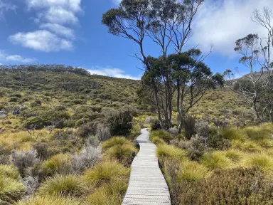
Terrain: Open alpine heath, tarns, boardwalk, exposed sections
Overnight: Lake Windermere Hut and camping platforms
Day two is short, which makes it useful.
You get time to settle into the rhythm of the walk, adjust your pack, manage wet gear, and deal with foot hot spots before they become a problem. The terrain is more open than difficult, but exposure still matters. A short day in good weather can feel generous. A short day in wind and rain can still feel cold.
Lake Will is the natural side trip from this section. It is a good option if the weather is reasonable and you want a scenic detour without adding a major summit.
Use this day to get organised. Dry what you can. Repack what is annoying you. Fix your sock system. The longer day to Pelion comes next.
Day 3: Lake Windermere to Pelion
Distance: 16.8 km
Typical time: 5 to 7 hours
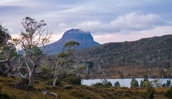
Terrain: Moorland, forest, wet track, river valley, gradual climb to Pelion Plains
Overnight: Pelion Hut and camping platforms
Day three is the longest standard day of the Overland Track.
The walking changes character as you leave the higher open country and move through a mix of moorland, forest, wetter low sections, and the long approach to Pelion. This is the day where your footwear, socks, pack weight, and snack system stop being theory.
The track can be muddy, and the wet sections can be tiring rather than technically hard. Keep your pace steady. Do not burn energy early just because the first kilometres feel manageable.
Pelion is one of the great overnight settings on the track. The plains open out, mountains gather around the horizon, and the walk starts to feel deeper than the Cradle Mountain postcard version of Tasmania.
Old Pelion Hut is a worthwhile historical side trip if you have time. Mount Oakleigh is a much more serious addition and is best treated as an extra objective, not something to squeeze in casually after a long day.
Day 4: Pelion to Kia Ora
Distance: 8.6 km, not including Mount Ossa
Typical time: 3 to 4 hours for the main track
Terrain: Climb to Pelion Gap, alpine side trips, descent toward Kia Ora
Overnight: Kia Ora Hut and camping platforms
Day four is short on the main track, but it holds the biggest optional prize: Mount Ossa.
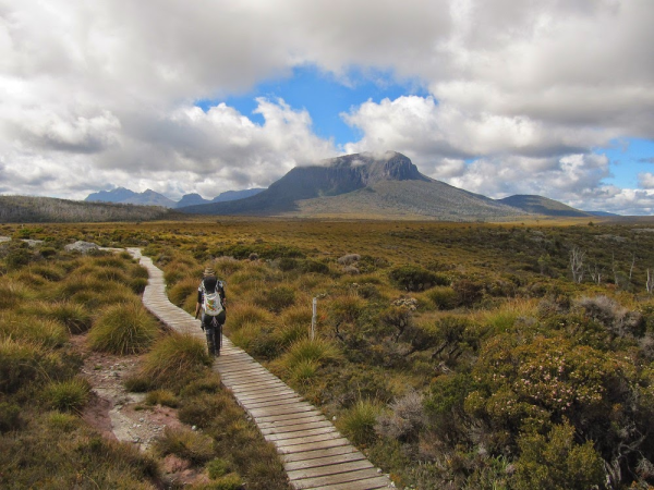
The route climbs to Pelion Gap, where packs are commonly left for the Mount Ossa side trip. Ossa is Tasmania’s highest mountain at 1,617 m. In clear weather, it can be the highlight of the trip. In poor weather, it can be a bad decision dressed up as ambition.
Treat Ossa as optional. You need a stable forecast, enough daylight, enough energy, and comfort on steep, exposed terrain. Low cloud, strong wind, snow, heavy rain, or an already tired group should end the discussion.
Mount Pelion East is another side trip from the gap. It is shorter than Ossa, but still steep and exposed. Choose one objective well rather than trying to force too much into the day.
After the side-trip decision, the main track descends toward Kia Ora. This is a good night to protect dry layers and prepare for the waterfall country ahead.
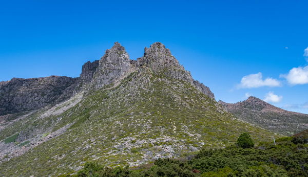
Day 5: Kia Ora to Windy Ridge, Bert Nichols Hut
Distance: 9.6 km
Typical time: 3.5 to 4.5 hours, plus side trips
Terrain: Forest, rainforest, historic hut, waterfall side tracks, Du Cane Range views
Overnight: Bert Nichols Hut and camping platforms at Windy Ridge
Day five is the forest and waterfall day.
The track passes through rich, wet country near Du Cane Hut, then gives access to side trips to D’Alton Falls, Fergusson Falls, and Hartnett Falls. These are worth considering, especially if the weather is settled and your group is moving well.
The practical warning is footing. Wet roots, mud, rocks, and waterfall spray can make side tracks slower than expected. Save enough time and energy to reach Windy Ridge without rushing.
Bert Nichols Hut is one of the larger and more substantial huts on the track, but the same rule applies: no hut bed is guaranteed. Keep your tent accessible and treat the hut as a bonus, not a booking.
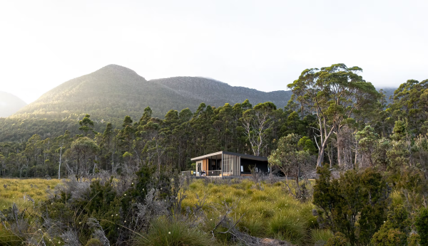
Day 6: Windy Ridge to Narcissus
Distance: 9 km
Typical time: 3 to 4 hours
Terrain: Gradual descent through forest and buttongrass plains to Lake St Clair
Overnight or finish: Narcissus Hut, ferry jetty, or continue next day to Cynthia Bay
Day six is often the psychological finish, but it is not the logistical finish.
The track descends through the Narcissus Valley toward Lake St Clair. You cross the Narcissus River by suspension bridge, then continue to the hut and ferry area. If you booked the ferry, reconfirm it using the radio at Narcissus Hut.
Do not cut your food too fine. Ferry timing can shift, weather can interfere, and groups can move slower than expected. Keep enough food margin to handle delay.
If you are walking the lake section, Narcissus is not the end. It is your final overnight area before a longer shoreline day.
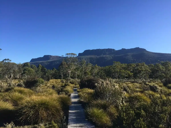
Optional Day 7: Narcissus to Cynthia Bay
Distance: 17.5 km
Typical time: 5 to 6 hours
Terrain: Lake St Clair shoreline, myrtle-beech rainforest, undulating forest track
Finish: Cynthia Bay and Lake St Clair Visitor Centre
Walking out along Lake St Clair gives the Overland Track a cleaner walking finish.
It is not technically difficult compared with the alpine sections, but it comes at the end of the trip, when feet are tender and packs smell like six days of wet socks and compromise. Do not underestimate it.
Echo Point Hut sits about 5 km into this section and can be used by walkers who want one more night out or need to split the lake walk. Most hikers either take the ferry from Narcissus or complete the shoreline section in one day.
If you have the time and food, the walk-out is worthwhile. If you are tight on flights, transfers, or energy, the ferry is the practical finish.
What to Expect
Terrain
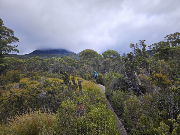
The Overland Track is a mix of boardwalk, mud, rock, rooty forest track, open moorland, alpine plateau, and short steeper climbs. The main track is not technical climbing, but some side trips involve scrambling, exposure, and rougher terrain.
The first day has the biggest early climb. Day three is the longest standard day. Day four can become a major day if you add Mount Ossa. Day five can be slow if you add waterfall side trips. Day seven, if you walk out, is longer than many tired hikers want it to be.
Weather
Expect cold, wet, and windy conditions even in summer. Tasmania Parks warns that severe cold, wet, and windy conditions can happen at any time of year. Almost half of the track is above 1,000 m on exposed plateaus, so weather has more influence than the kilometre count suggests.
Your waterproof jacket, pack liner, dry sleep clothes, gloves, beanie, and warm layer are not comfort items. They are the difference between a hard day and a risky one.
Wildlife
You may see wombats, wallabies, pademelons, possums, currawongs, and other Tasmanian birdlife. The important thing is not just seeing wildlife, it is not teaching wildlife to raid walkers.
Secure your food. Do not leave snacks in open tent pockets, outside packs, or hut areas. Possums and currawongs can be persistent, and food-conditioned animals become a problem for everyone.
Crowds and Hut Pressure
The booking system limits independent walker departures during the main season, but the track is still popular. Huts can feel busy, especially in poor weather when more people want to sleep inside.
The social side can be part of the charm: shared weather reports, boot-drying negotiations, and quiet relief when everyone reaches the hut safely. But if you need solitude every night, the Overland Track in peak season may test you.
Water: Sources, Safety, and Treatment
Water is generally available at huts through rainwater tanks and from natural sources along the route. This does not mean you should drink it untreated.
Tasmania Parks states that huts have freshwater tanks, but walkers still need to be self-sufficient. The practical recommendation is to boil, filter, chemically treat, or UV-treat drinking water. This is especially sensible around huts, lower areas, and any source with heavy human or animal traffic nearby.
Carry a reliable water treatment method and a backup. A squeeze filter, gravity filter, chemical tablets, or UV purifier can all work. In cold, wet conditions, boiling water is also practical because most walkers are already cooking with a stove.
Known hazards include contamination from human use near hut areas, wildlife, and stagnant water. Glacial-looking or clear water is not a guarantee of safety. Treat your water and keep moving.
For more detail on water treatment options, see Best Water Filters for Hiking.
Logistics
During the booking season, independent walkers need an Overland Track booking for a specific departure date. For the October 2026 to May 2027 season, Tasmania Parks lists bookings as opening at 9am on Tuesday 7 July 2026.
The 2026 listed booking-season fee is $312 for adults and $272 for children or concession walkers. Fees are reviewed annually, so check the official Parks page before booking.
The booking fee covers park entry for the duration of the Overland Track walk during booking season and shuttle access from the Cradle Mountain Visitor Centre to the start of the track. It does not include transport to Cradle Mountain, transport from Lake St Clair, or the Lake St Clair ferry.
On arrival at Cradle Mountain Visitor Centre, you need to present your booking confirmation, complete the walker briefing, and collect your pass. Tasmania Parks says walkers must collect their pass by the required deadline on departure day and be on track by the stated cut-off time.
Huts cannot be booked. Each hut has basic facilities such as bunk platforms without mattresses, composting toilets, freshwater tanks, and communal areas for cooking. There are no showers, hot water, or cooking equipment. Carry a tent, sleeping mat, sleeping bag, stove, fuel, food, and wet-weather gear.
A PLB or satellite messenger is strongly recommended. PLBs can be hired from some Service Tasmania locations and selected visitor centres, but numbers may be limited.
Mandatory Gear Checklist
This is not a full packing list. It is the gear that matters specifically on the Overland Track. For the complete kit list with product picks, see our companion guide: What to Pack for the Overland Track.
- Real waterproof shell: Alpine Tasmania can deliver cold rain and wind in summer. A light street raincoat is not enough. See Best Waterproof Jackets for Hiking and Best Lightweight Hiking Jackets.
- Warm insulation layer: You need warmth for hut evenings, cold breaks, and wet days. Fleece plus a light puffy is a sensible system.
- Weather-worthy tent: Huts are not booked, and you must carry a tent. Choose a shelter you trust in rain and wind. See Best Freestanding Tents.
- Sleeping mat and warm sleeping bag: Hut bunks do not have mattresses. Your sleep system still needs to work if you camp. See our best insulated sleeping pads for hiking for genuine cold-ground R-value picks.
- Pack liner and dry bags: Keep sleep clothes, insulation, and electronics dry. Wet gear compounds over six days.
- Footwear you have already trained in: Boots or trail shoes can both work, but do not debut new footwear here. See Best Waterproof Hiking Boots and Best Hiking Socks for Preventing Blisters.
- Gaiters: Useful for mud, wet vegetation, and keeping debris out of footwear.
- Water treatment: Filter, UV, chemical treatment, or boiling, plus backup tablets.
- Stove and fuel: No cooking equipment is supplied in huts.
- PLB or satellite messenger: Do not rely on phone reception.
- Paper map and offline navigation: Use the official map and carry offline maps as backup. A dedicated GPS device adds extra confidence given the limited phone coverage in the park. See the best hiking GPS devices for multi-day hiking.
- Headlamp: Essential for hut life, early starts, and delays.
- Blister kit: Tape, dressings, and the discipline to stop early.
For the full kit list with product picks, see What to Pack for the Overland Track.
For broader planning, see Plan Your First Multi-Day Hike and Multi-Day Hiking Gear: What You Actually Need.
Honest Assessment
The Overland Track is best for hikers who want a genuine multi-day alpine walk without designing a remote route from scratch.
It suits fit walkers with overnight hiking experience, patient beginners who prepare properly, and international visitors who want a compact but serious Australian wilderness trip.
It is not ideal for hikers who want guaranteed beds, predictable weather, dry feet, or a lightweight fair-weather holiday. It is also not a good first camping experience if you have never pitched a tent in rain, carried a loaded pack, or managed wet gear for more than one night.
The verdict: the Overland Track deserves its reputation. It is not hard because of distance. It is hard because Tasmania adds weather, exposure, mud, logistics, and hut uncertainty to every decision.
Final Thoughts
The Overland Track is one of Australia’s strongest multi-day walks because it gives you a real crossing, not just a scenic loop.
You begin under Cradle Mountain, move through alpine plains and forest, make weather-dependent decisions about summits and waterfalls, then finish at the head of Lake St Clair. If you walk out to Cynthia Bay, the journey feels even more complete.
Plan early. Book carefully. Carry the tent. Treat the water. Respect the forecast. Skip side trips when conditions are wrong.
The Overland Track is accessible, but it still asks something of you. That is why it stays with people.
For next planning steps, read Plan Your First Multi-Day Hike, Multi-Day Hiking Skills, and the Wild Trails destination guides for Milford Track and Torres del Paine O Circuit.
Frequently Asked Questions
How long is the Overland Track?
The standard Overland Track is 65 km from Ronny Creek near Cradle Mountain to Narcissus Hut at Lake St Clair. If you walk the Lake St Clair shoreline section from Narcissus to Cynthia Bay, add 17.5 km. That makes the full walking route about 82.5 km.
How many days do you need for the Overland Track?
Most hikers take six days to walk from Ronny Creek to Narcissus and then take the ferry across Lake St Clair. If you walk out to Cynthia Bay instead of taking the ferry, plan on seven days. Extra days are useful if you want to add side trips or avoid rushing in poor weather.
Do you need to book the Overland Track?
Yes, during the managed booking season from 1 October to 31 May, independent walkers need an Overland Track booking. The booking is for your departure date, not for hut beds. Huts are first-come, first-served, and you must carry a tent.
Can beginners hike the Overland Track?
A fit, well-prepared beginner can hike the Overland Track, but it should not be treated casually. You should be comfortable carrying a multi-day pack, camping in rain, treating water, using a stove, managing wet gear, and making conservative weather decisions. A shorter overnight hike before booking is a smart test.
Are huts guaranteed on the Overland Track?
No. Huts cannot be booked. They are available on a first-come, first-served basis and can fill up. You must carry a tent even if you hope to sleep in huts every night.
Is Mount Ossa worth it?
Mount Ossa is worth it in clear, settled weather. It is Tasmania’s highest peak and one of the classic Overland Track side trips. It is not worth forcing in cloud, strong wind, snow, heavy rain, or if your group is already tired.
Should you take the Lake St Clair ferry or walk out?
The ferry is the standard and more convenient finish. Walking out along Lake St Clair adds 17.5 km and usually another day. The walk-out gives a more complete foot journey, but the ferry makes sense if you are short on time, food, or energy.
What is the biggest mistake hikers make on the Overland Track?
The biggest mistake is packing and planning for the distance rather than the conditions. The Overland Track is not hard because 65 km is huge. It is hard because cold rain, wind, mud, hut pressure, side-trip decisions, and wet gear compound over multiple days.
