

Last updated: August 2026
Wild Trail Hiker is reader-supported. We may earn a commission when you buy through links on this page, at no extra cost to you. We only recommend products we’d consider taking on a multi-day trip ourselves.
Before You Go
The Four Pass Loop climbs over four passes above 12,000 feet in the Maroon Bells-Snowmass Wilderness near Aspen, Colorado. Every overnight stay requires an advance-reservation permit tied to a specific camping zone, a hard-sided bear canister is mandatory for every backpacker, and driving to the trailhead during the day requires its own separate parking or shuttle reservation. None of this is optional, and all three pieces need sorting out before you can lock in a start date.
Why This Trail
The Maroon Bells are two of the most photographed peaks in the country, and the Four Pass Loop is the way to see them from every angle instead of just the postcard view from Maroon Lake. It packs four passes above 12,000 feet, several genuinely blue alpine lakes, and a full lap around the Elk Range into a loop most fit hikers finish in three to four days, which is short compared to the West’s bigger classics like the John Muir Trail or the Wonderland Trail.
That compactness is exactly why it draws a crowd. Experienced Colorado hikers consistently rate it among the best multi-day trips in the state for the scenery-to-time ratio: you get high-alpine terrain, wildflower basins, and four distinct mountain passes without needing two weeks off work. Snowmass Lake, reached on day two or three depending on direction, is the trail’s most photographed backcountry moment: a deep blue lake sitting directly below Snowmass Mountain, a 14,000-foot peak. Fravert Basin, on the trail’s western side, is quieter and known among hikers for moose sightings in the meadows along the North Fork of the Crystal River.
The permit system is part of the trail’s reputation too. Overnight permits are released in narrow windows months ahead and book up fast, which means most people who eventually walk this loop spent real time planning around a specific reservation date, not a spontaneous long weekend.
Trail at a Glance
| Spec | Detail |
|---|---|
| Distance | 26 to 28 miles (42 to 45 km), full loop. Sources vary slightly depending on the exact GPS track and whether optional side trips are included. |
| Duration | 3 to 4 days is most common. Very fit parties sometimes do it in 2 nights; a 4-day, 3-night pace (one pass per day) is a comfortable default for most backpackers. |
| Difficulty | Hard. Four passes above 12,000 ft, roughly 7,750 to 8,000 ft (2,360 to 2,440 m) of cumulative elevation gain, and almost the entire route sits above 10,000 ft. |
| Best season | Mid-July through early September. Snow can linger on the passes into July, and creek crossings run high and cold with early-season snowmelt. Fresh snow can return to the high country by late September. |
| Permits | Required for every backcountry night, reserved in advance at recreation.gov. Released in blocks: mid-February for April 1 to July 31, mid-June for August 1 to November 30, and mid-October for the winter season. |
| Start / end trailhead | Maroon Lake, Maroon Bells Scenic Area (loop trail, same point both ways): Maroon Lake Trailhead on Google Maps |
Because this is a loop, the trailhead you start at is the one you finish at. A smaller minority of hikers start instead at the West Maroon Trailhead near Crested Butte, which avoids the Aspen-side shuttle system but adds several miles and requires a rougher access road.
Trail Map
View the Four Pass Loop on AllTrails: includes an elevation profile, current condition reports, and thousands of recent hiker photos and reviews.
Official Four Pass Loop trail page, White River National Forest (USDA Forest Service): the source of truth for permits, alerts, and current closures.
Getting There and Away
Getting there: Because this is a loop, “getting there” and “getting away” both point back to Maroon Lake. The nearest major air hub is Denver International Airport (DEN), roughly 220 miles and about 3.5 hours away via I-70 West to Glenwood Springs, then Highway 82 to Aspen. Eagle County Regional Airport (EGE) is closer, around 70 miles and 1.5 hours out, with more limited commercial service. Aspen/Pitkin County Airport (ASE) sits right in town but has the fewest flights and the highest fares of the three, so it usually only makes sense if cost isn’t the deciding factor.
Maroon Creek Road, which leads from Aspen to the trailhead, is closed to private vehicles from 8 am to 5 pm daily between May 15 and October 31 unless you hold an overnight parking reservation. The road opens to personal cars from 6 to 8 am, so an early drop-off from a friend or a taxi is one option. Otherwise, the standard route is parking at Aspen Highlands Ski Area and riding the RFTA Maroon Bells shuttle bus up to the trailhead. Book the shuttle and any parking reservation through the Aspen Chamber’s Maroon Bells reservation system well ahead of your trip; day-of, first-come-first-served shuttle spots exist but are not guaranteed in peak season.
If you’d rather drive straight to the trailhead and skip the shuttle, you can reserve overnight parking directly at Maroon Lake: a 60-hour (2-night) block runs around $10, and multi-night trips typically need to stack two consecutive reservations to cover the full loop. Verify current parking and shuttle pricing before you book; these fees are adjusted periodically.
Getting away: Same trailhead, since this is a loop. The last shuttle down from Maroon Lake typically departs around 5 pm; miss it and you’re looking at a long wait or a hitchhike back into Aspen, so build a buffer into your final day if you’re relying on the shuttle.
Staging towns: Aspen itself is the obvious pre- and post-trail base but runs expensive for lodging. Basalt, Carbondale, and Glenwood Springs, all 20 to 45 minutes down-valley on Highway 82, offer noticeably cheaper accommodation and are common choices for hikers staging the trip on a budget.
Day-by-Day Breakdown
Backcountry permits on the Four Pass Loop are tied to seven designated camping zones (Crater, Maroon, East Fork, North Fork, Geneva Lake, Snowmass Lake, and Upper Snowmass), and you must camp in the zone that matches your permit each night. The breakdown below follows a well-documented 4-day, 3-night clockwise pace, one pass per day, which several experienced trip reports single out as the most manageable itinerary for a first attempt. It is a reasonable default, not the only option: parties in a hurry sometimes compress it to 3 days by combining two passes into a single long day.
Day 1: Maroon Lake to East Fork Zone via West Maroon Pass (about 7 miles)
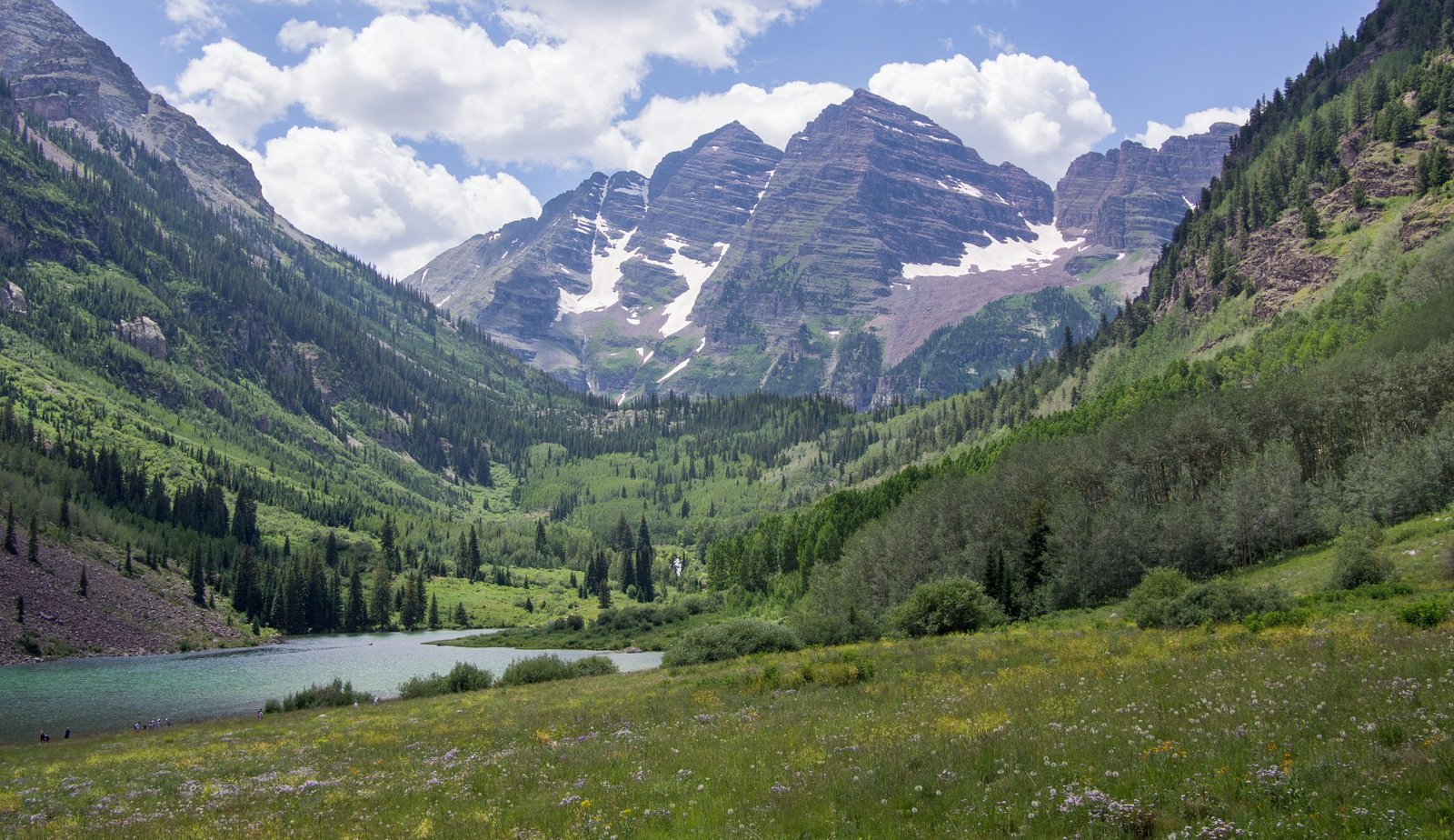
Highlight: Crater Lake and the classic Maroon Bells reflection.
From the Maroon Lake trailhead, an easy boardwalk and gravel path follows the lakeshore before the trail proper begins climbing. After roughly 1.5 miles you reach Crater Lake, one of the most photographed spots in Colorado, with the Maroon Bells rising directly behind it. From there the trail follows West Maroon Creek up a long, steady climb to West Maroon Pass at roughly 12,500 ft, the highest of the four passes and, by most accounts, the gentlest climb of the trip. Expect ample water along West Maroon Creek on the way up; refill before the final push to the pass, since sources dry up above treeline.
Day 2: East Fork Zone to Geneva Lake Zone via Frigid Air Pass (about 7 miles)
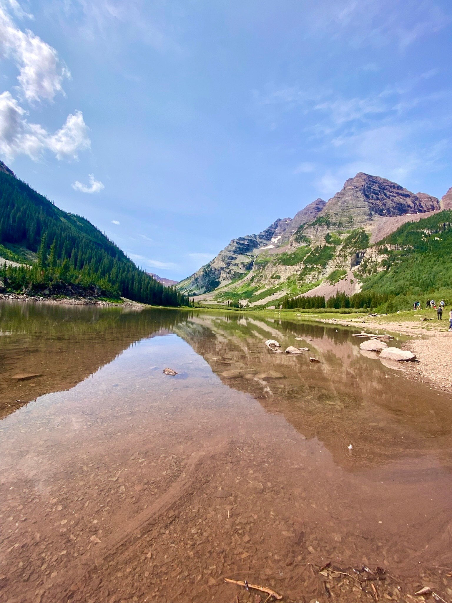
Highlight: The short, steep summit push on Frigid Air Pass.
This day’s defining feature is a climb that gains close to 500 ft in half a mile above 12,000 ft, short but genuinely steep, right below the summit of Frigid Air Pass (roughly 12,410 to 12,415 ft depending on source). The approach meadow is exposed with little shade, so an early start matters here more than most days on the loop. After the pass, the trail descends into Fravert Basin along the North Fork of the Crystal River, a section known for forest, small waterfalls, and moose. There is one shallow creek crossing in this stretch; most hikers wade it in camp sandals rather than risk wet boots for the rest of the day.
Day 3: Geneva Lake Zone to Upper Snowmass Zone via Trail Rider Pass (about 5 miles)
Highlight: The descent from Trail Rider Pass to Snowmass Lake.
The shortest day on this itinerary and widely cited as the most scenic. An optional mile-long detour reaches Geneva Lake itself if your pace and energy allow it. The climb to Trail Rider Pass (roughly 12,420 ft) is steady rather than brutally steep, and the payoff at the top is the trail’s signature view: the deep blue water of Snowmass Lake spread out below, with Snowmass Mountain and Hagerman Peak behind it. The descent to the lake is smooth and considered one of the best stretches of trail on the loop. Camp is a short walk beyond the lake in the Upper Snowmass zone, near Snowmass Creek.
Day 4: Upper Snowmass Zone to Maroon Lake via Buckskin Pass (about 7 miles)
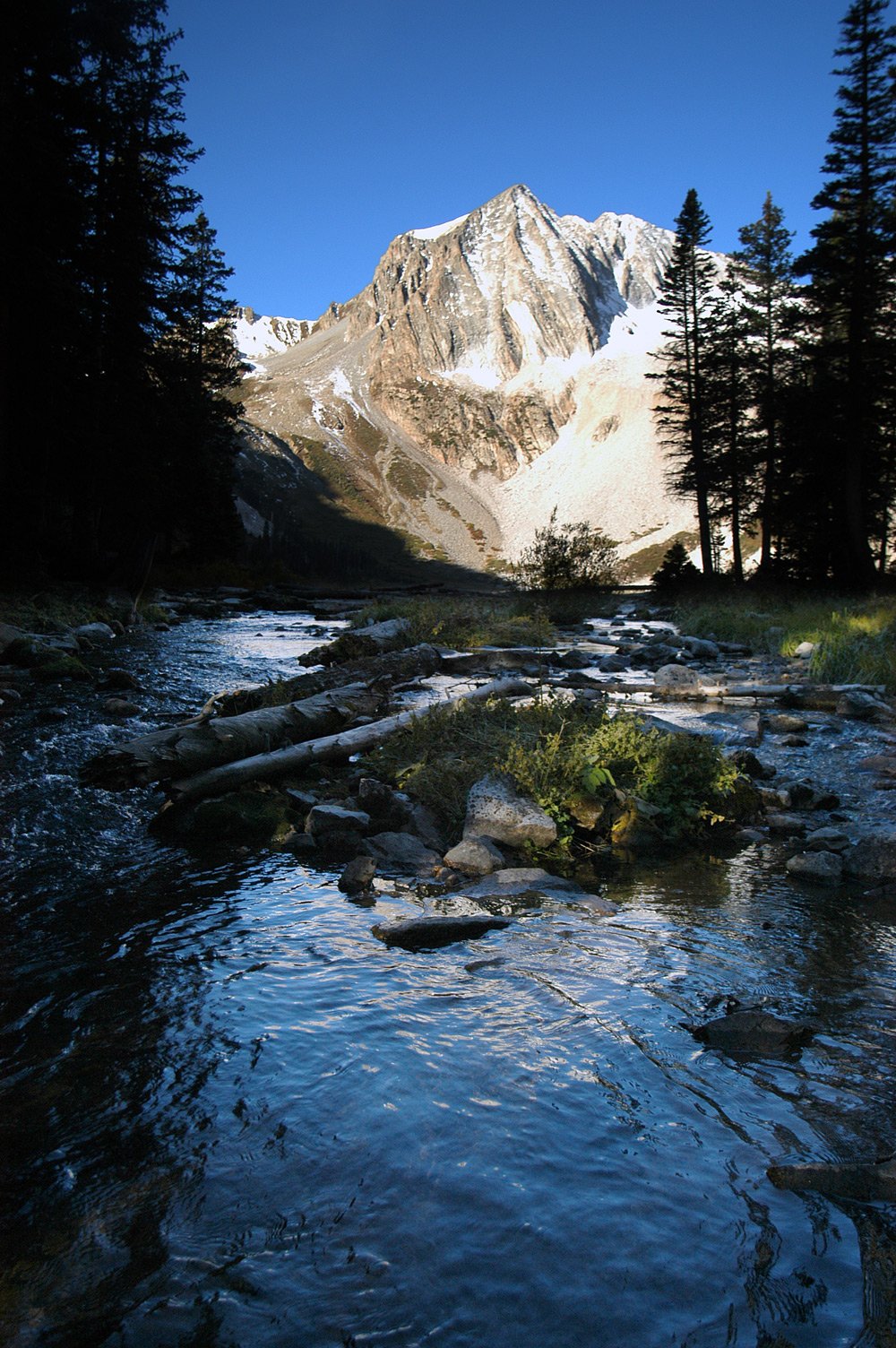
Highlight: Sunrise light on the peaks from the Buckskin Pass climb.
The final climb, up numerous switchbacks to Buckskin Pass (roughly 12,462 ft), is steady and typically takes a couple of hours from a Snowmass-area camp. From the summit, it’s a long descent back through changing aspen groves to Maroon Lake and the trailhead. This is the longest sustained downhill of the trip on already-tired legs, so trekking poles earn their keep here. An optional side trail to Willow Lake branches off partway down if you have an extra night and want to extend the trip; it isn’t in a permit zone and doesn’t require its own reservation.
What to Expect
Terrain: Rocky, well-maintained trail for most of the route, with loose scree and switchbacks on the pass descents, especially below West Maroon and Buckskin. Almost the entire loop sits above 10,000 ft, and the passes themselves are well above treeline with no shelter from wind or weather. Expect at least one creek crossing (Fravert Basin, between Frigid Air and Trail Rider passes) that can require wading in normal summer flow, and more in early season.
Weather: Typical July and August days bring highs in the 70s°F with overnight lows in the 30s and 40s°F, even in mid-summer, so camp at 11,000-plus feet is genuinely cold after dark. Afternoon thunderstorms are common from June through September and build fast at this elevation; the standard advice from every source on this trail is to be over each pass before early afternoon and to know your lightning-safety options (getting below treeline, avoiding ridgelines and isolated trees) before you’re caught out.
Wildlife: Black bears are present throughout the wilderness (no grizzlies in Colorado), along with moose, especially in Fravert Basin and other meadow sections, and mountain lions, rarely seen. Marmots and pikas are common near the passes. Give moose a wide berth: they are more likely to charge than bears are in this area.
Crowds: Maroon Lake itself is one of the busiest day-use spots in Colorado, especially at sunrise. Numbers thin out fast once you’re a few miles in, and the permit-zone system caps how many groups can camp in each zone per night, so backcountry crowding is more manageable than the trailhead scene suggests. Weekdays and the shoulder ends of the July to September season are noticeably quieter.
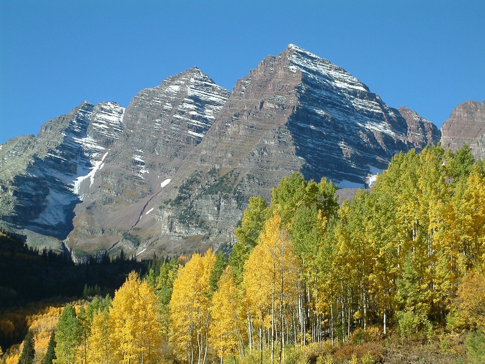
Signature features: Crater Lake’s reflection of the Maroon Bells, Snowmass Lake below Snowmass Mountain, the four named passes themselves, and Fravert Basin’s meadows and waterfalls.
Water: sources, safety, and treatment
Water is generally available along most of the route, but it thins out fast on the climbs: expect long dry stretches on the final approach to each pass, since most creeks and lakes sit lower in the valleys between them. Fill up before starting any climb, particularly the approaches to West Maroon Pass and Trail Rider Pass, where the last reliable sources sit well below the summit.
None of the water on this trail should be considered safe to drink untreated. Streams run through popular backcountry camping zones and past grazing areas at lower elevations, and giardia risk is real even in water that looks clean. A standard backpacking filter (a squeeze or gravity system) handles this trail well; the water here does not carry the heavy glacial silt load that clogs filters on trails like the Wonderland or John Muir. Treat every source, including the water at Snowmass Lake and along Snowmass Creek. A water filter rated for backcountry use is standard kit here, not optional.
Early-season hikers (late June to early July) should expect the Fravert Basin creek crossing and other snowmelt-fed sections to run higher, colder, and more hazardous than the numbers above suggest. Check current conditions with the Aspen-Sopris Ranger District before a trip planned for that window.
What Hikers Say About the Four Pass Loop
This section pulls together what people who have hiked the Four Pass Loop wrote down afterwards, so the planning above is checked against real trips. The reports run from 2013 to 2020, with a couple of undated ones, so treat them as the loop’s character, not today’s conditions. Check current permit rules and snow reports before you go.
Most people call it spectacular, and most say it is harder than the numbers suggest. One 2020 hiker described it as basically nonstop views and some of the best backcountry in Colorado. A 2017 trail runner called it one of the most beautiful runs he has done, in cold and wet weather, and said he and his partner underestimated how long it would take. A 2016 solo hiker noted that nearly the whole route sits above 10,000 feet, that he stopped to catch his breath more than usual, and that Trail Rider Pass climbs more steeply than the map suggested. A 2020 hiker flagged that same pass as the steepest and suggested a few days of acclimatising if you live near sea level.
The weather is the main variable. A 2020 hiker’s rule was to be back below treeline by noon, because afternoon thunderstorms with hail and lightning are common above it. A 2016 October trip had wind most nights, snow flurries and ice on a pond. A 2017 September run was cold and wet, and the runner told readers to take the forecast seriously and carry rain and cold gear. A 2013 June hiker had a clear summit day and used snow on the lower slopes for glissading, which is a reminder that the early season looks different.
Snow and crossings depend on the month. A 2020 hiker said snow can linger into June and sometimes July, and that microspikes may help on the high passes. A 2016 hiker found only minimal snow on West Maroon Pass in mid October, but snow on Frigid Air Pass made the descent into Fravert Basin slippery. A 2013 hiker found the Fravert Basin streams usually knee deep, enough to soak every sock he had, while a 2020 hiker in a dry July called the crossings moderate.
Crowds drop off fast after Maroon Lake. A 2016 hiker passed about 200 people near the lake on day one, then almost nobody; he saw no one on day three. A 2017 pair hit the trailhead on the busiest weekend of the year for fall colours and found nearby campsites full. A 2020 hiker called the loop moderately busy and said weekdays are quieter.
Navigation is mostly easy, with a few traps. The trail is well maintained and easy to follow, according to a 2020 hiker. A 2017 pair still got lost within the first four miles near the river and noted there are no loop signs and a side trail near Snowmass Lake that confuses people. A 2013 hiker found the loose rock on Snowmass Mountain itself far more difficult, but that is a separate summit climb.
Camps: Snowmass Lake is the favourite. Snowmass Lake was the highlight for the 2016 hiker, and the 2020 hiker praised it for sunset and sunrise and King Falls in Fravert Basin. The same 2016 hiker found Crater Lake underwhelming with little water, and a 2013 hiker warned against the rocky, treeless bivy area between Frigid Air and West Maroon Passes. That 2016 hiker’s first night, a mile below West Maroon Pass, was exposed to wind.
Logistics catch people out. A 2020 hiker’s main complaint was logistics: shuttles run to a schedule, parking fills, permits are required, and trailhead options are, in her words, a pick your poison situation. A 2013 hiker wished he had researched the road access windows before arriving late. A 2017 pair slept in their car and found Aspen lodging very expensive; their tip was to stock up on food before reaching town.
What Hikers Say They Packed, Used and Wished They Had
- A water filter or purifier. One 2017 runner drank untreated stream water without trouble but wished he had a filter. See best water filters for hiking.
- Rain and cold layers. Every report with bad weather says the same thing. See best waterproof jackets and best insulated jackets for hiking.
- Microspikes in the early season. Recommended for lingering snow on the high passes. See best microspikes for hiking.
- A way to keep your camera and phone alive. A 2013 hiker’s camera battery died before Frigid Air Pass and he missed photos there; a 2016 hiker had recurring camera problems. See best power banks for hiking.
- Spare socks. Knee-deep Fravert Basin crossings soaked a 2013 hiker’s entire sock supply. See best hiking socks.
- A bear canister and a wind-ready tent. A bear canister is required. A 2016 hiker forgot tent stakes and listened to the tent flap all night in strong wind. See best bear canisters for multi-day hiking.
- Trekking poles. Recommended for the steep climbs, scree and stream crossings. See best trekking poles.
Sources (paraphrased, no text copied): Jeff U on Team Run Run, September 2017; Joey on Backcountry Post, October 2016; Exiled Michigander on 14ers.com, June 2013; Backpackers Review trip report; Elise Ott on Backpacking Routes, 2020.
Logistics
Permits are the single biggest planning bottleneck on this trail. Reservations open at recreation.gov in three windows: mid-February for April 1 through July 31, mid-June for August 1 through November 30, and mid-October for the winter season. Fees run roughly $10 per person per night plus a small processing fee; confirm current pricing before you book, as these fees are adjusted from time to time.
Your permit locks you into a specific camping zone for each night, so build your day-by-day plan before you apply, not after. There are seven zones in total, and you can only camp in the zone your permit covers that night. Group size is capped at 10 people. Campfires are banned at all Crater Lake designated sites and anywhere above 10,800 ft, which covers most of the loop including Snowmass Lake, so plan on a stove for every meal. There are no toilets on the route: carry a WAG bag or be ready to dig a cathole at least 200 feet from water, trails, and campsites.
Separately from the camping permit, anyone driving to or parking at Maroon Lake between May 15 and October 31 needs its own parking or shuttle reservation, covered in Getting There and Away above. Don’t confuse the two: it’s entirely possible to have a valid camping permit and no way to legally get your car to the trailhead if you haven’t also booked the parking piece.
Mandatory Gear Checklist
This is not a full packing list. It is the gear that matters most specifically on the Four Pass Loop. For the complete kit list with product picks, see our companion guide: What to Pack for the Four Pass Loop.
- A hard-sided, IGBC-approved bear canister. Non-negotiable. Every overnight backpacker in the Maroon Bells-Snowmass Wilderness must carry one; rangers ticket and can require non-compliant hikers to leave. See best bear canisters for multi-day hiking.
- Trekking poles, given the loose scree on the pass descents and the creek crossing in Fravert Basin. See best trekking poles.
- A water filter, since nothing on this route is safe to drink untreated. See best water filters for hiking.
- An insulated jacket for camp. Overnight temperatures at 11,000-plus feet regularly drop into the 30s°F even in July and August. See best insulated jackets for hiking.
- A genuinely waterproof rain shell, not just water-resistant. Afternoon thunderstorms are a near-daily occurrence in peak season and build quickly above treeline. See best waterproof jackets.
- Footwear you’ve already broken in. The scree descents off West Maroon and Buckskin passes are hard on ankles and blistered feet alike. See best hiking boots.
Honest Assessment
This trail suits experienced multi-day hikers who are comfortable with sustained high-altitude effort, willing to manage an early-start, off-the-pass-by-early-afternoon routine around Colorado’s predictable summer storm pattern, and prepared to navigate a genuinely competitive permit system months in advance. Altitude alone rules out a lot of otherwise-fit hikers who haven’t spent time above 10,000 ft before: almost the entire loop sits higher than that, with no easy bail-out to lower ground on most days.
It isn’t the right choice for a first backpacking trip, for anyone not prepared to acclimatize before starting, or for hikers who want a quiet, solitude-heavy wilderness experience: the Maroon Lake trailhead and the first mile or two of trail are genuinely crowded in peak season. For a shorter taste without the full permit puzzle, an overnight out-and-back to Snowmass Lake via Buckskin Pass, or a day hike to Crater Lake, both cover some of the same terrain at a fraction of the commitment.
Among hikers who’ve done it, the consensus is that this is one of the best scenery-to-effort ratios in Colorado backpacking: four genuinely different alpine passes and one of the state’s best lakes, in a trip most people can fit into a long weekend.
Final Thoughts
The Four Pass Loop rewards hikers who plan the permit and parking logistics as carefully as they plan their gear. Start with how to plan your first multi-day hike if you’re still building toward a trip at this altitude and pace. If you’re weighing this against another short, high-reward Western loop, our Teton Crest Trail guide is a close comparison: similar time commitment, a different range entirely. For the exact kit to bring, see our companion guide, What to Pack for the Four Pass Loop.
Frequently Asked Questions
How hard is it to get a Four Pass Loop permit?
Competitive. Permits release in narrow windows (mid-February for the bulk of summer season) at recreation.gov and book up quickly for peak July and August dates. Booking the moment the window opens, with backup dates ready, is standard advice from experienced hikers.
Do I need a bear canister for the Four Pass Loop?
Yes, always. A hard-sided, IGBC-approved bear canister is mandatory for every overnight backpacker in the Maroon Bells-Snowmass Wilderness, with no exceptions. Rangers ticket non-compliant hikers and can require them to leave the backcountry.
What’s the best month to hike the Four Pass Loop?
Late July through August offers the most reliable combination of low snow and manageable creek crossings. Early July can still have lingering snow on the passes and high, cold creek levels; late September carries a real risk of early snowfall.
Can beginners hike the Four Pass Loop?
Not recommended as a first backpacking trip. The combination of sustained high altitude, four passes above 12,000 ft, and a genuine permit and parking logistics puzzle makes this better suited to hikers with at least one or two prior multi-day trips under their belt.
