

Last updated: July 2026
Wild Trail Hiker is reader-supported. We may earn a commission when you buy through links on this page, at no extra cost to you. We only recommend products we’d consider taking on a multi-day trip ourselves.
Before You Start
The Larapinta Trail is a serious desert walk. Overnight walkers need to book trail fees and designated campsites before starting. Water tanks are provided at key points, but surface water is unreliable and tank water should still be treated. The best walking window is usually May to August. Outside the cooler season, heat becomes a safety issue rather than a comfort problem.
Check NT Parks current conditions before you finalise your itinerary. Access, water, private facility rules and trail conditions can change.
Why Hike the Larapinta Trail
The Larapinta Trail is one of Australia’s great long-distance walks because it feels unmistakably tied to the country it crosses.
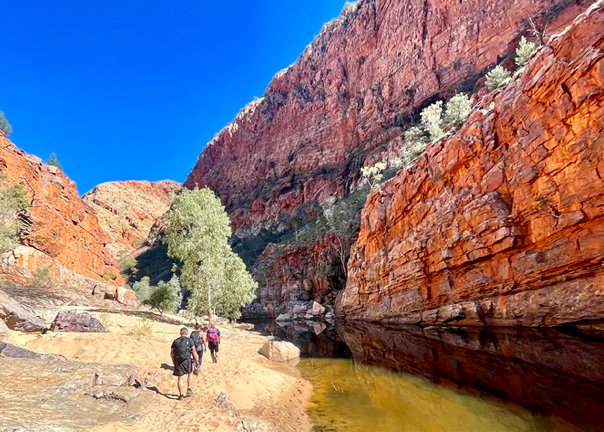
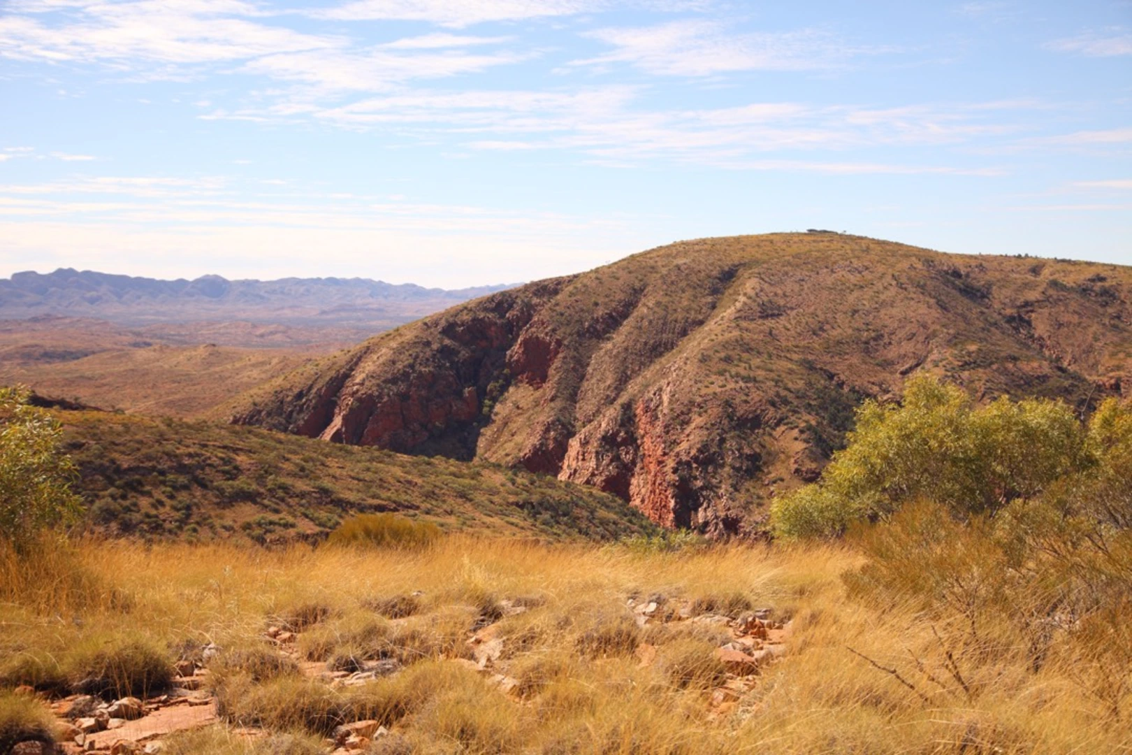
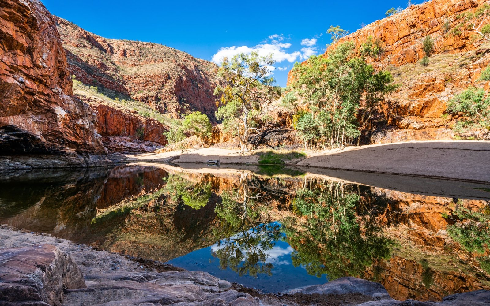
You are not walking through soft alpine meadows or a managed hut route. You are walking across hard red ridges, dry riverbeds, spinifex slopes, quartzite ranges, deep gorges and old desert country west of Alice Springs. The trail follows the West MacDonnell Ranges through Tjoritja / West MacDonnell National Park, linking places such as Simpsons Gap, Standley Chasm, Ellery Creek Big Hole, Ormiston Gorge, Redbank Gorge and Mount Sonder.
The appeal is the rhythm: early starts, long rocky sections, cold camps, heavy water carries, sudden shade in a gorge, and a final climb toward Mount Sonder. This is a trail for hikers who want a proper multi-day objective. It rewards preparation and punishes loose planning.
If you are still building your first overnight system, start with our guide to plan your first multi-day hike before committing to the full trail.
Trail at a Glance
| Item | Detail |
|---|---|
| Trail | Larapinta Trail |
| Location | Tjoritja / West MacDonnell National Park, Northern Territory, Australia |
| Nearest town | Alice Springs |
| Distance | Over 230km according to NT Parks |
| Official sections | 12 sections |
| Usual duration | 12 to 18 days for the full trail |
| Difficulty | Hard overall, with several Grade 5 difficult sections |
| Best season | May to August for most hikers |
| Direction | Commonly east to west |
| Permits and bookings | Trail fees and campsite bookings required for overnight walkers |
| Start trailhead | Alice Springs Telegraph Station: Google Maps pin (approx -23.7004, 133.8756, spot-check car park access) |
| End trailhead | Mount Sonder / Redbank Gorge: Google Maps pin (approx -23.7501, 132.9787, spot-check car park access) |
| Category | Wild Trails guides |
Trail Map
View the full Larapinta Trail route on AllTrails covers the point-to-point route across all 12 sections, with an elevation profile, user photos and recent trail reviews.
Official NT Parks Larapinta Trail section maps include individual section notes and PDF maps for the 12 official sections.
NT Parks Larapinta Trail information pack is the official map package for independent walkers. It includes a folded trail map and 12 section maps.
Getting There and Away
Getting there
Alice Springs is the staging town. Most walkers fly into Alice Springs Airport, stay in town, organise food drops, check current conditions, then start from Alice Springs Telegraph Station.
The eastern trailhead is close to town and can usually be reached by taxi, rideshare, local transfer or private vehicle drop-off. If you are joining the trail at a later section, transport becomes more important. Many trailheads have vehicle access, but some access roads need high clearance or 4WD. Check support vehicle access notes and road conditions before driving.
Getting away
The full trail finishes with the Mount Sonder return walk from the Redbank Gorge area. Unless you have organised your own vehicle shuttle, pre-book a pickup.
Larapinta Express lists transfers to Redbank Gorge, Ormiston Gorge, Ellery Creek and Standley Chasm, plus food container drops and retrieval. Alice Silver Passenger Services and Larapinta Trail Trek Support are also listed locally for transfers or trek support. Book early, confirm the exact pickup point, and verify current seasonal pricing.
Pre-trail staging town: Alice Springs. Post-trail recovery base: Alice Springs.
Larapinta Express currently lists the Redbank Gorge to Alice Springs transfer from about AUD $360, around 3 hours. Confirm the current price and pickup time when you book, since seasonal pricing changes.
A Sensible Full-Trail Itinerary
The Larapinta Trail has 12 official sections, but that does not mean you should walk it in exactly 12 days. A 14 to 16 day plan gives more margin for heat, feet, water and slow rocky terrain.
The outline below is a planning framework. Adjust it to your campsite bookings, food drops, water plan and fitness.
Day 1: Alice Springs Telegraph Station to Wallaby Gap or Simpsons Gap
Official section: Section 1, 24.7km Terrain: Open hills, rocky track, views back toward Alice Springs Difficulty: Moderate to difficult
This is the transition from town to trail. It starts conveniently, but it is still a long desert walking day. If you are carrying a full pack and still settling into rhythm, split the section rather than forcing a hard first day.
Day 2: Simpsons Gap to Jay Creek
Official section: Section 2, 26.2km Terrain: Dry valleys, rock outcrops, long-distance walking Difficulty: Moderate to difficult
This is a long steady day. Use it to settle your systems: morning pack-up, water rhythm, foot checks and snack timing. If something is rubbing, fix it here. Do not carry a blister into the harder middle sections.
Day 3: Jay Creek to Standley Chasm
Official section: Section 3, 13.6km Terrain: Steeper and more rugged range country Difficulty: Moderate to difficult
The distance drops, but the terrain gets rougher. Standley Chasm is privately owned and operated. Entry is around AUD $12 per adult, with overnight parking for Larapinta walkers around AUD $5 per night. The commercial campground operator sets its own camping fees. Check current rules before relying on it as a resupply, rest or camping point.
Day 4: Standley Chasm to Brinkley Bluff or Birthday Waterhole
Official section: Section 4, 17.9km Terrain: High quartzite ridges, exposed walking, Brinkley Bluff Difficulty: Difficult
This is one of the classic Larapinta sections. The trail follows high ridges through the Chewings Range and climbs toward Brinkley Bluff. The views are a major reason to walk the trail, but exposure is part of the price. Start early and carry warm layers if camping high.
Day 5: Birthday Waterhole to Hugh Gorge
Official section: Section 5, 14.9km Terrain: Spencer Gorge, Razorback Ridge, Linear Valley, Hugh River country Difficulty: Difficult
Section 5 is short on distance but serious in character. Depending on conditions, hikers may need to wade or swim through pools in Hugh Gorge. Pack electronics and sleeping gear so they can survive an unexpected wet crossing. Trekking poles can help with balance and knee load on rough ground. See our guide to the best trekking poles.
Days 6 and 7: Hugh Gorge to Ellery Creek North
Official section: Section 6, 28.9km total Terrain: Alice Valley, long open walking Difficulty: Moderate to difficult
Section 6 is one of the longest official sections. Strong hikers can push through in one long day, but many walkers are better served by splitting it.
This is where pack comfort matters. Water and food weight can turn a marginal backpack into a shoulder problem. Compare the best internal frame backpacks if you expect heavier carries. If your base weight is already controlled, the best ultralight backpacks may help, but do not choose a pack that collapses under water weight.
Day 8: Ellery Creek North to Serpentine Gorge
Official section: Section 7, 12.8km Terrain: Alice Valley views, Heavitree Range, gentler undulations Difficulty: Moderate to difficult
This is one of the shorter official sections and may feel more forgiving after the harder middle days. Use the distance to wash socks, air feet, sort food and recover properly.
Day 9: Serpentine Gorge to Serpentine Chalet Dam
Official section: Section 8, 13km Terrain: Ridgeline views, quartzite country, desert range scenery Difficulty: Moderate to difficult
This is a strong scenery day for relatively modest distance. It is also the setup day for Section 9, one of the hardest water-planning sections of the trail.
Days 10 and 11: Serpentine Chalet Dam to Ormiston Gorge
Official section: Section 9, 28.9km total Terrain: Rugged heart of the range country Difficulty: Difficult
Section 9 is a major Larapinta test. NT Parks states there is no reliable surface water along the way, so hikers need to carry a heavy pack with a two-day supply of drinking water. Most first-time end-to-end hikers should split this section. Your camp depends on campsite bookings and current conditions, but the point is simple: do not cut water margins.
Day 12: Ormiston Gorge to Finke River
Official section: Section 10, 8.9km Terrain: Limestone hills, Finke River headwaters Difficulty: Moderate
This is the shortest official section. Use the lower distance to reset: dry gear, adjust food loads, check feet and enjoy a slower day. Do not switch off completely. The western end still has long walking ahead.
Day 13: Finke River toward Hill Top Lookout or Rocky Bar Gap
Official section: Section 11, 26.3km total Terrain: Spinifex hills, Davenport River, Mount Sonder backdrop Difficulty: Moderate to difficult
Mount Sonder starts to dominate the walk. This is late in the trail, when cumulative load shows up. You may be fitter than on day one, but your feet may also be more battered. Good socks matter here. See the best hiking socks for preventing blisters.
Day 14: Finish to Redbank Gorge, then Mount Sonder Return
Official sections: Complete Section 11, then Section 12, Redbank Gorge to Mount Sonder return, 15km Terrain: Redbank Creek, rocky climb, summit views Difficulty: Moderate to difficult, with a hard climb
You can finish Section 11 and climb Mount Sonder on separate days, or climb Mount Sonder early the following morning. Many hikers start before dawn for sunrise, but that requires warm layers, a headlamp and careful footing. Build your pickup time around a realistic walking pace.
What to Expect
Terrain
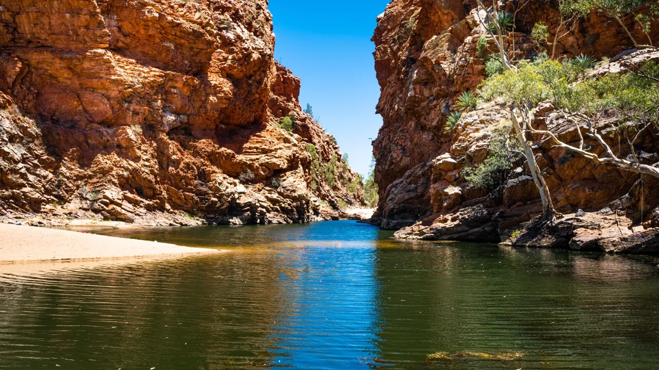
Expect hard, rocky, uneven ground. The Larapinta is not technically complex in the mountaineering sense, but it is physically wearing. Repeated stone impact, loose descents, dry creek beds and exposed ridges make the track harder than the distance alone suggests.
Footwear should already be broken in. Breathability matters in heat, but underfoot protection matters on repeated rocky days. See the best breathable hiking shoes if you are leaning toward trail shoes rather than boots.
Weather
May to August usually brings the best walking conditions, with clear days and cold nights. NT Parks warns that walkers need warm clothing in the cooler season, including thermal wear, a warm hat or beanie, and a sleeping bag rated below -5°C.
Outside the cooler months, temperatures can become extreme. If your plan depends on beating the heat every day, reconsider the plan.
Crowds and wildlife
The Larapinta is popular by Australian long-distance standards, but it is not a crowded hut walk. Expect people at major trailheads, gorges and popular campgrounds, with quieter stretches in between.
Expect birds, reptiles, insects and desert mammals. Snakes are possible. Mice, ants and insects are often the more practical food problem, so protect food in camp and in food drops.
Water: Sources, Safety and Treatment
Water planning is the core safety skill on the Larapinta Trail.
NT Parks states that surface water depends on rare and unpredictable rainfall events, and that temporary surface water is unreliable in both quantity and quality. Use water supplied at trailheads where available, but treat it because quality cannot be guaranteed.
Treat water by boiling, using sterilising tablets or filtering. A squeeze filter, gravity filter or bottle-compatible filter can all work. See the best water filters for hiking for the main options.
Known water issues:
- Section 9 has no reliable surface water and may require a two-day water carry.
- Hugh Gorge may require wading or swimming after water has pooled.
- Tank water should be treated.
- Surface water should be treated if used in an emergency.
- Heat, distance, effort and fitness all affect how much water you need.
Carry water for walking, cooking and emergencies. Do not wait until you feel thirsty before drinking.
Logistics
Bookings and fees
Overnight walkers must pay Larapinta Trail walking fees and camping fees through the NT Park Booking System. The walking fee is around AUD $25 per person per night, capped at about AUD $125 for a walk over consecutive days, with under-5s free. Most designated campsites are Category B at around AUD $10 per night, paid on top of the walking fee. Campsites need to be booked for each night on trail. Camping outside designated sites is only allowed in an emergency, injury or illness situation.
Campsites
NT Parks lists 26 designated camping sites on or near the trail, plus a privately operated campground at Standley Chasm. Facilities vary. Check each planned night before you book.
Food drops
Most end-to-end hikers use food drops. NT Parks states that food can be stored at Ellery Creek South, Serpentine Gorge and Ormiston Gorge. You need to collect a key from the Tourism Central Australia Visitor Information Centre and pay a refundable deposit plus a small non-refundable fee.
Food should be in a secure container with a lid, labelled clearly, and removed after the walk. Standley Chasm food drops need to be arranged directly with the operator. Commercial trek support companies can also organise food drops.
Current conditions
Check NT Parks current conditions before starting and again when you arrive in Alice Springs. Recent notices have included access limits around Jay Creek, Standley Chasm fee requirements, Hugh Gorge wading or swimming, Glen Helen closure information and food drop key reminders.
Mandatory Gear Checklist
This is not a generic overnight kit list. The Larapinta creates specific gear demands: water weight, rocky ground, sun exposure, cold nights and dusty camps. For the full kit, with specific picks and why each item matters, see what to pack for the Larapinta Trail. The essentials:
- Load-carrying backpack (65 to 85L): Choose a pack that carries a two-day water load onto your hips. Start with the best internal frame backpacks for heavier carries.
- Durable, broken-in footwear: Sharp rock and hot ground make sole failure the classic Larapinta problem, so favour a sturdy, well-bonded sole and ankle support. See the best hiking boots or the best breathable hiking shoes.
- Reliable freestanding shelter: Rocky, windy camps are hard to peg. Take a footprint for the sharp quartzite. See the best freestanding tents.
- Cold-rated sleep system: A bag rated below -5°C and an insulated inflatable mat (R-value around 3 or higher), because cold ground steals heat. See the best synthetic sleeping bags and the best insulated sleeping pads for hiking.
- Water treatment and carry: Treat all tank water and plan 4 to 6 litres per day, more for Section 9. See the best water filters for hiking.
- Trekking poles: Useful for rocky descents, balance and gorge crossings. See the best trekking poles.
- Reliable navigation device: Long sections are remote and sparsely marked, with no phone coverage for hours at a stretch. A dedicated GPS device, or a satellite communicator for emergencies, is worth the weight. See the best hiking GPS devices for multi-day hiking.
- Blister-resistant socks: Dust and repeated rock impact punish feet. See the best hiking socks for preventing blisters.
- Sun and fly protection: Long-sleeve sun layer, wide-brim hat, sunglasses, sunscreen, and a head net for the relentless flies. See the best bug nets for camping.
- Warm camp layers: Thermal base layer, insulated jacket, beanie and gloves for freezing mornings.
- Gaiters: Lightweight gaiters keep spinifex, gravel and sand out of your boots.
- Emergency communication: A PLB or satellite messenger is strongly recommended, especially for solo hikers.
For broader packing logic, see multi-day hiking gear: what you actually need.
Honest Assessment
The Larapinta Trail is for hikers who want a serious Australian multi-day walk, not a soft introduction to overnight hiking.
It suits you if you can walk consecutive days with a loaded pack, manage heat and cold, follow a water plan, and stay patient on rocky ground. It is a strong choice if you want a remote-feeling trail with marked sections, official camp infrastructure and practical support options from Alice Springs.
It is not ideal as your first overnight hike unless you are joining a guided trip or walking short sections. It is also a poor choice for anyone who dislikes early starts, heavy water carries, dusty camps or careful logistics.
Easier alternative: walk selected day sections from Alice Springs or the West MacDonnell trailheads. Best balanced option: 14 to 16 days with food drops and a conservative water plan.
Frequently Asked Questions
How long is the Larapinta Trail?
NT Parks describes the Larapinta Trail as running over 230km along the West MacDonnell Ranges. It is divided into 12 official sections, ranging from 8.9km to 28.9km.
How many days do you need for the Larapinta Trail?
Most full-trail hikers take 12 to 18 days. A strong first-time Larapinta plan is usually around 14 to 16 days because it gives more margin for heat, rocky terrain, water carries and food drop timing.
What is the best month to hike the Larapinta Trail?
May to August is the safest planning window for most hikers. These months usually bring cooler walking weather, but nights can be very cold. April and September can work for experienced desert walkers, but heat risk increases outside the main winter season.
Do you need to book the Larapinta Trail?
Yes. Overnight walkers need to pay walking trail fees and book designated campsites. You should also pre-book transfers and food drop support during the main walking season.
Is there water on the Larapinta Trail?
There are water tanks at key trailheads, but natural surface water is unreliable. NT Parks recommends using trailhead water and treating water because quality cannot be guaranteed. Section 9 is the major water-carry warning because there is no reliable surface water along the way.
Can beginners hike the Larapinta Trail?
Beginners should not attempt the full trail without preparation. Fit beginners can consider guided sections or shorter self-guided highlights. The full trail is better suited to hikers with multi-day experience.
Final Thoughts
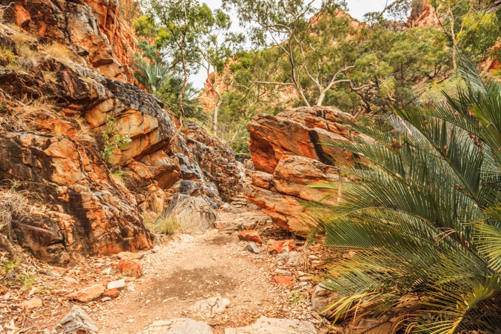
The Larapinta Trail is not just long. It is specific. It asks you to deal with desert walking on its own terms: cold mornings, hard ground, water discipline, exposed ridges, dust, tired feet and camps that feel a long way from town once the sun drops.
That is why it is worth doing.
Plan it properly, book the right campsites, respect the water, carry gear that works on day ten as well as day one, and give yourself enough time to notice the country you are walking through.
When your route is set, get your kit right with what to pack for the Larapinta Trail. For more route planning support, start with plan your first multi-day hike. For other destination ideas, browse the Wild Trails guides.
