

Last updated: August 2026
Wild Trail Hiker is reader-supported. We may earn a commission when you buy through links on this page, at no extra cost to you. We only recommend products we’d consider taking on a multi-day trip ourselves.
Before You Go
The High Sierra Trail’s classic finish, summiting Mount Whitney and descending to Whitney Portal, is currently off limits. A US Forest Service order closes the entire Mount Whitney Zone, including the switchback trail down to Whitney Portal, from June 18, 2025 through June 18, 2027. You can still climb to the summit from the west side, but you cannot legally walk out the east side this year. On top of that, every hiker needs a High Sierra Trail-specific wilderness permit with a daily quota, so the permit and your exit plan need to be worked out together, not separately.
Why This Trail
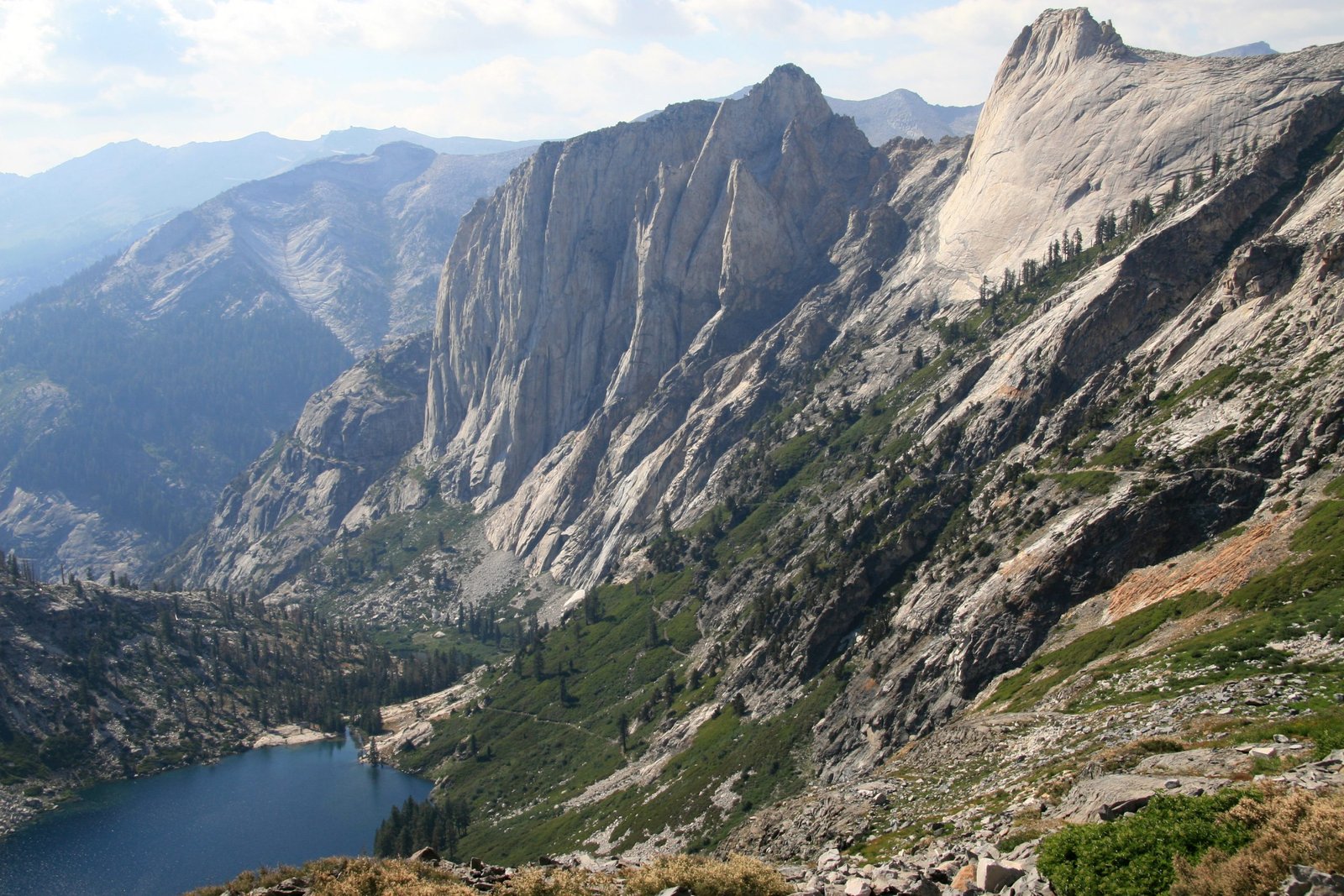
Ask experienced Sierra hikers to name the best multi-day trail that doesn’t get enough credit, and the High Sierra Trail comes up constantly. It covers a lot of the same granite, alpine lakes, and high passes that make the John Muir Trail famous, but in a fraction of the distance and without a multi-week commitment. Where the JMT runs 210 miles from Yosemite to Whitney, the High Sierra Trail delivers Sequoia’s highlights, the climb over Kaweah Gap, the ice-blue stare of Precipice Lake, the long drop into Kern Canyon, and the final push to the highest point in the contiguous United States, in about a week.
The route’s structure is part of the appeal. It runs almost due east from Crescent Meadow, crossing the Great Western Divide, tracing the floor of Kern Canyon, then climbing back out to join the John Muir Trail itself at Wallace Creek for the final approach to Whitney. That means a High Sierra Trail hiker gets several distinct Sierra landscapes packed into one trip: shaded giant sequoia forest, exposed alpine granite, a hot, dry canyon floor, and a 14,000-foot summit, each demanding something different from your gear and your pacing. Among hikers who’ve done both, it’s often described as the John Muir Trail’s little sibling: the same country, condensed. It’s the same one-week trade-off hikers weigh against other marquee US multi-day trips like the Wonderland Trail or the Teton Crest Trail: big scenery, compressed into a week rather than a month.
Trail at a Glance
- Distance: 72.2 miles (116 km), Crescent Meadow to Whitney Portal, in the trail’s traditional form. The current alternate exit forced by the Whitney Zone closure (see below) adds extra distance beyond this figure; exact mileage varies by source, so treat this as the traditional-route baseline rather than your total for 2026.
- Duration: 7 to 10 days. Eight days is the most commonly recommended pace.
- Difficulty: Hard. Two major high points (Kaweah Gap at 10,700 ft and the Mount Whitney summit at 14,505 ft), roughly 15,500 ft of cumulative elevation gain, and a hot, dry midsection through Kern Canyon.
- Best season: Mid-July through mid-September. The wilderness permit quota season runs roughly May 22 to September 26 in 2026; snow can linger on Kaweah Gap into July in a heavy winter.
- Permits: Required for every hiker, every night. A High Sierra Trail-specific wilderness permit is mandatory. A general Alta Trail permit does not cover the Seven Mile Hill to Kaweah Gap segment. Daily quota of roughly 40 people. Recent fee listings show $15 non-refundable plus $5 per person; confirm the current fee on the live Recreation.gov listing before you apply.
- Start trailhead: Crescent Meadow, Sequoia National Park: Crescent Meadow on Google Maps
- Traditional end trailhead: Whitney Portal, near Lone Pine: Whitney Portal on Google Maps. Closed to hikers descending from the summit through June 18, 2027 (see Before You Go).
- Current practical exit: Horseshoe Meadow Trailhead, via Cottonwood Pass or New Army Pass: Horseshoe Meadow Trailhead on Google Maps. Confirm this is still the current recommended workaround with Sequoia and Kings Canyon or Inyo National Forest when you apply for your permit.
This is a point-to-point trail, not a loop, so you need a transport plan for the far end. See Getting There and Away below.
Trail Map
View the High Sierra Trail on AllTrails: includes an elevation profile, recent condition reports, and photos, though note it still shows the traditional Whitney Portal finish rather than the current closure workaround.
Official NPS High Sierra Trail route description (Sequoia & Kings Canyon): the authoritative source for mile-by-mile distances between every camp on the route.
Getting There and Away
Getting there: Fresno Yosemite International Airport (FAT) is the closest major airport, about 2.5 to 3 hours’ drive from Sequoia’s Giant Forest area. Los Angeles is a further option, roughly 4.5 hours by road. The Sequoia Shuttle runs seasonally, generally late May through early September, between Visalia, Lemon Cove, and Three Rivers and the park, connecting with the free in-park shuttle that stops at Crescent Meadow; round-trip tickets run around $15 to $20. Driving yourself, Crescent Meadow is reached via the Generals Highway and the Moro Rock/Crescent Meadow Road, about 45 minutes from the Foothills entrance at Three Rivers. Backpackers with a wilderness permit can access the trailhead 24 hours a day, even when the road gate is otherwise closed to general traffic.
Getting away: In its traditional form, this point-to-point trail finishes at Whitney Portal, a 13-mile, roughly 40-minute drive up from Lone Pine on US 395. With the Whitney Zone closure in effect, hikers are currently exiting instead at Horseshoe Meadow Trailhead, reached via Horseshoe Meadow Road, also out of Lone Pine, about 25 minutes’ drive from town. Either way, you’ll need a shuttle or a second staged vehicle near Lone Pine, since there is no scheduled public transport serving either trailhead. Small operators occasionally run seasonal hiker shuttles between Lone Pine and the trailheads. Confirm current shuttle operators and rates before you go, since these change from season to season.
Staging towns: Three Rivers or Visalia before you start, both served by the Sequoia Shuttle. Lone Pine to recover afterward, a classic eastern Sierra town with motels, diners, and road access to both the Whitney Portal and Horseshoe Meadow trailheads.
Day-by-Day Breakdown
The itinerary below follows the trail’s traditional east-bound direction from Crescent Meadow, spread over 7 to 8 hiking days at a moderate pace. Distances are drawn from the official NPS route description and cross-checked against recent trip reports.
Day 1: Crescent Meadow to Bearpaw Meadow (about 11.4 miles)
The trail leaves Crescent Meadow through shaded giant sequoia forest before opening onto a warm, south-facing slope at Eagle View, with sightlines back to Moro Rock and out to the glaciated peaks of the Great Western Divide. The route crosses ground burned by the 1980 Buckeye Fire, then passes Nine Mile Creek and Buck Canyon before a final climb to Bearpaw Meadow. This is also home to Bearpaw High Sierra Camp, a reservation-only tent camp run by the park concessionaire, alongside backpacker campsites with a bear box. Spring-fed creek crossings can run high early in the season; check conditions when you collect your permit.
Day 2: Bearpaw Meadow to Big Arroyo Junction via Kaweah Gap (about 11.1 miles)
The most demanding day on the trail. Past Lone Pine Creek, a long series of switchbacks climbs below Angel Wings, a sheer granite wall, before crossing Hamilton Creek near the lower Hamilton Falls and reaching Big Hamilton Lake, a popular fishing camp with good views. Beyond the lake, the trail climbs through Hamilton Gorge on a ledge and short tunnel blasted by the Civilian Conservation Corps after a 1937 avalanche destroyed the original suspension bridge. Above the gorge you reach Precipice Lake, one of the most photographed spots on the trail, before topping out at Kaweah Gap, 10,700 ft, the highest point on the Great Western Divide crossing. A moderate descent leads to camp at Big Arroyo Junction. Some trip reports note a trail washout near Hamilton Lakes has occasionally required a Black Rock Pass detour; check current conditions with a ranger at permit pickup.
Day 3: Big Arroyo Junction to Kern Hot Springs (about 14.3 miles)
A long day that starts with a moderate climb onto the Chagoopa Plateau, with an optional side trip to Moraine Lake for hikers who want a shorter day and a scenic camp. The plateau is followed by a long, dry stretch, so fill water bottles at Sky Parlor Meadow before the steep, rocky switchback descent of nearly 4,000 ft into Kern Canyon. At the bottom, Kern Hot Springs offers a small concrete soaking tub fed by a natural hot spring right beside the cold Kern River, plus a large camp with bear boxes. Hikers who prefer a shorter day can split this stretch by camping at Moraine Lake or Upper Funston Meadow instead.
Day 4: Kern Hot Springs to Wallace Creek (about 12.4 miles)
The trail runs north along the floor of Kern Canyon, past Junction Meadow, before climbing out alongside Wallace Creek and gaining roughly 3,600 ft to reach the junction with the John Muir Trail and Pacific Crest Trail. The canyon floor can be brutally hot by midday, so an early start pays off. Wallace Creek is a popular camp where three long-distance trails converge, so sites fill quickly in peak season.
Day 5: Wallace Creek to Guitar Lake via Crabtree Meadow (about 9.7 miles)
A comparatively easy day past Sandy Meadow to Crabtree Meadow, where a ranger station offers a last check-in point, then on past Timberline Lake to Guitar Lake at roughly 11,500 ft, the last camp with water before the summit push. Guitar Lake is exposed and cold overnight, and marmots are a real threat to any food left unattended, even briefly.
Day 6: Guitar Lake to the Mount Whitney summit and back toward Crabtree (about 12 to 13 miles round trip)
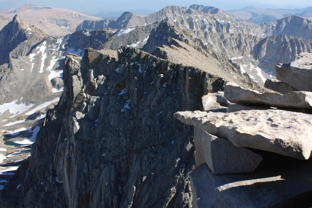
Most hikers start well before dawn to reach the summit for sunrise and to be off exposed ground before afternoon thunderstorms build. Fill every water bottle before this climb: there is no reliable water source between Guitar Lake and the east side of the mountain. The trail switchbacks up to Trail Crest at roughly 13,600 ft, then a 2-mile spur trail (each way) leads to the summit of Mount Whitney at 14,505 ft, the highest point in the contiguous United States. In a normal year, hikers continue over Trail Crest and descend the east side to Whitney Portal. Because that descent currently sits inside the closed Whitney Zone, hikers instead need to retrace their steps back over Trail Crest to the JMT/PCT corridor and continue toward an alternate exit rather than finishing at the portal. This is the single biggest change from how the trail is traditionally described, so check current NPS and Inyo National Forest guidance before you rely on it.
Days 7 to 8: Exit via Cottonwood Pass or New Army Pass to Horseshoe Meadow Trailhead
From the Crabtree area, the current workaround continues south on the shared JMT/PCT corridor past the Siberian Pass junction to reach the Cottonwood Pass or New Army Pass turnoff, then descends to Horseshoe Meadow Trailhead. Distances, camp options, and permit requirements for this alternate exit are not consistently documented across public sources yet. Verify mileage, camping zones, and whether any additional Inyo National Forest permit applies directly with Sequoia and Kings Canyon or Inyo National Forest staff before you finalize your plan.
What to Expect
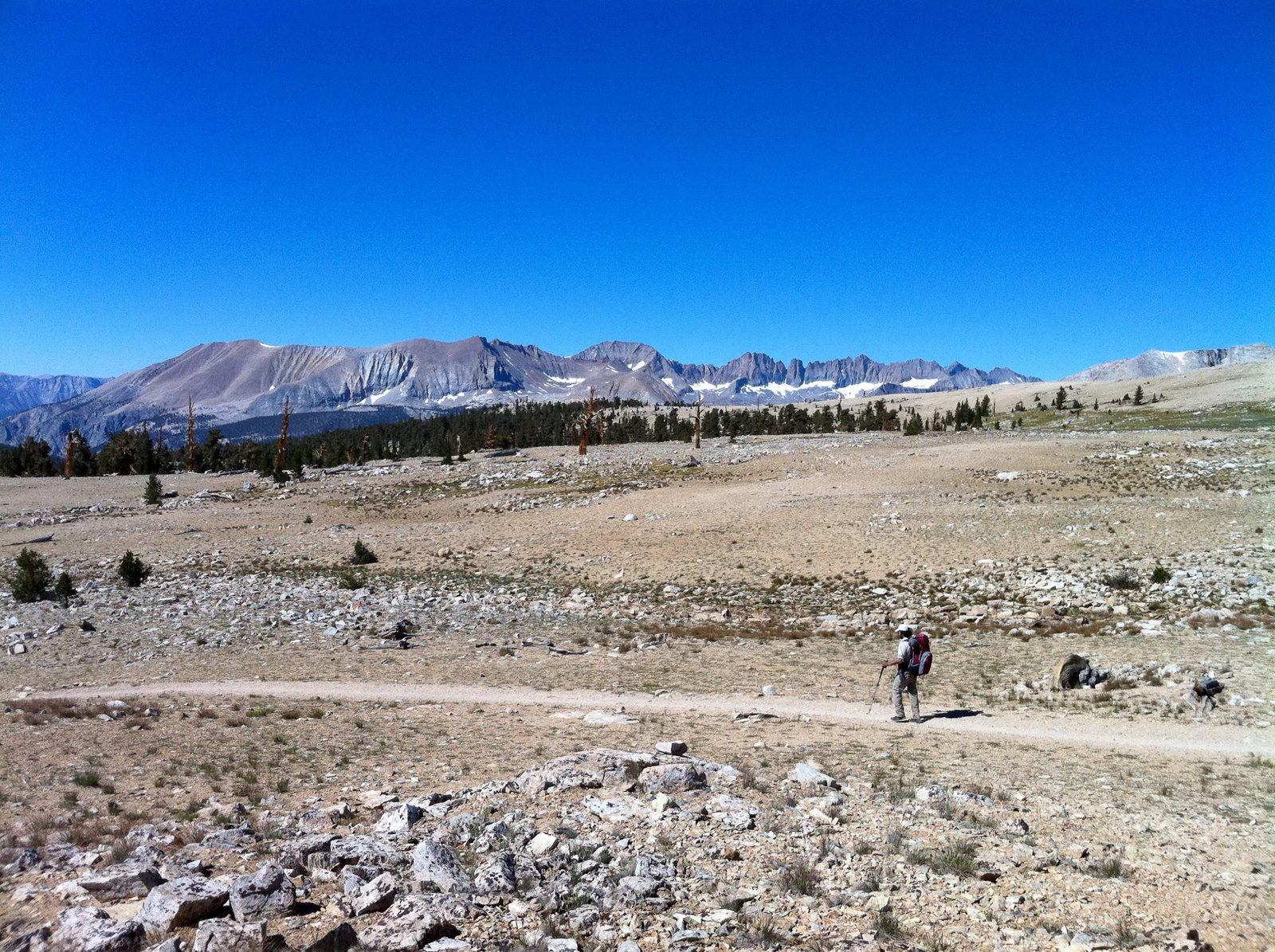
Terrain: Shaded sequoia forest and exposed granite switchbacks in the first two days, a hot, dry canyon floor in the middle third, and high alpine desert on the approach to Whitney.
Weather: Summer days in Kern Canyon can reach the 80s and 90s°F, while high camps like Guitar Lake drop into the 30s and 40s°F overnight, even in August. Afternoon thunderstorms are common in July and August; plan to be off Kaweah Gap and the Whitney summit by early afternoon.
Wildlife: Black bears are present throughout the route, along with mule deer and marmots, the latter a genuine hazard to unattended food at high camps. Bighorn sheep are occasionally seen near Whitney.
Crowds: The daily quota keeps overall numbers manageable, but camps at trail junctions, Wallace Creek, Crabtree Meadow, and Guitar Lake in particular, fill quickly in late July and August. September offers a quieter trail and cooler days.
Signature features: Kaweah Gap and Precipice Lake, the blasted tunnel through Hamilton Gorge, the soaking tub at Kern Hot Springs, Guitar Lake beneath Whitney’s west face, and the summit itself.
Water: sources, safety, and treatment
Water is generally frequent for the first two days, with creek crossings every few miles, and again once you reach the Kern River in Kern Canyon. The two stretches to plan around carefully are the descent from the Chagoopa Plateau into Kern Canyon, where the last reliable fill-up is at Sky Parlor Meadow, and the final climb from Guitar Lake to Trail Crest, where there is no water at all.
No natural source on this trail should be considered safe to drink untreated. The Kern River corridor in particular sees heavy hiker and pack-stock traffic, which raises contamination risk. A standard pump or squeeze filter, such as a Sawyer Squeeze, handles most sources on this trail without issue; glacial silt isn’t the problem here that it can be on some higher, more glaciated Sierra routes, but late-season creeks can run low and cloudy, so a simple pre-filter is worth carrying. The main hazard is less about water quality and more about underestimating the two dry stretches, especially the exposed climb above Guitar Lake. See best water filters for hiking, and for broader water-safety and navigation fundamentals across multi-day trips, see multi-day hiking skills.
Logistics
Wilderness permits for the High Sierra Trail are issued through Recreation.gov under Sequoia and Kings Canyon National Parks, with a rolling advance booking window and a same-day-prior walk-up allocation covering the rest of the daily quota. Pick-up is in person at the Lodgepole Visitor Center; you cannot print a High Sierra Trail permit at home. Recent fee listings show $15 non-refundable plus $5 per person during the quota season, which runs roughly May 22 to September 26 in 2026. Confirm the current fee on the live Recreation.gov listing before you apply, since older sources quote different figures.
Because the traditional Whitney Portal exit currently sits inside the closed Whitney Zone, talk through your planned exit with the wilderness permit office at the time you apply, not after you’ve started walking. Staff can confirm current guidance on the Cottonwood Pass or New Army Pass alternative, and whether any additional Inyo National Forest permit or fee applies to that segment, since it falls outside the national park boundary.
Bear canisters are mandatory for all food and scented items for the entire trip. Several popular camps, including Bearpaw, Big Arroyo, Kern Hot Springs, and Wallace Creek, have bear boxes you can use to supplement canister space, but don’t plan around one being empty when you arrive.
Mandatory Gear Checklist
This trail leans hard on a few categories more than most: food storage, traction on rock, and warmth at altitude. For the exact kit dialled in for this trail, see what to pack for the High Sierra Trail. For the broader kit list beyond what’s below, start with multi-day hiking gear: what you actually need.
- A bear canister, required for every night on this trail. Bear boxes at some camps help but don’t replace it. See best bear canisters for multi-day hiking.
- A pack sized for a week-long food carry plus a bear canister, since the canister alone eats a lot of internal volume before anything else goes in. See best multi-day backpacks.
- Trekking poles, given the sustained climbing and descending, particularly the steep drop into Kern Canyon and the climb to Kaweah Gap. See best trekking poles.
- A reliable water filter, with a simple pre-filter for late-season, low-flow creeks. See best water filters for hiking.
- An insulated jacket for camp, given overnight temperatures near freezing at Guitar Lake and other high camps even in August. See best insulated jackets for hiking.
- A sleep system rated for near-freezing nights, since Guitar Lake and the other high camps sit well above where a warm-weather-only setup is comfortable. See best synthetic sleeping bags and best sleeping pads for camping.
- A genuinely waterproof rain shell, for the afternoon thunderstorms that build quickly near Kaweah Gap and on the approach to Whitney. See best waterproof jackets.
- Durable, broken-in footwear with good rock traction, for the rocky switchbacks in Kern Canyon and the long daily mileage. See best hiking boots.
- Hiking socks built for consecutive big-mile days, given the daily distances and the rocky Kern Canyon switchbacks. See best hiking socks for preventing blisters.
Honest Assessment
This trail suits a hiker who wants John Muir Trail-level scenery without a multi-week commitment, and who is comfortable with sustained climbing and descending plus a genuinely hot, dry midsection through Kern Canyon. It rewards someone who can plan carefully around a live permit quota and, this year, around a real change to the traditional finish.
It’s not the right call for a first backpacking trip, given the altitude, the mileage, and the current permit and exit complexity, and it’s not the trip for anyone set on the classic experience of descending triumphantly to Whitney Portal, since that finish isn’t available right now. For a shorter, faster alpine trip with a similarly high scenery-to-effort ratio, the Teton Crest Trail is worth a look; for hikers who want the fuller version of this same country and have more time, the John Muir Trail covers much of the same ground at greater length.
Among hikers who’ve walked both, the consensus is that the High Sierra Trail delivers a disproportionate amount of classic Sierra scenery, granite passes, alpine lakes, a real summit, for a relatively modest time commitment. That’s exactly why it keeps coming up as the trail experienced backpackers recommend to friends who can’t take three weeks off for the JMT.
Final Thoughts
The High Sierra Trail rewards a hiker who treats the permit process and the exit plan as seriously as the itinerary itself, especially this year. Start with how to plan your first multi-day hike if you’re still dialling in fitness and logistics, and if you’re weighing this against the full Sierra traverse, our John Muir Trail guide covers the longer, more committing version of much of the same country. Once your kit is sorted, our what to pack for the High Sierra Trail guide covers the exact list, from the mandatory bear canister to warmth for Guitar Lake’s near-freezing nights. Browse more Wild Trails guides if you’re comparing this against other multi-day trips. For another short, high-Sierra alternative to a multi-week thru-hike, see our Rae Lakes Loop guide, a 4 to 5 day Kings Canyon loop that also crosses the JMT/PCT corridor at Glen Pass.
Frequently Asked Questions
Can I still finish the High Sierra Trail at Whitney Portal in 2026?
No. A US Forest Service order closes the entire Mount Whitney Zone, including the trail down to Whitney Portal, from June 18, 2025 through June 18, 2027. You can still summit Mount Whitney from the west side, but the traditional descent to Whitney Portal is currently prohibited, and hikers need an alternate exit plan.
How hard is the High Sierra Trail?
Hard. Expect roughly 15,500 ft of cumulative elevation gain, two major high points above 10,000 ft, and a hot, dry stretch through Kern Canyon in the middle of the trip. It’s a reasonable step up for an experienced multi-day hiker, but not a good first backpacking trip.
Do I need a separate permit for Mount Whitney?
You need a High Sierra Trail-specific wilderness permit for the whole route, issued through Sequoia and Kings Canyon National Parks. Because the traditional Whitney Portal exit is currently closed, confirm with the permit office whether your planned alternate exit requires any additional Inyo National Forest permit.
How many days do I need for the High Sierra Trail?
Most backpackers take 7 to 10 days for the full route, with 8 days being the most common pace. Very fit hikers with light packs sometimes do it faster, but the current alternate exit likely adds at least a day compared with the traditional Whitney Portal finish.
Is the water safe to drink on the High Sierra Trail?
Treat every water source. None of the natural water on this trail should be considered safe to drink untreated, and the Kern Canyon corridor in particular sees heavy stock and hiker traffic. Carry a filter and watch for two genuinely dry stretches: the descent into Kern Canyon and the final climb above Guitar Lake.
